

- Carreño Asturias Centre
- Distance: 2,8 kms
- Difficulty: Half
- Altitude: 3
- Unevenness: 56
-
On foot:
1 h.
Round trip
- Start point: Perlora Residential Community
- Tour type: Round trip
- Layout of the route: Download kml, Download gpx
Just 3 kilometres of flat and comfortable track to see part of the coast of Carreño and where we will find up to four beaches along the route.
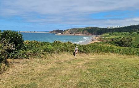
We start at Xivares beach itself, almost next to Gijón. After enjoying the views, we pass through the bushes on the left, and then the housing estates, to reach the old railway line that ran along the edge of the cliffs.
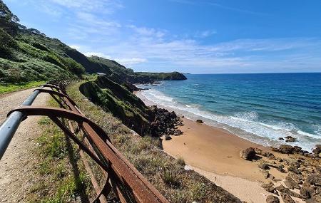
Here, between tunnels and bridges, we can enjoy these beautiful pieces of coastline, of rock eaten away by the water, with pools between them where a rich and varied fauna hides, such as octopus, crabs, crabs, crabs, barbadas or sea urchins and starfish, and where we can see the seagulls on the rocks waiting to catch a succulent morsel.
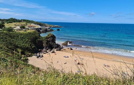
After the two beaches of El Tranqueru, we come to Carranques beach, with its recreational area with barbecues and beach bar, to complete a quiet, effortless walk, to enjoy with the family and the pure sea air.
Perlora Residential Community - Xivares Beach 2,8
This short but spectacular route begins in the vicinity of the Carranques beach car park, near the residential town of Perlora.
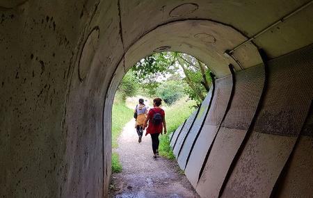
It is a greenway, of great scenic value, recovered from the old narrow-gauge railway line Gijón-Avilés "El Carreño", whose route passed along the edge of the cliffs of El Tranqueru. This railway line was inaugurated in 1902 and was used until 1975. The path recovers these same landscapes, but to be walked on foot.
400 metres into the route, you pass through the first of three tunnels - one of which is more than 136 metres long and all of which are well lit - which leads to a meadow. Some 300 metres further on, we pass through the second of the tunnels, close to the village of El Monte Morís, whose exit leads to the small beach of Los Tragones.
After the first kilometre, we reach the beach of El Tranqueru, which gives its name to the route, located near the village of Xibares. It is a sandy and rocky beach, about 250 metres long, which is not easy to access.
Some 600 metres further on, we come to the third and last of the tunnels, which leads us to Xibares. If we continue walking along the coastline, we will come to Xivares beach, the end point of our route.