
- Case Eastern Asturias
- Distance: 5,9 kms
- Difficulty: Half
- Altitude: 1.950 m.
- Unevenness: 1.160 m.
-
Climb:
3 h. 30 min.
One way
- Geographic situation: Redes Natural Park
- Start point: Banners
- Layout of the route: Download kml
The route to this summit known as the "Perfect Mountain" starts out from Pendones

Pendones is located about 1 km from the turning to La Ponteciella, some 7 km from Campo de Caso on the AS-17 Avilés-Puerto de Tarna road.
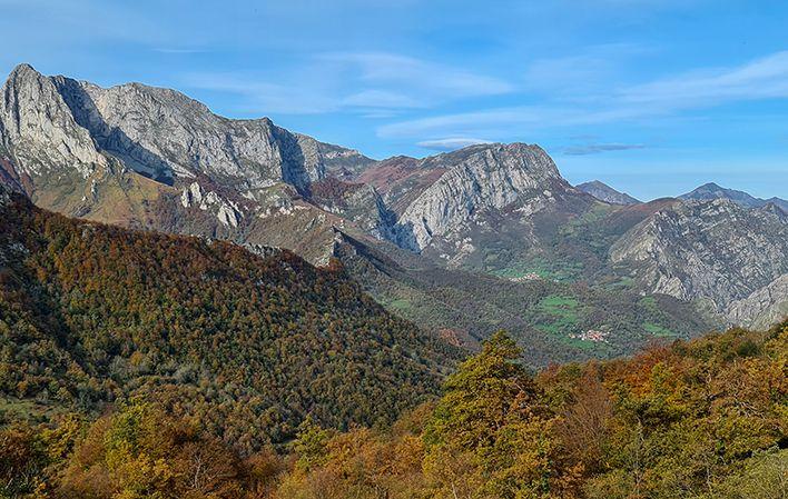
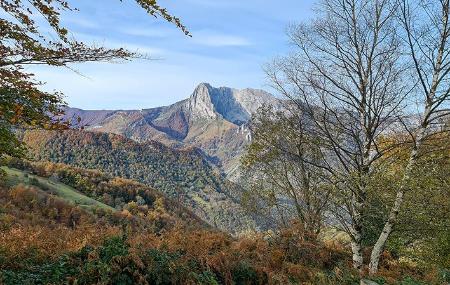
The route to this summit known as the "Perfect Mountain" starts out from Pendones. Tiatordos is located in a wild setting, with a majestic east face and amazing views from its summit. The most frequented climb runs along a mountain track with a bridge. After passing a turning on the left and crossing the second bridge, take the left fork following the course of the River Falla. At the next crossroads, turn right up a small slope towards Palombar (1,100 m). Continue along the narrow Foz de Palombar gorge up a steep path, after which you reach the old Pláganu mountain meadow (1,300 m). There are remains of old stone huts on the flat area, which you leave behind to continue the climb through a dense beech wood. You then come to the Xeruz spring. Continue the climb up to 1,540 m, reaching Tiatordos mountain meadow, where several herders' huts stand. You will see the outlines of neighbouring peaks in the distance: Maciédome, Campigüeños, La Carasca, La Senda, etc.
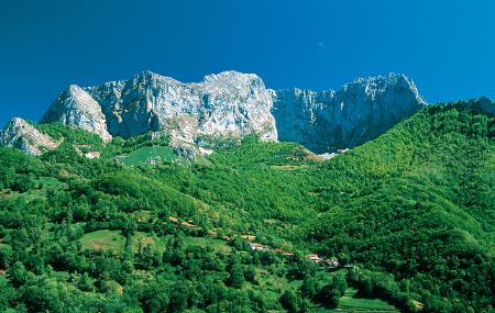
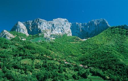
After a break by the spring, continue the climb to the summit via any of the rocky couloirs to the foot of the impressive sheer drop of what is known as the Copa de Tiatordos, formed by a vertical face with a sheer drop of over 500 m. Finally, you can enjoy the spectacular panoramic views offered by this summit.
Pendones - Tiatordos 5
From Pendones (Caso) the route sets off towards this peak known as the Perfect Mountain, with its wild surroundings, the majesty of its eastern wall and the marvellous panoramic view it offers from its summit.
The most popular route follows a mountain track that fords a bridge. We leave a fork to the left and after crossing the second bridge we take the fork to the left following the course of the river Falla.
At the next junction we turn right up a small climb in the direction of Palombar (1,100 m). We continue along the narrow Foz de Palombar up a steep path, after which the old sheepfold of Pláganu appears (1,300 m.).
On the plain there are remains of the old huts, which we leave behind and continue climbing through a dense beech forest. We come across the Xeruz spring and continue climbing up to 1,540 m., the point where the Tiatordos sheepfold is located, where there are several shepherds' huts. In the background we can make out the silhouettes of the neighbouring peaks, Maciédome, Campigüeños, La Carasca, La Senda, etc.
After a rest next to the fountain, we continue towards the summit through any of the stony channels until we reach the foot of the impressive gap of the so-called Copa del Tiatordos, formed by a vertical wall of more than 500 m. of free fall. Finally we will enjoy the spectacular panoramic views that this summit offers us.