

- Cabrales Eastern Asturias
- Distance: 13,1 kms
- Difficulty: High
- Altitude: 2.649 m.
- Unevenness: 1.769 m.
-
Climb:
7 h.
One-way
- Geographic situation: Central Massif of Picos de Europa (Cabrales-Valdeón).
- Start point: Invernales del Texu
- Layout of the route: Download kml
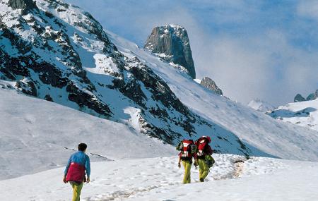
Invernales del Texu is a sheepfold located a few metres below the start of the Áliva track, 1 km. from the fork to Sotres (CA-1 road). Once in the Vega de Urriellu, we head northwest to the narrow pass of the Brecha de los Cazadores.
Texu - Torrecerredo winter sports facilities 13
Once in the Vega de Urriellu and after stocking up on water from the spring near the J.D. Úbeda refuge, we head northwest along a path marked out with "jitos" - small piles of stones used by mountaineers to indicate the way - which takes us to the narrow pass of the Brecha de los Cazadores (2,253 m.). Once we have passed this and with a magnificent panoramic view of the great monolith of Pico Urriellu, we advance towards the Arenera pass (2,283 m.) flanked by the limestone walls of the Agujas Areneras and the Neverón de Urriellu (5 h.).
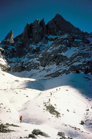
We descend briefly to a hollow where there is a fork with the route to the J.R. Lueje refuge in Jou de Los Cabrones. We avoid taking this route by going to the left along the itinerary that continues signposted with stone markers, through holes and hills under the northern foothills of Neverón de Urriellu and La Párdida. As soon as we reach a hollow to the left of the route, we descend to the pass of Jou de Cerredo (2,300 m.) where the route from Los Cabrones also arrives (6 h.).
From here, surrounded by these impressive mountains, we head towards the Torrecerredo spurs to crown its summit by the route considered normal. It is an easy but somewhat exposed climb, and safety equipment is particularly recommended for inexperienced mountaineers. The signposting leads us to a gravel pit and further on to a series of overlapping terraces that are easy to cross. We are at the base of a deep and stony channel and avoiding the progression along the bottom of it, we climb up towards the right wall to then turn left and place ourselves at the base of the central wall.
We climb the last projections that we will overcome in a slanting way to our left thanks to the abundant and safe holds that the wall has. Very close to the summit ridge we come across a small cave, a feasible bivouac for extreme cases.
There are only a few metres left to complete this ascent, which ends at 2,649 m., the highest point in Asturias and the whole of the Cantabrian Mountains. The summit is crowned by a geodesic vertex and an image of the Virgin of Covadonga with a panoramic view over the main nucleus of the three massifs and other mountains further away.