

- Quirós, Proaza and Santo Adriano Asturias Centre
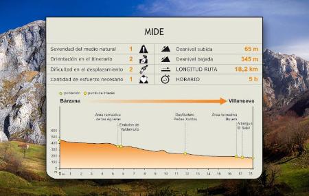
- Distance: 18,2 kms
- Difficulty: Short
- Code: GR109
- Altitude: 454,01
- On foot: 5 h.
- Start point: Barzana
- Tour type: Crossing
- Layout of the route: Download kml
From Bárzana, in the council of Quirós, the GR joins the Senda del Oso and, following the course of the river Trubia, embarks on a spectacular route that continues to Proaza, approaching the bear enclosure where the bears Paca and Tola live, to finish the stage in Villanueva, in the council of Santo Adriano.
Barzana - Viḷḷanueva 18,2
Leaving the village of Bárzana, next to the start-end of the stage signpost, the first section of the route runs along the AS-229 road. Leaving San Salvador on the right and just after passing the Ethnographic Museum of Quirós, the route joins an asphalted track that runs along the left side of the road, parallel to it, coinciding with the GR of the Senda del Oso, along which it continues until it reaches the village of Villanueva, where the stage ends.
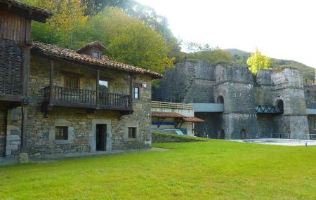
Before reaching the Senda del Oso, we can visit the Ethnographic Museum of Quirós and Region, located in the village of La Fábrica, and dedicated to the way of life of the high villages of the Trubia valley region. The museum recreates a traditional Quirós dwelling, with its different rooms and furnishings, as well as showing the traditional trades of the area, such as the "madreñeros", coopers and weavers.
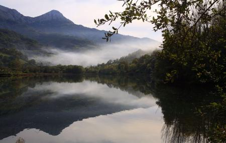
Once the path joins the asphalted track, the Senda del Oso, the route follows the course of the River Trubia, leaving behind the villages of Arrojo (Arroxu) and Veiga, where it crosses the river over a wooden bridge. The path crosses from river bank to river bank, over wooden bridges, at various points along the route.
The route then continues along the bottom of the valley, between limestone and quartzite slopes, and a very varied vegetation, made up of riverside woodland, with ash trees(Fraxinus angustifolia), alders(Alnus glutinosa) and hazelnut trees(Corylus avellana); copses of oaks(Quercus robur), chestnut trees(Castanea sativa), and also some meadows. Generally, the whole route has a protective wooden fence.
In this way, we reach the Valdemurio reservoir, in the village of Las Regueras, where the path crosses a long wooden bridge, goes around the reservoir and ascends through a tunnel. At several points along the route, you will pass under stone tunnels cut into the rock.
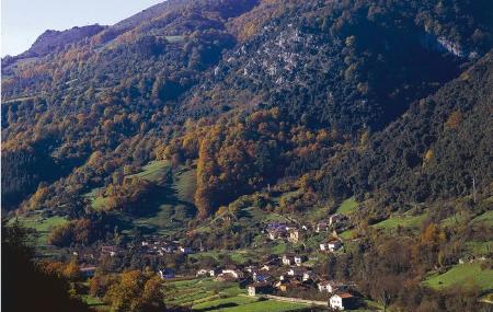
After passing the Valdemurio reservoir, the route continues parallel to the AS-229 road, leaving behind the villages of Caranga de Arriba or Santullano and Caranga de Abajo, and continues through the Peñas Xuntas gorge, where it once again runs along the river bank, crossing a landscape where the presence of holm oaks(Quercus ilex) stands out, until it reaches Proaza.
Once we have left the town of Proaza and before reaching the Buyera recreational area, we will find the bear enclosure next to the path, where the bears Paca and Tola live in semi-freedom. From this part of the route we can see the Forcada Peak towards the back. The Buyera recreational area has children's playgrounds, a sports track and swimming pool. Near the enclosure is the Casa del Oso (Bear House), from where we can comfortably observe the animals and where there is a permanent exhibition on the Cantabrian brown bear.
Continuing with the final section of the route, we will first pass behind the El Sabil lodge, descend slightly and cross the AS-229 road, so it will be necessary to take extreme precautions. We then enter the village of Villanueva, until we come to the start-end of the stage signpost, just past the Town Hall. A few metres further on is the Roman bridge of Villanueva, perfectly preserved, as well as a small rest area next to a stone washhouse with wooden tables and benches.