

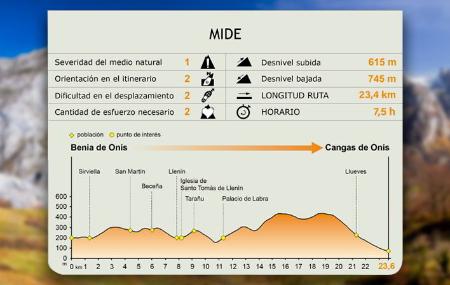
- Onís and Cangas de Onís Eastern Asturias
- Distance: 23,37 kms
- Difficulty: Half
- Code: GR109 - Inland Asturias
- Altitude: 435,08
- On foot: 7 h. 30 min.
- Start point: Benia
- Tour type: Crossing
- Layout of the route: Download kml
GR109 - Inland Asturias - Stage 4
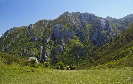
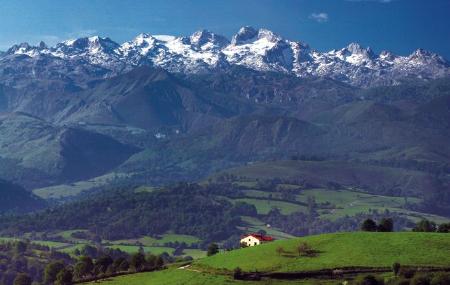
Between the councils of Onís and Cangas de Onís, the fourth stage of the GR links the capitals of both municipalities, passing through different rural centres where the rich heritage of the civil and religious buildings combines, in excellent harmony, with the beauty of the natural surroundings where they are located.
Benia - Cangues d' Onís/Cangas de Onís 23,37
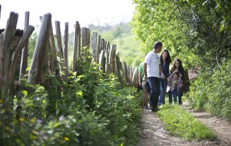
The GR starts in Benia de Onís, in the council of Onís, and continues westwards through small villages. Taking advantage of the communications between the different rural centres, it passes through the council of Cangas de Onís, where it ends by descending along a forest track above the town of Cangas de Onís.
Benia de Onís, capital of the municipality, is home to various buildings of interest, in addition to the parish church, such as the mansion of Los Valles, the house of Abajo, the house of Filomena Pellico and the house of Cebos, forming a well-preserved ensemble in a beautiful setting.
The stage starts on the AS-114 road in Benia de Onís, where there is an information panel indicating the beginning of the stage. A few metres further on, on this same road, in the direction of Cangas de Onís, the stage continues along a small road on the right, in the direction of Talaveru.
The first section of this stage runs through several villages on a tarmac road, although there are also sections of gravel. Continuing along the road, through pastures, and climbing slightly, we shall pass through the rural villages of Sirviella and, a little further on, San Martín (Samartín), now in the council of Cangas de Onís, where we shall have to pay attention to the signs, as the route turns off to the left.
Shortly afterwards we come to Beceña, where the route leaves the chapel of Santo Toribio de Beceña on the right, and continues slightly downhill alongside the River Prunea, amid riverside vegetation, towards the next village, Llenín.
In Llenín, also at the exit of the village and on the right, is the church of Santo Tomás, with another notable specimen of yew tree or texu.
Afterwards, and climbing slightly, the road leads to Tárano (Tarañu), a small village from where there are fantastic views of part of the valley of the river Güeña. The route leaves Tárano on a slight descent along a small asphalted road and, shortly afterwards, along a track through meadows.
The next section of the path continues downhill and crosses the river Les Vegues over a small bridge. It then crosses the rural village of Llabra, where the Palace of Labra and the church of San Bartolomé are located.
Leaving Llabra behind, the path continues uphill moderately and continues along a forest track through several hills populated by ferns(Osmunda cinnamonea) and heather(Erica arborea), with scattered copses of radiata pine(Pinus radiata), and through a small mass of Pyrenean oaks (Quercus pyrenaica).
The last section of the stage descends by road to Llueves, crossing the rural centre, and reaches the CO-1 road, which connects with Cangas de Onís, some two kilometres away. At the entrance to Cangas de Onís there is an information panel indicating the end-beginning of the stage.