

- Santo Adriano, Yernes y Tameza and Teverga Asturias Centre
- Distance: 25,3 kms
- Difficulty: High
- Code: GR109
- Altitude: 1242,16
- On foot: 9 h.
- Start point: Villanueva
- Tour type: Crossing
- Layout of the route: Download kml
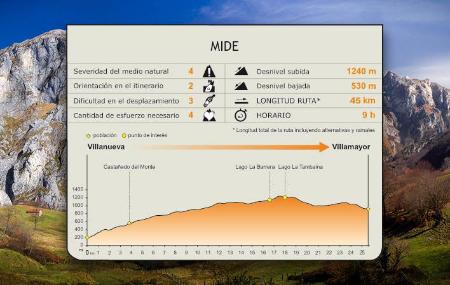

From the Roman bridge of Villanueva de Santo Adriano, the GR runs through Proaza, enters the small council of Yernes y Tameza, and ends in Teverga, crossing the Puertos de Marabio, passing the lakes of La Barrera and La Tambaina, and going around the Pico Caldoveiro in the last stretch, to the town of Villamayor.
Villanueva - Viḷḷamayor 25,3
The stage starts in the centre of Villanueva de Santo Adriano, in the Plaza de Ángel Fernández, where the Town Hall building is located, next to which we will find the panel at the start of the stage, and the chapel of Carmen. The town of Villanueva is divided by the river Trubia and by the route of the Senda del Oso, which crosses the capital of Santo Adriano over the bridge, a purely medieval construction, pointed and quite high, with a single, very open semicircular arch, which was an obligatory crossing point for the path that descended from Ventana.
In addition to the medieval bridge, Villanueva also boasts the parish church of San Romano, a Romanesque temple with a single rectangular nave and semicircular chancel, with an oven vault in the apse, where there are mural paintings with images of Santa Catalina, the Assumption of the Virgin and San Sebastián.
The church of Santo Adriano de Tuñón, a pre-Romanesque Asturian work (9th century), is also located near the Trubia river.
On the way to the bridge over the Trubia, we will come across the washing place and the public fountain of Villanueva, both made of stone. The fountain, built in 1928, was financed by José Antonio Fernández, an indiano who returned from America and contributed the 8,000 pesetas it cost, and who used the water that came from the Xanas stream.
The route begins by crossing the Trubia over the Roman bridge and climbing steeply up to Castañedo del Monte (Castañéu'l Monte), most of the route coinciding with the GR-101.1.
From Castañedo del Monte, the ascent continues by road to the rural village of Linares, at the exit of which the route continues along the road to the left. Shortly after leaving behind some repeater antennas, the route leaves the road and turns to the right, going up a concrete track, which shortly afterwards becomes a dirt track. The ascent continues for a long stretch, between meadows and huts, passing by the Braña de San Bartolomé and leaving behind the chapel of the same name.
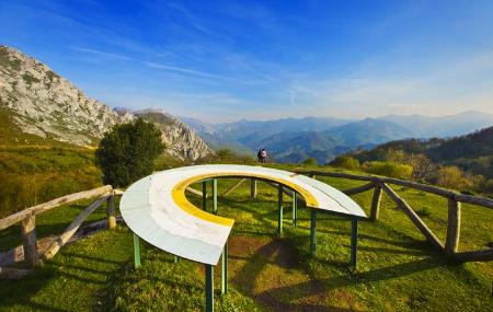
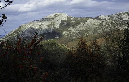
The dirt track finally reaches a hill where there is a GR-101.1 information panel and the GRGR-109 vertical signpost. From the pass, continuing along the signposted path towards Villamayor, the route continues upwards through the meadows of Las Forcadas and El Llanu, where it turns to the right, entering the valley where the lakes of La Barreda and La Tambaina are located, among beech(Fagus sylvatica), holly(Ilex aquifolium) and hawthorn trees. The last stretch of the route skirts Pico Caldoveiro on the left and begins to descend through holly trees, with views of the Sierra de Peña Gradura on the left and the Sierra de La Llomba on the right. The descent continues in a southerly direction, passing by some huts, until we reach the road, along which we continue to the right until we find an asphalted track on the left that we continue descending until we reach the rural village of Villamayor, at the exit of which we will find the end of the route sign, next to a fountain.
Alternative route - Section 1 9,2
- Alternative strech:
At the start of the route, another option is not to cross the bridge and follow the signs that, on the banks of the river, lead to San Andrés, from where you continue uphill along the road to Castañedo del Monte.
Alternative route - Section 2 10,5
- Alternative strech:
After passing by the Braña de San Bartolomé and leaving behind the chapel of the same name, the dirt track finally reaches a hill where there is a GR-101.1 information panel and the GRGR-109 vertical signpost. From there, we have the option of going down to the right, towards Cuevallagar, and continuing along the alternative dirt track, towards Yernes and the Aula Vital. Afterwards, return along the same path to the pass where it joins the main path to reach Villamayor.