

- Mieres Asturias Centre
- Distance: 23,6 kms
- Difficulty: Half
- Code: GR208 - Central Mountain Cycle Ring
- Mountain bike: 2 h. 30 min.
- Tour type: Crossing
- Layout of the route: Download kml
GR208 - Central Mountain Cycle Ring
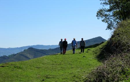

The seventh stage of the GR-208 Central Mountains Cycling Circuit starts at Alto la Colladiella. After crossing the AS-337 road, follow the Cabañón Greenway up a dirt road that leads to a downhill stretch along a concrete track between Pontaos and Alto de la Mozqueta (aka Alto La Faya). You then cross the LA-7 secondary road and take the track up to the high meadows of Ablaneo and Urbiés. Just before you get there, a scenic balcony offers views of the magnificent Samuño Valley, belonging to the borough of Langreo.
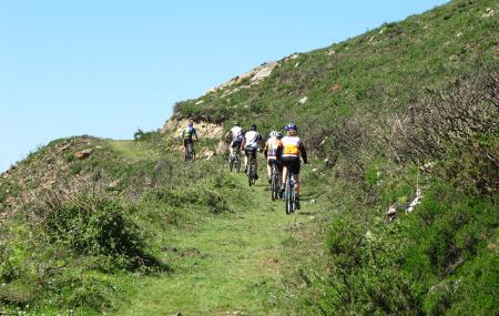
The trail then runs for a while along a flat track it shares with the PR-44, above the surroundings of the Urbiés Range, until reaching Panda Peak. You skirt this peak to then take an uphill fork, instead of the PR-34 fork, which also shares the trail and heads for San Xusto.
The GR-208 heads up towards Cogullu Peak, although the path always runs below the borough boundary line on the slope belonging to the borough of Mieres. At La Violar, turn right and take a track that leads below Felechosa, Mata Porrín and Espines Peaks, where the Cycling Circuit continues down the Rebullu Range to the village of El Cau.
You take the MI-11 road straight down from El Cau to Alto de Santu Miano. Cross the road here with caution and then take the path on the other side along which the PR-44 Langreo Circuit Path runs. At Domingo Moro, the GR-208 turns left (leaving the aforementioned Langreo PR) towards L'Acía, which you skirt from above, without entering the hamlet. You then take a path that goes around Borrón del Corralón to then head uphill towards Collado Muezca col, leading to the base of Campón Peak.
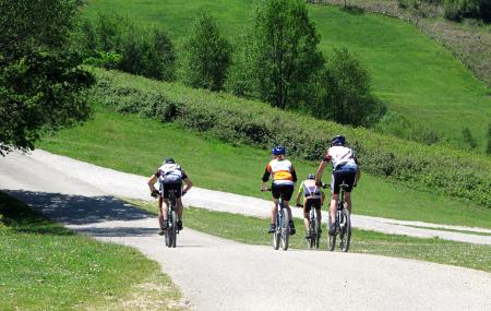
From here, a winding path with ups and downs leads to La Teyerona Recreational Area where you take the concrete road that runs along the side of La Peña towards the village of La Matiná. You leave this village via the first turning which heads downhill along stretches of the Camino Real road, which crosses the La Matiná Range, along some rather technical stretches of the trail. These are short stretches that will soon lead you to the village of Les Casetes (Requintín), from where you then head downhill without stopping along tarmacked roads to La Peña, whose sports facilities you reach at the end of the stage.
Alto la Colladiella - La Peña 23
The seventh stage of the GR-208 "Anillo Ciclista Montaña Central" starts at the Alto La Colladiella (Mieres) and after crossing the AS-337 road takes the Senda Verde del Cabañón to ascend along a dirt track that leads us to a section that from Pontaos descends along concrete surfaces to the Alto de la Mozqueta or Alto La Faya. We then cross the local LA-7 road and take the track towards the Ablaneo and Urbiés fields. A little before this, and from a viewpoint, we can contemplate the magnificent valley of Samuño.
The section continues flat along a track that also shares the PR-44 path, above the surroundings of the Sierra de Urbiés, until we reach the Pico Panda peak, which we skirt to take an uphill branch, leaving another one along which the PR-34 descends, which also shares the same route and which goes towards San Xusto.
The GR-208 climbs towards Pico Cogullu, although the path goes below the municipal boundary line, always on the Mierense side. At La Violar turn right and take a track that takes you below the Felechosa, Mata Porrín and Espines peaks, at which point the Cycle Route continues down the Rebullu mountain range towards the village of El Cau.
From El Cau, take the MI-11 road and go down it without any detour until the Alto de Santu Miano, whose road is crossed with caution to take the path that opens up on the other side and along which the PR-44 "Sendero Vuelta a Langreo" runs. At Domingo Moro, the GR-208 turns to the left (leaving the aforementioned PR Langreano) towards the hamlet of L'Acíu, which is skirted above, and without entering it we take a path that skirts the Borrón del Corralón, to climb and thus gain the Collado Muezca, towards the base of the Pico Campón.
From here, along a winding route with ascents and descents, we continue towards the La Teyerona Recreational Area where we take a concrete path that goes along the slope of La Peña towards the village of La Matiná. This village is left at the first turn-off that goes down the slope along sections of the royal path, which crosses the Sierru La Matiná, whose route has some technical passages. These are short stretches that soon leave us in front of the village of Les Casetes (Requintín), from where we descend without rest and on tarmac roads to La Peña, where we reach the sports facilities at the end of the stage.