
- Aller and Mieres Asturias Centre
- Distance: 16,2 kms
- Difficulty: Short
- Code: GR208 - Central Mountain Cycle Ring
- Mountain bike: 3 h.
- Tour type: Crossing
- Layout of the route: Download kml
GR208 - Central Mountain Cycle Ring

The sixth stage of the GR-208 Central Mountains Cycling Circuit starts out from the FEVE railway station in Cabañaquinta, heading along the AS-252 road towards the borough of Laviana. You follow this road for 1.5 km and then turn left down a path that leads to a water shed. A historic trail leading directly down to Serrapio starts at this point. You continue on from this village to the Shrine of San Vicente de Serrapio, where you then join the road that goes towards Uriés.
From this moment on, you climb the road for 1.6 km until reaching the village of Uriés. There you link up with the PR-205 and head up Caleya la Fuente lane to the outskirts of the village until you reach a wide track that leads up to the turning to San Fernando Pit, whose facilities can be visited. From there, you continue the uphill climb along the main trail towards the places called El Pinal and El Mayaín, always following the Uriés-Campa Espinera Greenway, until completing the ascent at Collado Ablanu col.
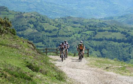
Here you have two options. The hiking option bears left, skirting La Burra Blanca Peak before reaching Campa Espinera mountain meadow. The mountain bike route continues straight on to La Navaliega, where the GR-208 bears left, heading steeply uphill towards Collado de Caballos col. After reaching the top, you start the descent towards Carva de Bustaleo. There are stretches of trails and concrete tracks that lead little by little up to Campa Espinera, where the trail joins up with the hiking variant. Here you will have magnificent views over the Turón Valley from Urbiés, where the trail joins up with the Greenway leading to Figareo.
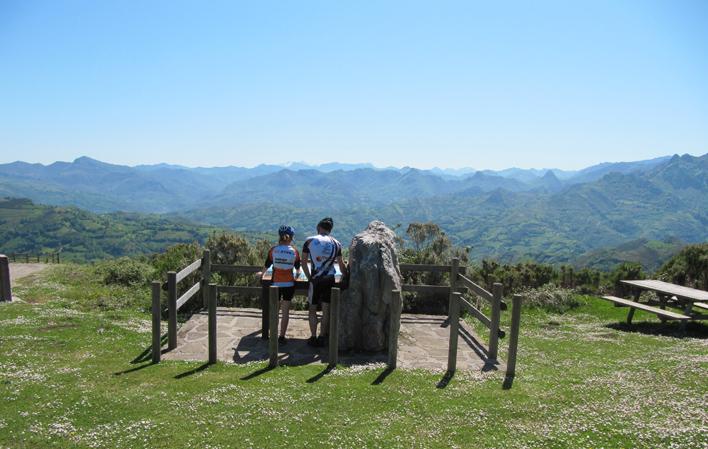
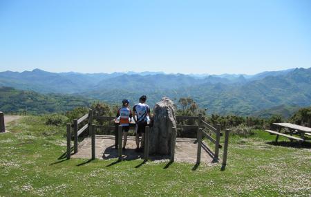
The GR-208 Central Mountains Cycling Circuit continues on to Campa Cimera, oblivious to all the junctions such as the Turón Path or the Meruxal Path. It is a steady descent that becomes faster when you leave Pico Tres Concejos behind you on the way to the end of the stage at La Colladiella. Here you will see two landmarks crowning the place, the monuments to Miners and to the Maquis (mountain guerillas who continued to fight long after the Civil War ended).
Cabañaquinta - La Colladiella 16
The sixth stage of the GR-208 "Anillo Ciclista Montaña Central" starts at the FEVE station in Cabañaquinta (Aller), following the urban road AS-252 in the direction of the council of Laviana. We drive along this road for 1.5 km, and then turn off to the left onto a path which leads us to a water house. At this point a historical path starts which leads directly to Serrapio. From this village we continue on to the sanctuary of San Vicente de Serrapio, where we now join the road that leads to Uriés.
From this point onwards we climb along the road for 1.6 km until we reach the village of Uriés. In this village we connect with the PR-205 which, going up the Caleya la Fuente, towards the outskirts, leads us to the wide track that climbs up to the turnoff to Pozo San Fernando, whose installations can be visited. From this point we continue ascending along the main track towards El Pindal and El Mayaín, always following the route of the Senda Verde Uriés-Campa Espinera (Uriés-Campa Espinera Green Path), until the ascent ends at Collado Ablanu.
Here there are two alternatives. The hiking route goes to the left going around La Burra Blanca peak and ends at Campa Espinera. The mountain bike (BTT) route continues straight on towards La Navaliega, where the GR-208 turns to the left, taking a steep slope towards Collada de Caballos. Once the summit is reached, a descent begins towards the Carva de Bustaleo. These are stretches of road and concrete that gradually climb towards Campa Espinera, where it joins up with the hiking route. Here there is a magnificent view over the valley of Turón from Urbiés, the connection point of the Senda Verde that leads to Figareo.
The GR-208 "Anillo Ciclista Montaña Central" (Central Mountain Cycle Route) continues onwards towards Campa Cimera, without all those junctions such as those of the Senda de Turón or the Meruxal. It is a continuous descent that becomes faster as we leave the Pico Tres Concejos behind, on the way to La Col.ladiel.la, the final point of the stage. Here we will recognise the two landmarks that crown the place, the monuments to the Miner and to the Maquis.