- Address El Franco and Tapia de Casariego Western Asturias
- Distance Distance: 22,3 kms
- Difficulty Difficulty: Short
- Code Code: GR204 - Coastal Path E9
-
On foot
On foot:
5 h. 30 min.
One way
- Start point Start point: Oporto/Viavélez
- Route type Route type: hiking
- Tour type Tour type: Hike
- Layout of the route Layout of the route: Download kml
GR204 - Coastal Path E9 - Stage 27 It can be done on foot or by bicycle.
The trail commences in the village of Viavélez, which is accessed via the FR-4 road.
This approximately 17-km-long stretch of the E-9 Coastal Path starts in the village of Viavélez and ends in the town of Tapia de Casariego, near the pilgrim hostel.
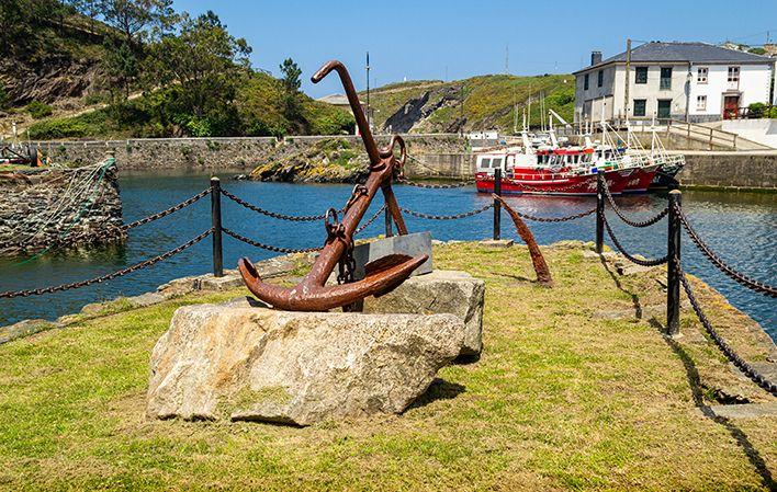
The trail heads out of Viavélez towards Viavélez Scenic Balcony. Mention should be made of the sculpture called "Coastline", by Ernesto Knorr. The trail continues to the River Mernes, crossing pastureland before reaching the village of San Pelayo, where you can visit the Chapel of San Pelayo.
Leaving San Pelayo, the trail enters a small pine and eucalyptus wood, "Monte Molina", on the way to Monellos Beach, from where you can enjoy the unique surroundings. It then continues on to Valdepares, passing Fonfría Mansion, home of the Camposorio Family dating from the 16th century and built in the Galician manor style. You can also visit the Church of San Bartolomé.
Leaving Valdepares behind you, the trail then passes through pastureland and forrage crops laid out in geometric plots (the result of land consolidation processes) before approaching the coast once again. This is an area of cliffs par excellence, where you can visit Cape Blanco, on which sits the structure of a hill fort.
Leaving Cape Blanco behind and continuing on parallel to the cliff on the way to La Atalaya, you pass by the "Fuente de Pipiello" rest area before getting to Porcía Scenic Balcony. From this scenic balcony, you can see the entire mouth of the River Porcía.
After contemplating this area and bordering the River Porcía along its right bank, you come to the village of Porcía. The flour mill, the Shrine of Our Lady of Remedies (St James' Way) and Porcía Mansion are all worth a visit here. Taking advantage of the tracks of the old Porcía iron ore mine railway, it is possible to reach the old loading docks, equipped with an observation point and rest area. The trail approaches the coast once again and, after reaching Centolleira Point, heads inland towards the villages of Campos and Salave.
It crosses the coastal strip to then head for Torbas Beach, followed by Valmorto and Figo Beach, which boasts a rest area and scenic balcony overlooking the beach.
The trail then continues on to Salave Ponds, whose shores offer views of an area shaped by Roman gold mining.
Heading up into Mount Mirayos, with its mighty pine trees, you reach Campo Longo Scenic Balcony, offering views of the entrance to Viavélez Harbour and cliffs of unforgettable beauty.
The trail then heads inland to the Chapel of San Antonio to return in search of the sea to Cape Cebes Scenic Balcony, before tackling the last kilometre to reach the area of Represas, on the outskirts of the fishing town of Tapia de Casariego.
Viavélez - Valdepares - Porcía Beach - Salave Ponds - Tapia de Casariego
Oporto/Viavélez - Tapia 22
The starting point is in the village of El Porto/Viavélez (El Franco) via the FR-4 road.
This section of the E-9 coastal path starts in the village of Viavélez and ends in the town of Tapia de Casariego, in the vicinity of the pilgrims' hostel, with a length of just over 17 km.
The path starts at El Porto/Viavélez and heads towards the Viavélez viewpoint. Of particular note is the sculptural work called "Litoral" by Ernesto Knorr. The path continues towards the river Mernes, crossing meadows and reaching the village of San Pelayo, where you can visit the chapel of San Pelayo.
Leaving San Pelayo behind, the path enters a small pine and eucalyptus forest, "Monte Molina", on the way to Monellos beach, from where you can enjoy a unique setting. It continues towards Valdepares passing by the 16th century palace of Fonfría, a house of the Camposorio family in the Galician pazo style. You can also visit the church of San Bartolomé.
Once we have left Valdepares and crossed areas of meadows and forage crops in geometric plots (the result of land consolidation processes), the path approaches the coast once again. This is an area of cliffs par excellence, where you can visit Cabo Blanco, on which there is a castle structure.
Leaving Cabo Blanco and continuing parallel to the cliffs on the way to La Atalaya, we pass the "Fuente del Pipiello" rest area until we reach the Porcía viewpoint. From this viewpoint it is possible to contemplate the entire mouth of the river Porcía.
After contemplating this area and bordering the river Porcía along its right bank, we reach the village of Porcía, where we can visit the flour mill, the hermitage of Nuestra Señora de los Remedios (Camino de Santiago), and the Porcía palace. Taking advantage of the old railway track used to extract iron ore from the Porcía mine, it is possible to reach the old loading bay, where an observation point and rest area have been set up. The route approaches the coast again and once it reaches Centolleira point, it goes in search of the villages of Campos and Salave in the council of Tapia de Casariego.
The path crosses the rasa and from there we can approach the beach of Torbas, the route advances towards Valmorto and the beach of Figo, which has a rest area and viewpoint over it.
The route continues towards the Lagunas de Salave, from the banks of which we can contemplate an area shaped by Roman gold mining.
Going into the pine-clad Monte Mirayos, you reach the Campo Longo viewpoint, from where you can see the entrance to the port of El Porto/Viavélez and cliffs of unforgettable beauty.
The route continues inland towards the hermitage of San Antonio to return in search of the sea, reaching the viewpoint of Cabo Cebes, before tackling the last kilometre and reaching the area of Represas, on the outskirts of the fishing village of Tapia.


