- Address Villaviciosa and Piloña Eastern Asturias
- Distance Distance: 19,6 kms
- Difficulty Difficulty: Short
- Code Code: GR108 - Travesía Andariega (Walking Route)
- On foot On foot: 5 h. 30 min.
- Start point Start point: Amandi (Villaviciosa)
- Route type Route type: Hiking
- Tour type Tour type: Crossing
- Layout of the route Layout of the route: Download kml
GR108 - Travesía Andariega - Stage 2
Amandi - Miyares
Amandi - Miyares 19,6
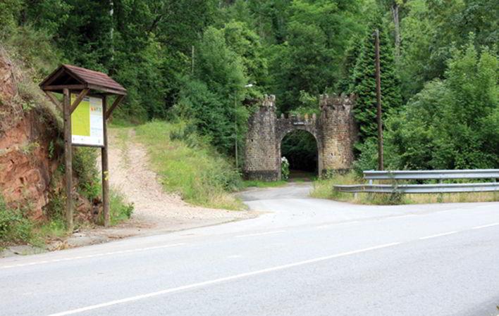
From this point onwards and for a stretch of the route we share the path with the PR-AS137, Molinos del Profundu. Leave the road and take the path on the left that enters a wooded area, passing next to the wall at the entrance to the La Vega estate, where you will soon come across a muddy area that you can avoid by passing through the pumarada on the left. We soon reach some houses on the plain, where we take an asphalted road that runs alongside the river for a short stretch, and ignore the concrete track on the left. From here you can see the church of Santa María de Lugás on the right (in 745 Pope Zacharias donated the church to the Asturian king, Alfonso I the Catholic). Shortly after we pass by the country house of Villaverde de Fuentes, we reach a crossroads where the PR-AS137 turns off to the right, and we must continue straight ahead to cross over the stream of Fondovil and walk under a luxuriant tree cover of chestnut trees, the odd oak and a beautiful riverside forest. Soon the path starts to climb and there is a sign on the road that says "A Covadonga", just at a bend where a dirt track turns off to the left.
We continue along the dirt track through a totally rural landscape, and shortly afterwards the path ends at a house on top of a greenhouse farm, which we do not see. A little before this, at a bend, a path turns off to the left, which becomes impassable for vehicles, ascending through a small patch of woodland. At the exit we come to an asphalted track next to a house with a palm tree and a concrete railing. Here we continue straight on towards the white house we see in the background.
Continue along the road to the right. In Coru we can visit the Romanesque chapel of Los Mártires de Coro, San Cosme and San Damián, affectionately known as "los Martirinos". The route continues along the main road towards Breceña. After passing through the village on the main road, on the left-hand side of the road you will see some large barrels with small roofs and gates. Continue for a short distance until you reach the turn-off to the village of Buslaz. Take the track on the right that heads towards Buslaz.
When you reach Buslaz, take a 180º turn to the left, just at the entrance to the village, and head towards the chapel of San Juan, where you take a path that leaves it on the right. This path is impassable for vehicles and has a large amount of vegetation, which sometimes makes traffic difficult. We ascend slightly in search of the high part of the mountain range, from where we have a nice view of the surrounding area. We soon pass by the Tandión peak, the highest point on this route. Shortly after, we are greeted by a building with a huge graffiti of Sietes.
Sietes is a village that became famous because Microsoft presented its Windows Siete programme, although it is worth visiting the group of granaries in the Campón neighbourhood, as well as the church of San Emeterio, one of the artistic jewels of 16th century Asturian art.
The church of San Emeterio de Sietes, an offshoot of San Martín de Vallés, is 10 kilometres east of Villaviciosa. It was built in 1555 and offers a beautiful model of Renaissance architecture, not very common in the monuments of the province.
It has a tall, spacious nave supported by sturdy abutments and an elegant bell tower.
Its doorway, on the epistle side, has seven entrance steps; it is flanked by fluted columns with their capitals on a high base, and angel heads adorn the frieze of the cornice. The pediment, which stands out between the two delegate finials, has sculpted in low relief, the Nativity of the Son of God placed in the manger and on the sides the Virgin and Saint Joseph; the two characteristic animals can be seen in the background. Above it, the figure of the bust of the Eternal Father stands out, with the world in his hand, surrounded by the heads of angels; and higher still, under the cornice, the symbolic cross of redemption.
Also notable for its carving and elegant forms is the altarpiece of the high altar, which seems to be contemporary with the erection of the church, whose main painting represents the scene of Calvary, after the Descent from the Cross, with the Saviour on the lap of his Blessed Mother, accompanied by Saint John and the Magdalene; on the sides the good and the bad thief, bound hand and foot to the Cross; and in the background Nicodemus and another personage with sheets in his hands. The highest painting shows the Crucifixion of the Lord, and on the sides there are other smaller panels depicting biblical themes.
It was once a thriving village with a casino, being the first village in the council of Villaviciosa to have electricity and electricity in all the houses.
We pass next to the church of San Emeterio, where we turn off to the right and shortly after we reach the main road, which we cross, passing next to the casino to head towards Perviyao, and shortly after we return to the main road. We continue along this road, looking at the meadows and woods of the parishes of Lliberdón, Colunga and Cabranes on the left. We continue on to Anayo (32.460 km), where we can have refreshments in the village bar next to the road. Anayo is the highest village on the whole journey, from where we can enjoy beautiful views of the Piloña valley, the Picos and the Sueve. The church of Santa María de Anayo dates back to the 11th century, but the current layout is from the 17th and 18th centuries.
Continue along the road until you reach the road from Colunga to L' Infiestu.
Take the road to the left towards Colunga. Leave the road and take the path to the right, which enters a wooded area, soon turning left and becoming a path full of undergrowth, which overlooks the ruins of the Caserío de la Retuerta, now abandoned. Once past it, we reach a track that we must follow to the left, beginning a steep descent through a concrete road surface at times.
When we reach the small oratory we turn right and soon come out into a clearing from where we have a splendid view of the mountains through which the path from Oviedo/Uviéu goes to Covadonga. We descend towards the neighbourhood of Cuesta de Borines, where we leave the road we are on, heading towards the Viyao river.
When you reach the road, turn left, and a few metres further on you will find the road from Borines / Boriñes to Colunga. When you reach this road, continue along it to the right, towards Vallobal, whose parish church preserves the devotion to San Lázaro, patron saint of lepers, as between the 12th and 17th centuries there was a community of lepers/malnourished people, who were cared for in a hospital in this town. This small place owes its importance to the Malatería or Hospital de leprosos de San Lázaro, which for five centuries took in the patients of this plague, who were rejected by the society of other times and confined in these buildings.
The parish church of San Lázaro de Vallobal is, among those that belonged to the leper colony, one of the few that conserves the dedication to the saint, as in most cases this dedication has been transferred to the Magdalena. In 1850 Madoz refers to it as Santa María de Balloval. There is copious documentation of this malatería: from "mandas testamentarias" (testamentary mandates), in the 16th century, Pedro de Antayo testifies in his favour two bushels of spelt and wheat, a cow and a jug of wine. In 1599 Juan de Cutre donated between Lloraza and Vallobal ten hanegas of bread and two bacon; and in 1740 Felipe V dictated some "constitutions" for its better government.
In the one hundred and fourteen years between 1661 and 1775, some sixty patients were admitted to the hospital. The number of patients was small: in La Paranza there were usually between six and twelve, in Cabruñana an average of three, in Vallobal five and in Villafría seven. Admission was by means of a medical certificate and also by virtue of an order from the ecclesiastical ordinary. It was exceptional for the sick to have to go out begging in this malatería, this only happened when there were so many malatos that the income was not enough to maintain them, in which case, as the house they had for their room was not enough, they were taken into the houses of the neighbours, who helped them with what they had: chestnuts, walnuts, firewood and hazelnuts; just so that they would not perish, so charity was far more important than hygiene. The malatería was governed and administered by the de la Villa Estrada family until 1739, when the Royal Court appointed the parish priest of Ques as its administrator. In the CATASTRO DEL MARQUÉS DE LA ENSENADA-1756 we read: "malatería to collect four poor malatos from the country, its administrator is D. Sebastián Posada y Castello, priest of the parish of Santa Eulalia de Ques, who must annually give 5 fanegas of spelt bread in grain to each malato, 5 to the priest of San Lázaro, 5 to the tax collector and 8 for himself; if there is surplus it is applied to the worship and decency of the aforementioned church of San Lázaro de Vallobal".
In 1843 his assets were put up for auction. The last patient of this malady was not discharged until 1776 and as in 1267 there were already lepers here "Leprosis de Vallobal I modium de segundo", San Lázaro de Vallobal is credited with more than five hundred years of activity.
In Vallobal is the Sidrón cave, an interesting site with remains of Neanderthal man, which are currently the basis of a project to discover his genome. Once you have crossed Vallobal, continue along the road until you reach the village of Miyares. When you reach Miyares, leave the road and take the one that goes off to the left and passes next to the church of Santa María de la O.
At the entrance, on the right hand side, is the Palace of the Villa family (16th-18th century), with the Miyares Tower (14th century). In this village we can find Casas de Indianos from the 19th and early 20th centuries. Past the church of Nuestra Señora de la O (19th century) is the house of Elías Torre, located on a small hill at the exit of Miyares, in the direction of Borines. It was built in 1925 for Elías Torre Noriega, and to overcome the difference in level between the road and the house there are several flights of steps that lead to a large covered porch, in which some semicircular arches stand out.
We take the narrow road that heads towards the village of La Estrada. Once there, we cross the road to the right, following the first turning to the left that is almost in front of us, leaving a blue house on the right. Continue along the narrow track in search of the village of La Goleta, leaving the 16th century Palacio de Cutre on the left, which has now been converted into a hotel.
Texts: Antonio Alba Moratillas (Editorial Prames)


