

- Ribadedeva Eastern Asturias
- Distance: 7,9 kms
- Difficulty: Short
- On foot: 2 h. 30 min.
- Start point: Pimiango (Cueva del Pindal car park)
- Tour type: Circular
- Layout of the route: Download kml, Download gpx
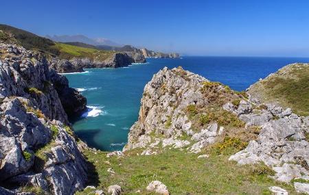

On the easternmost border of Asturias we find a route that brings together parietal art, Romanesque remains and nature and landscape with viewpoints between the sea and the mountains. Declared a Unesco World Heritage Site, the Pindal cave, facing the sea and sheltered from it by a fine Atlantic holm oak grove, hides in the depths of the cave cave paintings between 13,000 and 18,000 years old.
From here, the path takes us close to the cliff to reach the remains of the Romanesque monastery of Santa María de Tina.
Between forests and eucalyptus plantations, we come to the point of Tina, a place on the edge of the cliff where Asturias ends and the gap of the Tinamayor estuary separates us from Cantabria. There is no doubt that holm oaks dominate the vegetation in the area due to their particularity, but no less so, although they are scarcer, are the wild olive trees, which are scattered in the interior of the holm oak grove and hanging over the cliffs in isolated places.
Birds of prey, such as falcons, dominate the skies, and if we are patient and look carefully, in the bushes and on the ground we may come across a praying mantis, a species that is present throughout the area.
Cueva del Pindal - Pindal Cave 7,9
This circular route starts in the vicinity of the Pindal Cave. The first few metres run through a private meadow and do not constitute a path as such. Once you have left the car in the car park, go along the path and take the first crossroads on the left that you see.
After approximately 300 metres, we come to the entrance to the Pindal cave, which is worth seeing as it is home to one of the most beautiful examples of Palaeolithic art in our region. After another 400 metres, we are close to the hermitage of San Emeterio, which has its own interpretation centre; we enter an area of eucalyptus trees.
After the first kilometre, we come to a crossroads with a road and take the left-hand branch. About 300 metres ahead are the ruins of the 13th century church of Nuestra Señora de Santa María de Tina.
After about 2 kilometres, you will see some abandoned houses and a crossroads, where you turn left; you will take the right-hand branch later on.
Around kilometre 3 of the route, we find ourselves on an ideal ledge where we can see the mouth of the Deva River perfectly. We then return to the crossroads from where we started, which will be another kilometre away. Once at the crossroads again, we now opt for the branch to the right, which is right in front of us. We continue straight on along this road without turning off until we reach Pimiango.
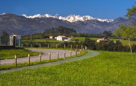
We reach Pimiango, kilometre 6.1; on the way we can see the Picos de Europa and the Picu Urriellu (Naranjo de Bulnes). We leave the village by a path to the right that goes back to the coast. In 700 metres we find a viewpoint, where there is also a fountain to refresh ourselves. We continue on our way.
At kilometre 7.7, as we reach the end of the route, there are several crossroads: to the right, one of them goes to the hermitage again, but we continue straight on until we reach the car park again.
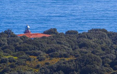
If we continue down this path, we will reach the San Emeterio lighthouse.