

- Belmonte de Miranda, Somiedo and Teverga Asturias Centre
- Distance: 16,8 kms
- Difficulty: Short
- Code: GR101 - Camino Real del Puerto de la Mesa (Royal Road to Puerto de la Mesa)
- Unevenness: 634
-
On foot:
5 h. 30 min.
round trip
- Start point: Port of San Lorenzo
- Tour type: One way
- Layout of the route: Download kml, Download gpx
GR101 - Camino Real del Puerto de la Mesa - Stage 2
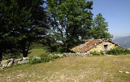
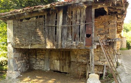
The mark of man can be found on this route at every step, in every stone that was laid by the Romans to build their road to the Meseta; we also find it in the traces of the previous ones, those of the tomb necropolises, the remains of which can still be seen along the route.
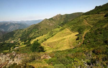
Nature is evident in the different species of trees and bushes, as well as in many of the species of fauna that can be seen, or that leave their traces. But, undoubtedly, the main element of nature on this route is the landscape.
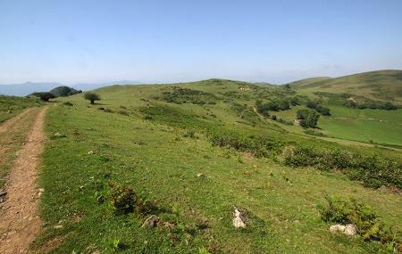
Walking along the crest of the sierra, where it is easier to walk, we can see to the right and left the nearest valleys and the most distant mountains, the rivers, forests and pastures of Somiedo, Teverga, Grado, Belmonte de Miranda, Yernes y Tameza and more. A route with an eagle's eye view.
Puerto de San Lorenzo - Dolia (Belmonte de Miranda) 16,8
This route, of a historical nature, is based on an ancient Roman road, once conceived to link the Meseta with Asturias and thus facilitate communications between traders from both regions.
The initial route went as far as Pravia, but nowadays it is asphalted from the village of Dolia.
We start the route from the San Lorenzo pass, where we find two paths: one to the left, which passes halfway up the hillside, and another to the right, which climbs up to the antenna. We will take the first one, to the left.
After approximately 6.8 kilometres, the path crosses another agricultural path, and we continue straight on without turning off.
After 12 kilometres from the start of the route, we come to another crossroads, which we ignore and continue straight on. Three kilometres further on, at kilometre 15, we come to Venta Porcabezas.
At approximately kilometre 16, the road forks; turn right to reach the village of Dolia, which is about 2 kilometres away. We can also start the route from this village, but in the opposite direction. It was the last village that the traders had at that time before tackling the long passage of more than 40 kilometres to the Meseta.