
- Somiedo Asturias Centre
- Distance: 12 kms
- Difficulty: Short
- Code: PR15.1
- Unevenness: 334
-
On foot:
3 h. 45 min.
Round trip
- Start point: Lake Valley
- Tour type: One way
- Layout of the route: Download kml, Download gpx
PR15.1
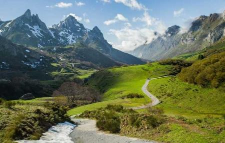
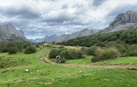
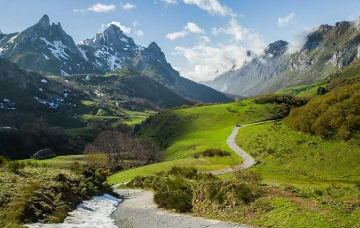
From the village of Valle de Lago to Lago del Valle we are surprised by 6 kilometres of ethnography, flora, fauna, geology and landscape that can eclipse our five senses. Colour, diversity and the work of the land by humans are the predominant tone of this route.
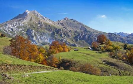
On the wooded slopes, beech and the occasional arraclan are the dominant species. The rest are grasses and the everlasting teito, which is used to make the roofs of the huts of the same name. But if there is one plant that stands out, it is the large and colourful flowers of the genecianas - yellow or orange - which fill the upper part of the valley in June and July.
There are many small birds to be seen in the area, including the beautiful Yellowhammer, a bird with a particular yellow colour. If we are lucky enough to see bears from the route, on the slopes, we must proceed with caution so as not to disturb their peace and quiet...
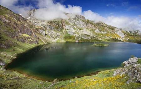
We are in a Natural Park which is also a Biosphere Reserve: remember to leave everything as it was and not to collect plants or animals. Perhaps with luck, in April or May, you will be able to reach the glacial basin of the lake and enjoy the spectacle of a sunny day, with a clear path or even with some snow, to find the surface of the lake completely frozen.
Valle de Lago - Lago del Valle 12
The route starts in the village of Valle de Lago, in the council of Somiedo. It is a practically straight and ascending path that takes us to Lago del Valle.
Two and a half kilometres from the start of the route, we come to a fork where we take the path on the right. From here you will begin to see, on your left, the teitos, huts with a roof made of vegetation, typical of this area. They have a rectangular or square floor plan, and the walls are made of masonry; the roof is characteristically composed of a wooden framework that supports a roof of vegetation, generally of the broom type.
At kilometre point 3.40, there is a fork, where we take the path to the right, along the side of the mountain, to the south of our position. About 500 metres further on, we can enjoy the spectacular panoramic view of the valley from the "braña del Gabitón". Here we can see several more teitos.
After the first 5 kilometres we come to another fork, where we opt for the path to the left. A few metres further on, we will have to cross a rocky area, so it will be necessary to pay attention and advance carefully.
From the next kilometre or so, we will be able to get our first view of the Lago del Valle. Continue around the lake in a clockwise direction. About 500 metres further on, we will be at the highest point of the route and we will have to continue in an easterly direction to begin the descent to the village of Valle de Lago.
Approaching the end of the route, at kilometre 9.20, we will be able to contemplate, on our right, the teito de Corba, and going straight ahead we will arrive at Valle de Lago, to conclude our route.
It can be done by mountain bike, taking into account the three slopes.