

- Tapia de Casariego and Castropol Western Asturias
- Distance: 10,4 kms
- Difficulty: Short
- Code: GR204 - Coastal Path E9
- Unevenness: 30
-
On foot:
3 h. 15 min.
Round trip
- Start point: Tapia
- Layout of the route: Download kml, Download gpx
GR204 - Coastal Path E9 - Stage 28 (first section)
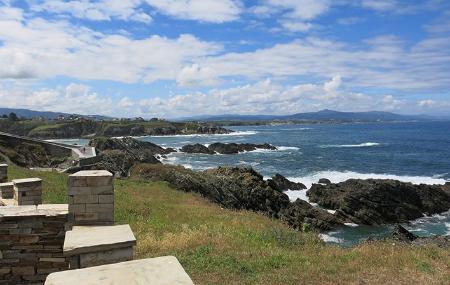
Almost on the western borders of Asturias, the Way of St. James brings us closer to Galicia, enjoying the coast, its villages and, above all, its beaches, with jewels such as Penarronda beach, declared a Natural Monument.
This sandy area stands out for its dune system, which shelters several protected species of flora. Among the fauna of the nearby cliffs of the Pantorgas islets we can see oystercatchers and shags, but the star is undoubtedly the otter, which occasionally appears in the Penarronda stream.
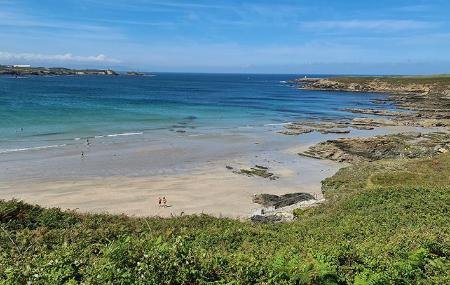
We can't miss the beaches of Santa Gadea, Mexota and Serantes, all on the way, and enjoy each one either during the walk or by going to them afterwards.
And the crowning touch is to reach the recreational area on the beach of Arnao, after passing another one next to a lagoon, and enjoy the mouth of the Eo, the largest estuary in Asturias.
Tapia - Arnao Beach (Castropol) 10,4
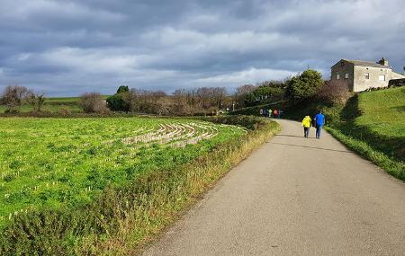
We leave the village of Tapia along the pavement that runs parallel to the road, taking its beach as a reference point, on the right, as the start of the E9 route is at this point.
Half a kilometre after starting, we turn off to the right to pass next to the football pitch, where we shall see the river Anguileira. Follow the path straight on. Two kilometres further on, if we turn right, we can visit La Paloma beach.
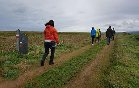
Continuing 500 metres further, we will find a fork and take the path on the right, going straight on without turning off. In the next 500 metres, at kilometre 4 of the route, if we take a path on the right, we can get close to Sarello beach, and right next to it is Mexota. You will come to a fork again, where you turn right once more.
After about 4.9 kilometres, we find ourselves in A Penela; here we must turn right, and a few metres further on we reach Villamil. We leave the village straight on, without turning off at the crossroads.
After a kilometre from the previous point, we turn right towards Santa Gadía, where we can go down to contemplate its beautiful beach. About 300 metres further on we reach Santa Gadía, where we turn left to go to the hermitage of San Lorenzo, located a few metres further on. From here we can turn right and contemplate its beautiful beach.
After 7.5 kilometres from the start of the route, we turn right and see Penarronda beach, which has been declared a Natural Monument. It is shaped like an elongated shell and its flora includes a unique plant: the sea wallflower, an endangered species that is not found anywhere else in Asturias. It is also part of the Río Eo, Oscos and Terras de Burón Biosphere Reserve. We cross Penarronda along its wooden footbridges.
Back on the track, we turn left and continue straight on without turning off until we reach kilometre point 8.3, where we turn left again and continue straight on.
Near the end of the route, at kilometre 9.15, we come to some ponds. Here we turn left and continue straight on until we reach Arnao beach, the end of our route. In the vicinity of this beach is the Arnao platform, a set of fossilised coral formations that once formed a reef.