Retour La voie ferrée, le long de la Voie verte de l'Eo
La voie ferrée, le long de la Voie verte de l'Eo
La route des chemins de fer, qui traverse la commune de San Tirso de Abres, à l'extrême ouest des Asturies, est d'une grande valeur historique et culturelle.
La voie ferrée traverse la commune de San Tirso de Abres, dans la partie la plus occidentale des Asturies. Ces terres sont baignées par la rivière Eo, qui a été déclarée en 2007 réserve de la biosphère par l'UNESCO sous le nom de Río Eo, Oscos et Terras de Burón.
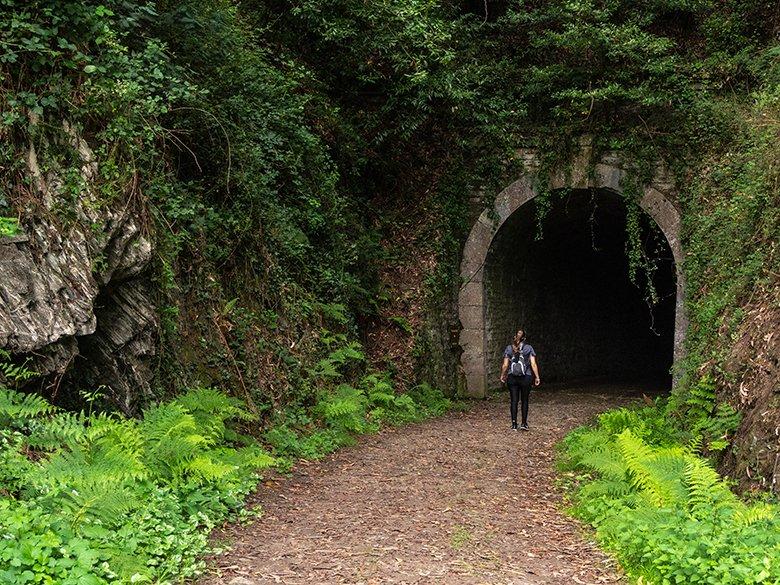
Le plus grand charme de cette voie verte réside dans sa valeur historique et culturelle, puisqu'elle longe l'ancien chemin de fer minier qui reliait A Pontenova, en Galice, à San Tirso de Abres, dans les Asturies.
De nombreux exemples de son patrimoine industriel sont encore conservés, comme une centrale hydroélectrique ou les six tunnels qui jalonnent le parcours et qui constituent l'un de ses éléments les plus caractéristiques.
Ainsi, si vous le souhaitez, nous pouvons faire un peu de tourisme industriel tout en randonnant dans un environnement naturel d'une grande beauté, une option fantastique !
Tout ce que vous devez savoir avant de chausser vos bottes
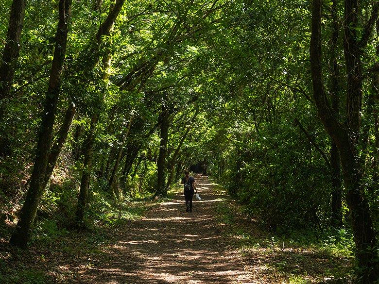
La voie ferrée ou voie verte d'Eo (PR. AS-300) est l'un des itinéraires les plus faciles à réaliser dans les Asturies.
D'unelongueur de 13 kilomètres (aller et retour), il s'agit d'un itinéraire linéaire d'une durée d'environ 3 heures et demie (au total), avec peu de dénivelés et seulement 45 mètres de dénivelé.
C'est donc un parcours idéal pour les enfants (en adaptant toujours la distance à leurs capacités), même avec une poussette capable de supporter quelques secousses. Bien entendu, il peut également être parcouru avec une poussette sans aucun problème.
Le revêtement de la route est assez bon, donc si vous portez une paire de chaussures de randonnée, cela suffira. En fait, d'une manière générale, il convient également aux personnes à mobilité réduite qui utilisent des fauteuils roulants ou d'autres aides.
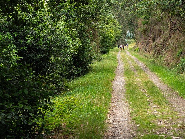
En raison du faible dénivelé et des quelques obstacles qui jalonnent le parcours, une autre bonne alternative serait de le faire à vélo. Et ne vous inquiétez pas si vous n'en avez pas, car à San Tirso de Abres, il existe plusieurs entreprises qui en louent.
Quelle que soit l'option choisie , n'oubliez pas de vous munir d'une lampe de poche ou d'une lampe frontale (la lampe de poche de votre téléphone portable peut être utile), car vous traverserez de nombreux tunnels qui ne sont pas toujours éclairés.
Si vous souhaitez emmener votre chien, nous sommes sûrs qu'il s'amusera beaucoup ! Tout au long du parcours, vous trouverez de l'eau douce sous forme de ruisseaux, ce qui vous permettra de vous désaltérer autant que vous le souhaitez. Il y a également un accès à la rivière pour qu'il puisse s'y ébattre.
La Route des chemins de fer : tourisme industriel et randonnée tout à la fois !
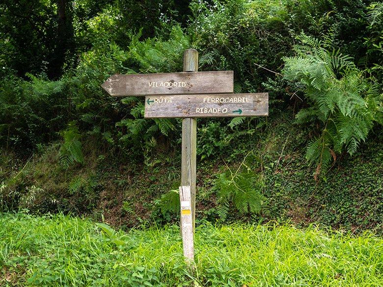
La voie ferrée traverse la zone occupée par l'ancien chemin de fer minier qui parcourait la ligne Villaodrid-Ribadeo en Galice pendant la première moitié du XXe siècle.
Il passe entre la chaîne de montagnes de Neira et la vallée de Lorenzana, une zone qui abritait autrefois plusieurs gisements de fer, dont l'extraction était assurée par l'entreprise Sociedad Minera de Villaodrid (SMV).
Cependant, une partie des 33 kilomètres de son tracé traverse la commune asturienne de San Tirso de Abres, où 13 d'entre eux ont été reconvertis en voie verte par la Fundación de los Ferrocarriles Españoles, dans le cadre de son projet de récupération des voies ferrées désaffectées.
Ce train a fonctionné de 1903 à 1964, et après son transport par rail, le fer partait par bateau du quai de chargement de Ribadeo (que l'on peut encore voir à côté du pont de Los Santos) vers la Biscaye et d'autres ports européens.
La voie ferrée part de San Tirso de Abres (ville exemplaire des Asturies en 2011) et va jusqu'au ruisseau O Cairo, à la frontière entre les Asturies et la Galice, bien qu'elle puisse être prolongée de 6 kilomètres sur l'asphalte jusqu'à A Pontenova (Galice).
Mais allons-y pas à pas...
Vous pouvez garer votre véhicule n'importe où dans le village, et l'un des endroits où il y a beaucoup de places de stationnement est près du pont, à côté de l'aire de loisirs le long de la rivière.
Le parcours commence d'un côté de la route d'accès à San Tirso, tout près du virage avant le pont, et dans ses premiers mètres, il passe à côté de l'ancienne gare, qui est aujourd'hui une maison privée.
À cet endroit, vous verrez également un bâtiment cylindrique qui semble avoir été un dépôt, probablement de charbon.
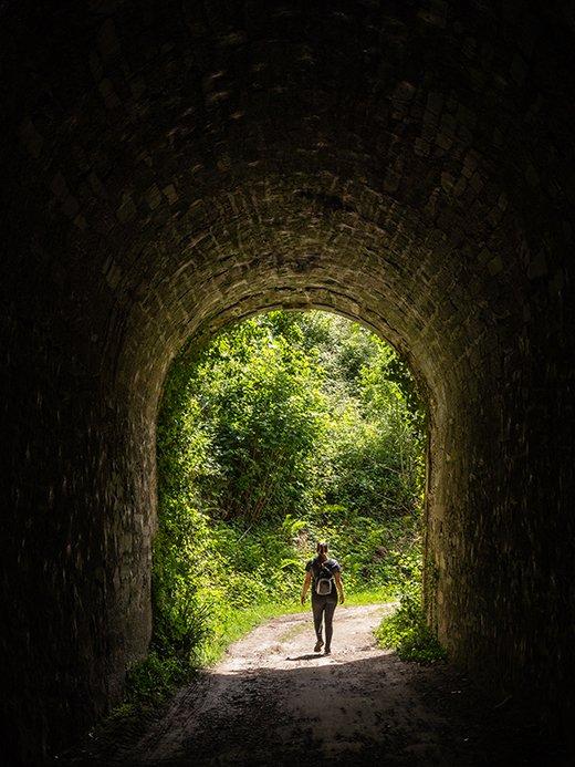
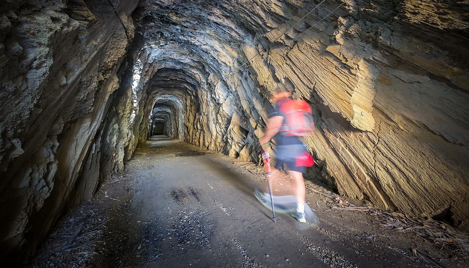
L'undes aspects les plus frappants de l'itinéraire est la présence de six tunnels. Le premier, le tunnel de San Tirso (90 mètres de long), se trouve peu après le début de la randonnée, à environ 300 mètres du départ.
Viennent ensuite le tunnel de Volta (90 mètres et courbe), le tunnel central (65 mètres, le plus court), le tunnel de Pedrido (100 mètres), le tunnel de Carriceiro (130 mètres) et le tunnel d'Asela (le plus long avec 173 mètres).
Tous sont correctement éclairés par des lampes alimentées par des panneaux solaires, mais certains d'entre eux peuvent ne pas s'allumer lors de votre passage, alors n'oubliez pas d'allumer votre lampe frontale ou votre torche pour plus de sécurité et évitez de trébucher ou de vous éclabousser, car il y a de nombreuses fuites et flaques d'eau.
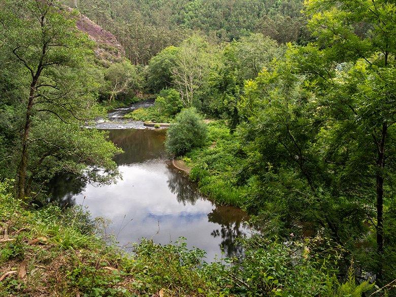
La voie verte de l'Eo compte quatre espaces naturels protégés dans un rayon de moins de 5 kilomètres: la réserve de biosphère Río Eo, Oscos et Terras de Burón, ainsi que le SIC ( site d'importance communautaire) Río Eo, la zone de protection spéciale des valeurs naturelles Carballido et la zone de protection spéciale des valeurs naturelles Río Eo (qui font partie du réseau Natura 2000).
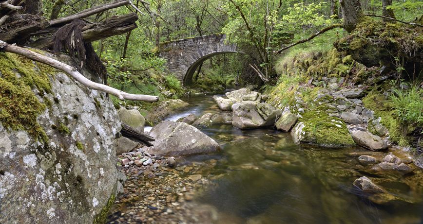
Le sentier est facile à suivre, ce qui permet de se détendre et de se laisser porter tout en écoutant le son de la rivière Eo, un autre des protagonistes de cet itinéraire, qui abrite des animaux tels que la truite, la truite de mer et le saumon.
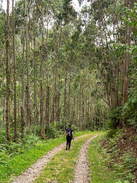
Le lit de l'Eo est également entouré d'une forêt riveraine dense, dominée par les aulnes, les saules, les frênes et même les châtaigniers, mais on peut également voir plusieurs plantations d'eucalyptus, une espèce abondante dans cette zone.
Le seul point délicat du parcours est celui où il faut traverser les trois voies de la route N-640 au milieu d'un virage, vers le kilomètre 1,5 du parcours. Il n'y a pas beaucoup de voitures qui passent, mais il faut être très prudent, surtout si vous voyagez avec des enfants ou des chiens. Et n'oubliez pas que si vous êtes à vélo, le plus prudent est de descendre et de traverser à pied.
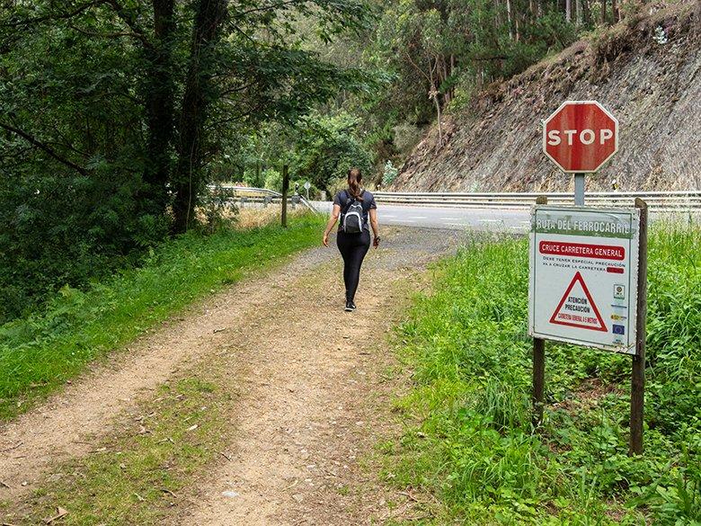
Peu après ce croisement, on trouve deux tables de pique-nique, les seules de tout le parcours, et tout près d'elles l'accès (un peu fermé) à l'ancienne centrale hydroélectrique, la centrale do Louredal, qui date de 1932.
Plus loin, sur la droite, il y a une centrale en activité dont l'accès est interdit, et à côté une passerelle métallique qui traverse la rivière à une certaine hauteur.
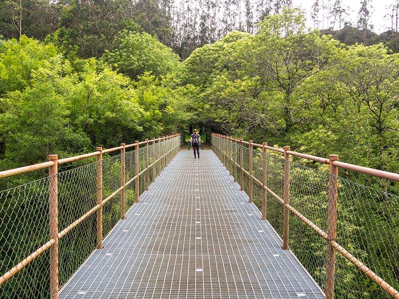
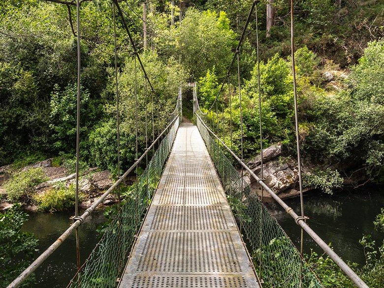
Si vous en avez envie et que vous n'avez pas le vertige, vous pouvez également faire un détour par la droite, en descendant jusqu'au pont suspendu de Piago Mayor, l'un des endroits les plus beaux et les plus bucoliques de la route.
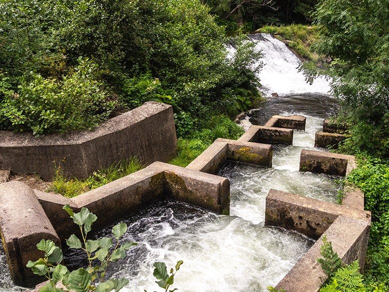
En revenant sur le sentier, quelques mètres plus loin (toujours à droite), vous trouverez la descente vers l'échelle à saumons, une curieuse invention qui empêche les saumons de se coincer dans les barrages et leur permet de poursuivre leur voyage en amont.
Il s'agit d'un autre des endroits les plus pittoresques de l'itinéraire, qui comporte également une cascade assourdissante, abondante et photogénique.
En revenant sur le sentier, dans la partie la plus aérée de cette forêt fluviale verdoyante, il faut faire attention à ne pas oublier un autre endroit intéressant, le déversoir, qui a été construit pour donner un exutoire à un petit ruisseau situé sous les voies ferrées.
Il se trouve sur la gauche et il faut descendre un sentier court mais assez raide, indiqué par une flèche discrète sur le sentier principal.
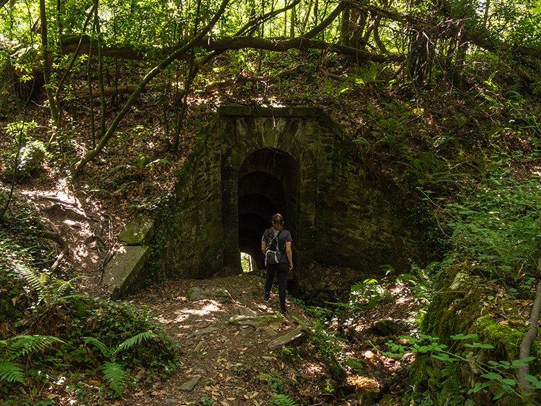
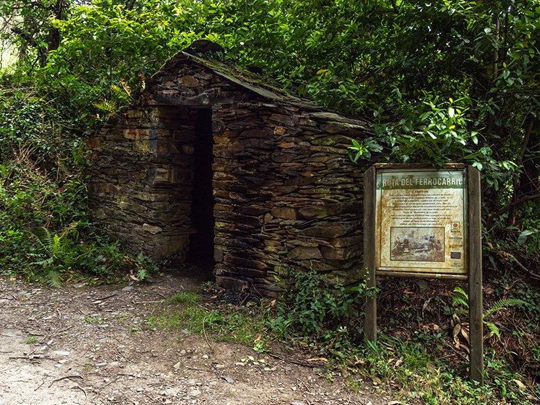
Le dernier élément représentatif de l'ancien chemin de fer minier que nous rencontrerons est un "caseto", un petit bâtiment en maçonnerie avec des toits en ardoise, qui servait à stocker le charbon utilisé comme combustible pour le chemin de fer.
Nous atteindrons bientôt la fin de l'itinéraire, marquée par le ruisseau O Cairo, frontière naturelle entre les Asturies et la Galice. À ce stade, vous pouvez choisir de faire demi-tour ou de continuer encore 6 kilomètres sur l'asphalte jusqu'à A Pontenova, où se trouvent les fours de calcination qui transformaient le minerai transporté plus tard par le train.
La Route des chemins de fer est un excellent exemple de conservation du patrimoine industriel asturien, conçu pour promouvoir l'écotourisme basé sur le respect de la nature, le sport et, surtout, la connaissance de l'histoire des Asturies.
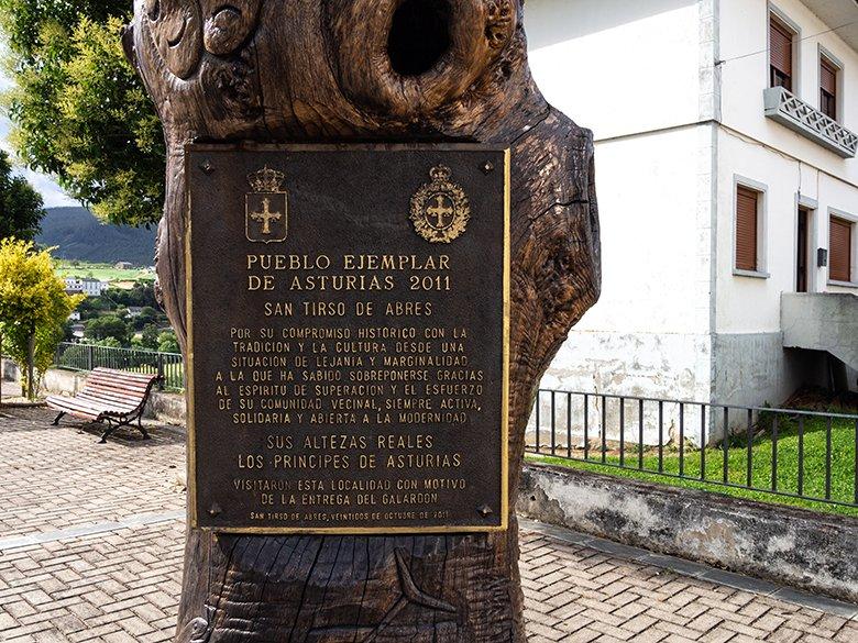
Mais attendez ! Ne partez pas sans avoir visité El Llano, capitale du conseil. Vous pourrez vous promener dans ses rues, visiter l'église paroissiale de San Salvador, la chapelle de San Juan, la place de l'hôtel de ville ou l'ancien palais du Condado de Altamira ("O Pacio"), qui date du XVIe siècle.
Si vous préférez, vous pouvez vous reposer dans l'aire de loisirs ou, s'il vous reste de l'énergie, découvrir la rivière Eo à bord d'un canoë, un bon plan !
Abonnez-vous à notre newsletter et profitez d'offres, de réductions et de nouveautés
S'abonner

