
Route to the braña de Sousas with children in Somiedo
The Somiedo Natural Park, with its unique landscape and cultural richness, is one of the hiking paradises in Spain.
The Natural Park of Somiedo in Asturias, with its unique natural and cultural wealth, is one of the best places in Spain for hiking and exploring landscapes and places, of which there are hardly any left.
It is true that Somiedo has mountain routes that can be really hard and difficult, but it also has routes that are not excessively complicated, and which are ideal for introducing children to this passion that is hiking.
One of the routes that we did as a family, and which seems to have been designed for children, is the one that goes from Valle de Lago to Braña de Sousas.
The route to Braña de Sousas with children!

Practical information about the route
Distance: from Valle de Lago to Braña de Sousas there are 3 kilometres, to which you will have to add as many kilometres on the way back.
Gradient: the cumulative gradient of the route is about 250 metres.
Difficulty: easy to do with children who are used to walking.
The start of the route to Braña de Sousas with children
To get to Valle de Lago, we take the road from Pola de Somiedo (the only road that leaves Pola de Somiedo, except for the main road), and after 8 kilometres it ends in Valle de Lago.
In our experience, the best way to find the start of the route is to look out for the large red and white sign indicating the start of the route when you reach Valle de Lago. The sign is located in the second nucleus of houses that make up the village (the Barrio de La Caleya), on the right-hand side of the road, and a little before arriving in front of a bar which makes the road fork in two.
The branch to the right is actually the start of the route, and the one to the left is the one we continue along for about 400 metres to reach the car park in Valle de Lago, as it is not easy to find a place to park in the village. The car park is located on both sides of the road and has space for more than 50 vehicles, so it is rare that you will not find a place to park your vehicle.
Once you are at the starting point of the route, the path is simple, as it is the PR-AS 16.1 short-distance footpath, you just have to pay attention to the white and yellow markings and follow them.
The path is wide and well surfaced, so it can easily be done by bicycle, and even with pushchairs suitable for uneven terrain. You also have the option of doing the route to the Braña de Sousas with children on horseback, as there are companies in Valle de Lago that organise them.
Shortly after leaving Valle de Lago, we cross the Río del Valle over the bridge, and leave the path to the right that leads to the church and the cemetery. Soon we find a couple of other forks, but we just have to keep an eye on the signs to follow the right path to the braña.
As we ascended among oak, beech and hazel trees, and with the stone fences delimiting the farms, we could see how Valle de Lago was getting smaller and smaller at the bottom on our right.

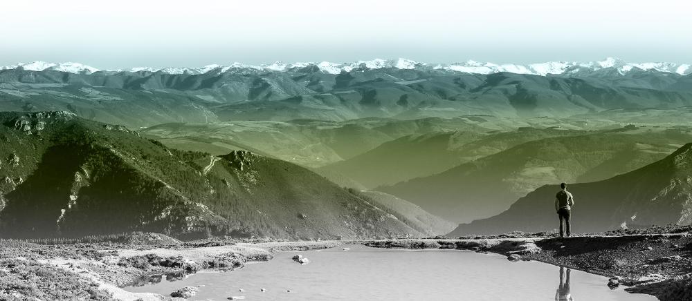
As we gained altitude, we began to enjoy wonderful views of the valley of glacial origin through which the Río del Valle flows. This valley is one of the largest in the Somiedo Natural Park, and at its end is the famous Lago del Valle, the largest mountain lake in Asturias.

La Peña Furada and Braña del Fuexu
Little by little we reached the divide that leads to another new valley, the one formed by the River Sousas. From this point onwards, the area becomes quite beautiful and a bit steep, with steep slopes, where we had to encourage the children to continue because they were starting to get a bit tired.
The path is in the shade of a grove of beech trees and runs halfway up the slope, so at some points it is protected by a metal fence to avoid accidents.
Here we stopped to take a look at the beautiful Enraimada Forest on the slope opposite. This fairytale forest is a protected area with restricted access, where the brown bear has its refuge. To the right, we can see a truly unique mountain, Peña Furada or Pico Castiellu, a rocky crag with a natural window that makes it unmistakable. The landscape in this area is truly magical.

A little further on, we pass by the Braña del Fuexu, which we can access by a branch of the path that goes off to the right, which leads to it. This hut is very well preserved and here we found the so-called "cabanas de teito". The children thought they were in front of a goblin's house.

On the left is another path, which is one of the return options, that leads to the Peña Furada viewpoint. There is another turning to the left on the path, some 300 metres further on, which also leads to the viewpoint, along a path that is less steep than this first turning.

The Braña de Sousas
From here, the path takes a wide turn to the right, passing through a really beautiful wooded area that is very pleasant in summer, and after another wide turn to the left, we finally reach the Braña de Sousas.
Up to here we had covered 3 kilometres of path, and we had overcome a difference in altitude of about 250 metres, something that, without being too much of a burden, we were able to do well with the children.
From Braña de Sousas we had spectacular views of the bottom of the glacial cirque, dominated by the Alto del Muñón, one of the most outstanding mountains in the Sierra del Rebezu, which closes off the entire southern part of the valley where we are.

As the braña was full of cows grazing peacefully, it was hard to resist taking a lot of photos of the cows with the cows in the background. If you are going to do the Braña de Sousas Route with the children, take advantage of the opportunity, but try not to disturb them.

In the Cantabrian Mountains, the "brañas" are the high pastures where the cattle graze in summer. However, in Somiedo they go further, and the brañas are the same grazing areas, but accompanied by traditional constructions that are used to house the "brañeiro" and the livestock.
In the "brañas" of Somiedo, the most common thing is to find "cabanas de teito", which are usually rectangular in shape, with a roof made of broom. On some occasions, and specifically in the Braña de Sousas, there are other older constructions, which are the "corros", circular stone buildings with a dolmite-shaped door lintel and a stone roof, with a false vault and a curious smoke outlet.
The Braña de Sousas, as well as being one of the best preserved, is one of those with the largest number of corros. It was well worth coming here to see this unique ethnographic site and the impressive glacial valley in which it is located.
This was the place we chose to eat our sandwich and rest for a while, sitting on a stone with a view of the corros and the cows.
El Collado del Muñón
After lunch we continued along the path ahead to the bottom of the valley. At one point we could see the depression at the foot of the Alto del Muñón. Here was the cirque where the ice that fed the glacier accumulated and which, with the thaw, formed a lake of which there is nothing left today.
As the children had managed to get this far and were feeling strong enough, we continued up the path. This path runs through the rocky areas until it reaches the Collado del Muñón, which is another kilometre of walking and a further 200 metres of ascent. I don't recommend it for very young children, because they can end up very tired.

This pass marks the natural boundary between Asturias and León and, as well as offering great views, it is a good place to see some of the herds of chamois that graze in these high areas.
The way back
The way back was the same as the way out, with the only difference that we took the detour that led to the Peña Furada viewpoint. From the viewpoint we enjoyed wonderful views of the Enraimada Forest, and we were able to take some beautiful photos of the Braña del Fuexu, with the Peña Furada in the background.
To return to Valle de Lago, we continued along this new path that we had taken to get closer to the Peña Furada viewpoint.

To go to the same point where we started the route in Valle de Lago, at the first turning we found shortly after the viewpoint, we took the main road to the left, which led us to the path along which we did the route.

We saw that if you want to take a shortcut, when you reach this turn-off you can take the one on the right. This path goes down through a wooded area of beech, oak, hazel and chestnut trees and, when it reaches the base of the valley, it crosses it through the meadows to go straight to the point where the car park is located.

Subscribe to our newsletter and take advantage of offers, discounts, and news
Subscribe
