Back Foces de El Pino route in Aller
Foces de El Pino route in Aller
The Foces de El Pino Route, in Aller, is one of the most spectacular routes in Asturias at any time of the year. A cowboy's road, Jacobean route and Roman road, it offers you a captivating landscape.
The Foces de El Pino Route (P.R. AS-31) is one of the most spectacular routes you can take in Asturias at any time of the year, being especially captivating in the rainy season, when the river Valmartín creates numerous waterfalls and impetuous rapids.
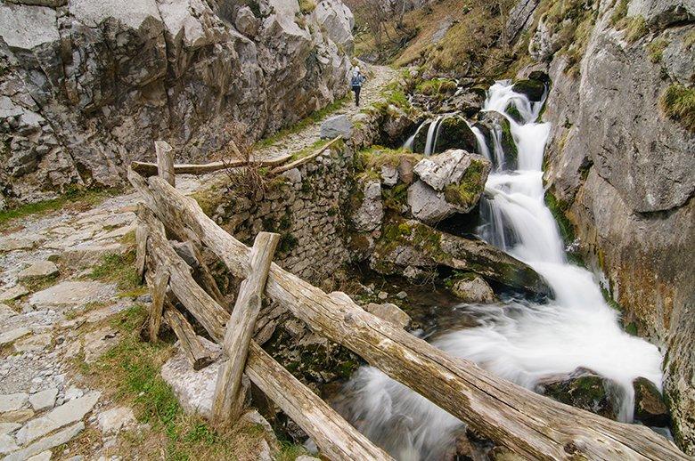
The Foces de El Pino Route follows a Roman road that was once followed by pilgrims on the Way of St. James. It was -and is- also the usual route for the cowboys of the Aller council to drive their cattle up to the meadows at the end of winter.
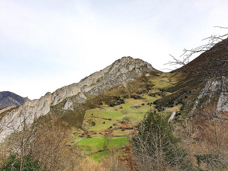
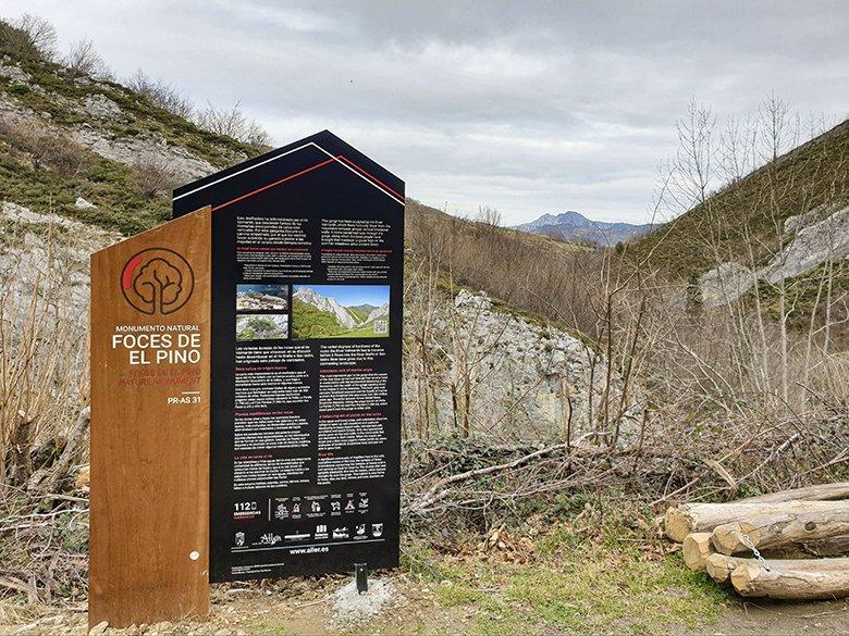
This route crosses the Fuentes de Invierno mountain range through a gorge that the river Valmartín cut into the mountains of Allerano over millions of years. The gorge, which in some sections is narrow and less than 6 metres wide, forms a unique landscape of important geological value, which is why it was declared a Natural Monument in 2001.
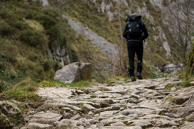
The Foces de El Pino route is simple, well signposted and does not present any greater difficulty than expected as it crosses forests and natural rocky areas. However, due to its length (6.5 kilometres) and the dampness of the rocky ground, the route is not suitable for people with mobility problems or bicycles. It is advisable to wear shoes with good grip and carry walking sticks from October to May.
El Pino and Felechosa, two villages from where you can start the route
The Foces de El Pino route starts next to the Molín de Peón. Right next to it there is a small recreational area with space to park a couple of vehicles. Unless you get up very early in the morning, it is practically impossible to find a free space.
The nearest village is El Pino. In the village you will find the Church of San Félix (a Site of Cultural Interest), the Casona del Patio (16th century) and the Casona de La Torre (17th century). An asphalted track leads quickly to the start of Las Hoces de El Pino, passing the ferruginous water spout of La Fuente de La Salud. However, my advice is to start the route in Felechosa, so you can add one more route (see below).
Felechosa is a village that triples its population during the ski season. It has a great number of bars, restaurants, accommodation, shops, etc.
The hermitage of the Virgen de La Antigua, located in the upper part of the village and the subject of a curious legend, stands out. Alleranos born in Felechosa are known by the nickname of "los de la viga travesá". It is said that during the construction of the temple, the villagers were obsessed with trying to put a beam through a window. In one of the countless attempts, the beam fell to the ground in the perfect position to insert it.
Near the hermitage there is a mill that has been declared an Asset of Cultural Interest, but it is not the only monument in this category, as the manor house of the indianos of the Hotel El Parador also belongs to this category.
ROUTE 1. Senda Verde de Foyoso, a pleasant walk between Felechosa and Molín de Peón
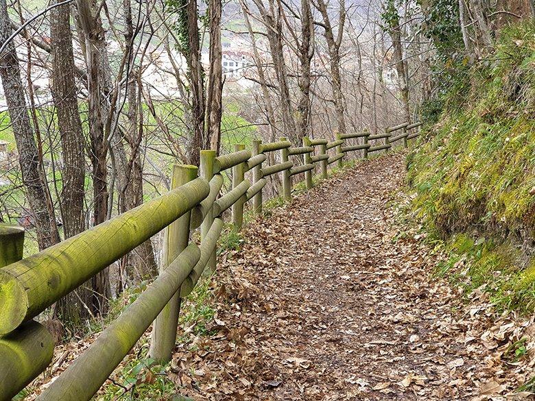
To get to Molín de Peón from Felechosa cross the bridge over the river Braña or San Isidro, in the lower part of the village. On the hillside begins the Senda Verde de Foyoso (P.R. AS-242). This is a simple 1.5 kilometre route parallel to the San Isidro river that crosses a deciduous forest until it reaches the Molín de Peón.
At this point you can continue along the Foces de El Pino route, retrace your steps, or follow the asphalted track that will take you to the centre of Felechosa, passing through El Pino. 3.5 kilometres long, the circular route of the Senda Verde de Foyoso is 3.5 kilometres long. This path is ideal for shorter days when you don't have time to go deep into the heart of a forest, or for snowshoeing.
ROUTE 2. Las Hoces de El Pino from Molín de Peón to El Posaero
Regardless of whether you have reached the start of the Ruta Foces de El Pino directly by car, on foot from El Pino, or by following the Senda Verde de Foyoso from Felechosa, the starting point will be the Molín de Peón. This hydraulic marvel was also a fulling mill and later a micro hydroelectric power station. Nowadays, the Fishermen's Association "El Maravayu" has restored the facilities to be reused as a trout fry nursery.
The Foces de El Pino Route continues along the path on the left. The route ascends comfortably in the shade of chestnut and oak trees, forests inhabited by wolves, wild boar, roe deer and chamois. It is a good route to take your binoculars with you.
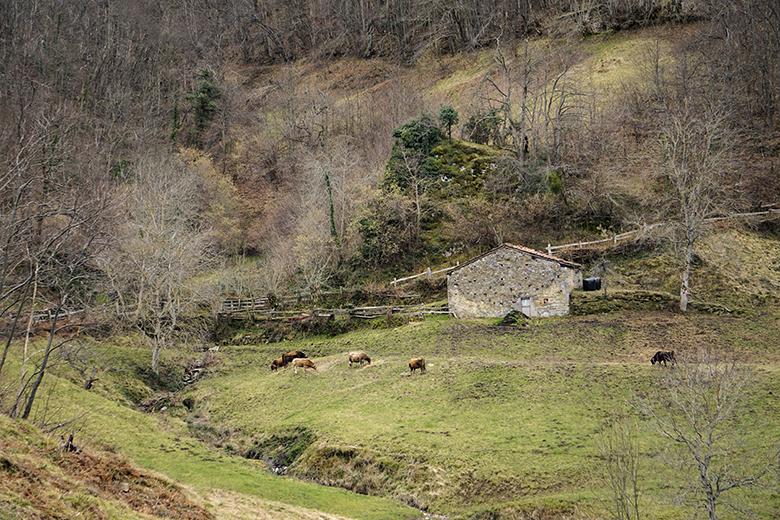
As you gain height, holly and beech trees appear and the path becomes stonier, although it is still wide. Shortly afterwards we come across an old cattle drinking trough, the Fuente Gavalanceras, where we can refill our canteens.
After crossing a wooden bridge, the gorge becomes narrower. The vertically cut limestone walls show fossils of seaweed and marine animals more than 300 million years old.

In some sections you can see the stone slabs placed in chapacuña to prevent the cattle from slipping in the humidity; this is the most critical point, but also the most spectacular.
On leaving the gorge we reach Las Pandas. Here we find a series of waterfalls that descend rapidly to the foot of a natural wall.
Following the cobbled path you reach El Posaero Bridge, the final point of the Foces de El Pino route. If you started the route in Felechosa and return from this point, you will have covered a total of 8 kilometres in less than 4 hours.
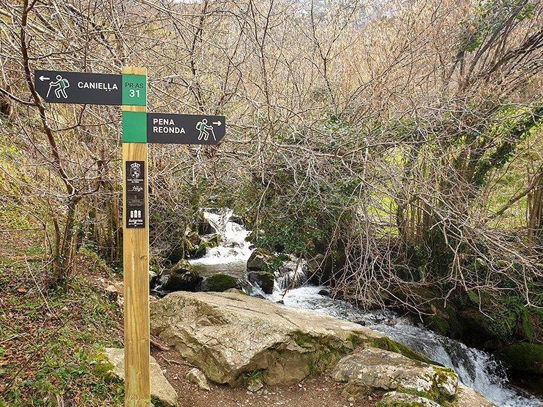
ROUTE 3. Las Hoces de Ruayer (ascent through Canieḷḷa)
Do you want more? Just where the Ruta Foces de El Pino ends, at the Puente El Posaero bridge, a path starts on the left towards the sheepfold of Las Campas. A steady but easy climb leads into a beech forest that gives way to La Cabritera, a grazing area.
We climb a little more until we reach the Alto de Canieḷḷa and continue southwards, passing through L'Acebal and Carbayalín, where we reach the track to the Vegará/Vegarada pass. Continuing downhill we reach the village of Ruayer/Río Aller and its fountains. After crossing them we reach the village of La Paraya, the end of the route.
As you can see, this is a very demanding route, both in terms of its length (18 kilometres) and the cumulative difference in altitude (over 1000 metres). It is obvious that it is ideal to have two vehicles and leave one in Felechosa and the other in the village of La Paraya. It will take you 7-8 hours to complete this route.
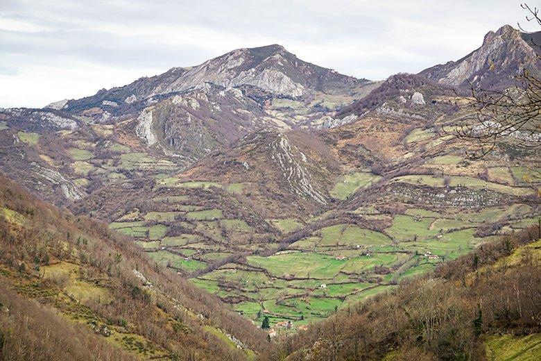
If you change your mind in the middle of the route or prefer to do a circular route , there is a plan B. Once you are at the Alto de Canieḷḷa, cross to the ridge at the base of Pena Reonda and zigzag down the steep slope that starts at the Fondil sheepfold. You will reach El Posaero bridge in record time. To tackle this stretch it is best to carry walking poles, otherwise you will have to descend with your hands and it is really tiring.
Latest tips
The photos accompanying this article were taken in January, on an unusually warm day in an unusually dry winter. Remember that it is very important to check the weather forecast before you go up the mountain.
If you intend to eat at a restaurant in the area, book a table as soon as possible, especially if it is the weekend or if the ski season has already started. Don't leave the council of Aller without trying the Alto Aller sausage, the trout, or its typical dessert, the panchón.
Subscribe to our newsletter and take advantage of offers, discounts, and news
Subscribe
