Back 4 hiking routes with splendid views in Cangas del Narcea
4 hiking routes with splendid views in Cangas del Narcea
Cangas del Narcea offers you numerous hiking routes to fully enjoy the nature and culture of the area. Here are 4 short routes!
Cangas del Narcea is one of those areas of Asturias where nature is a real blessing, and where traditional culture will be present in every step you take.
Given the vastness of the territory and its characteristics, there are numerous hiking routes for you to enjoy.
Here are four short hiking routes to discover unique spots!
Cuetu d'Arbas (El Puertu - La Laguna d'Arbas - El Cuetu d'Arbas)
Starting point: El Puertu
Duration: 1 h. 45 min.
Distance: 3,82 km
Difficulty: Medium
Difference in altitude: 518 m.
Type: Ascent
Transit: Free
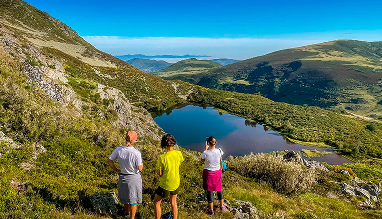
The route runs through the Partial Nature Reserve of Cueto de Arbas. Its 2,002 m. undoubtedly make it one of the most popular ascents in the region, but this does not mean that it is difficult. The route starts in the highest village in Asturias, El Puertu Leitariegos, at 1,550 m., and during the ascent you will be able to contemplate the immense glacial valley that extends from its hills. There are plenty of cirques and glacial excavation basins that house lakes such as Arbas, the largest in the whole region.
This route starts in the village of El Puertu (referring to Leitariegos). Take a path that starts in the square and climbs gently upwards towards the chairlift that can be seen in the distance. In a few metres, you will reach a wide track, turning right towards the telephone repeater next to the route. Continue uphill until you reach an area at the end of the track, where you will find the Arbas lagoon.
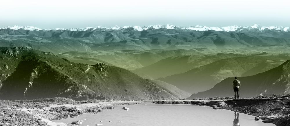
Right at the lagoon - shown in the photo at the top of this post - your ascent begins. You leave the path and reach a false plain, which in front of you has a watercourse that ends near the pass. It is at this point where the path turns off to the right to go up the other watercourse that takes you steeply down to the Fanetina pass.
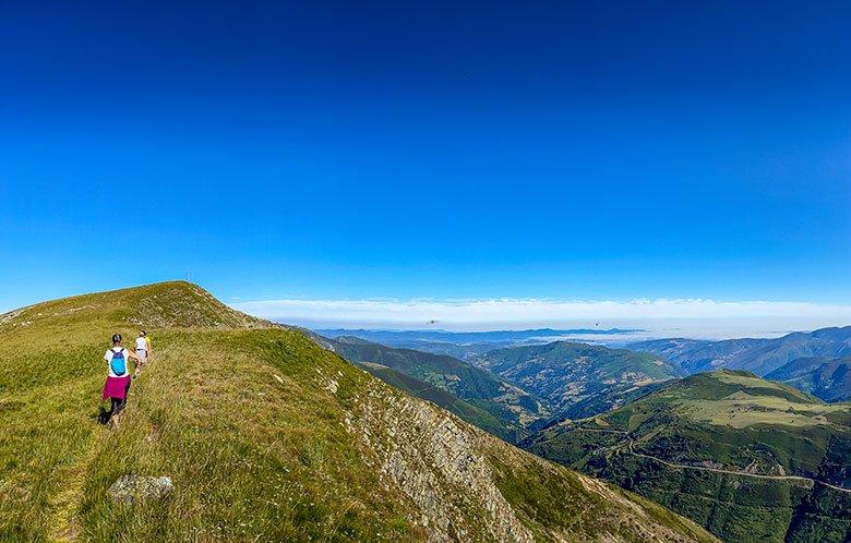
During your ascent you will see the Arbas lake in all its splendour, discovering that above it there is another smaller lake. You will also enjoy the view of the two sides of the pass and all the peaks bordering Somiedo.
Once you have reached the pass, you continue your walk along the ridge that divides Asturias and León, leaving the Picu Rapáu behind you. In a short time you will reach the summit of El Cuetu d'Arbas, at an altitude of 2002 metres. There is a hut, antennas and a geodesic vertex. It is a perfect place to make out the Naviegu valley, Picu'l Fraile, the Cabril mountain range and El Cornón, and, if visibility permits, you can even see the massif of Las Ubiñas.
Once you have enjoyed the summit, you will have to return the way you came.
Forest of Mual (Mual - Mirador de Montecín - El Chanu La Collada - Mual)
Starting point: Mual
Duration: 3 h. 10 min.
Distance: 9,12 km
Difficulty: Medium
Difficulty : 477 m.
Type: Circuit
Transit: Free
At the gates of the Integral Natural Reserve of Muniellos, the inhabitants of Mual lead a livestock and agricultural life. This route passes through farmland (cortinales), meadows and forests. Here you will discover the perfect coexistence between human uses and the conservation of nature.
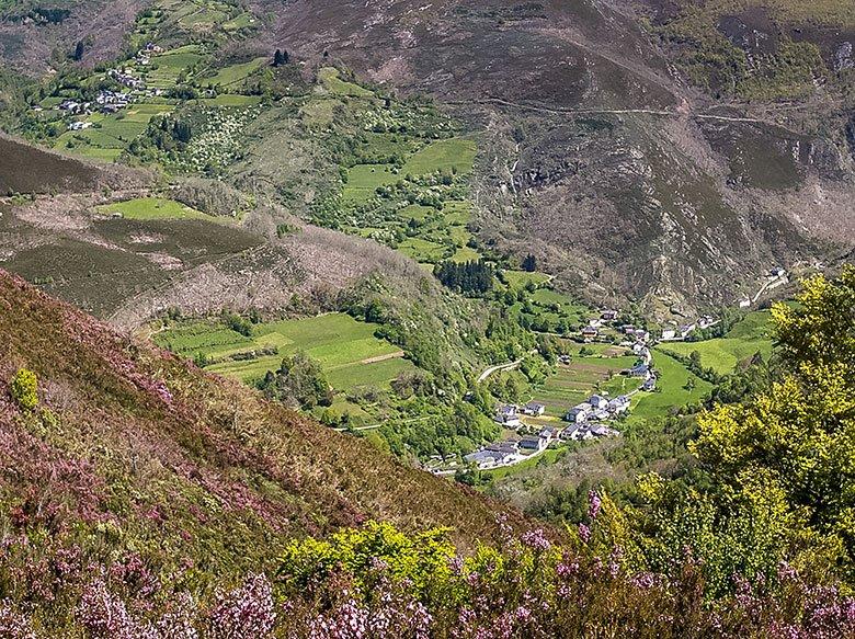
The route starts at the crossroads of the road and the path that runs through Mual, lined up at the bottom of the valley. You will have to walk through the village of Mual until you reach the chapel, where you will take a detour on the left that crosses the river and reaches the village square.
The route continues along the track that starts on the right and which, gently ascending, heads towards the stream, between chestnut and oak trees. Once you have crossed the stream at a turn in the path, you will come to a crossroads just after it. There you take the path to the right, entering a beautiful chestnut grove where you will discover the corripas - small circular stone constructions used to store the hedgehogs of the chestnut tree, leaving them there to cure until their fruit comes off more easily.
Continue in the same direction and along the path that is more marked, until you reach a sharp bend next to a meadow, where the path forks. Then take the path on the right, continuing upwards between oak and chestnut trees, and later crossing a beautiful beech forest.
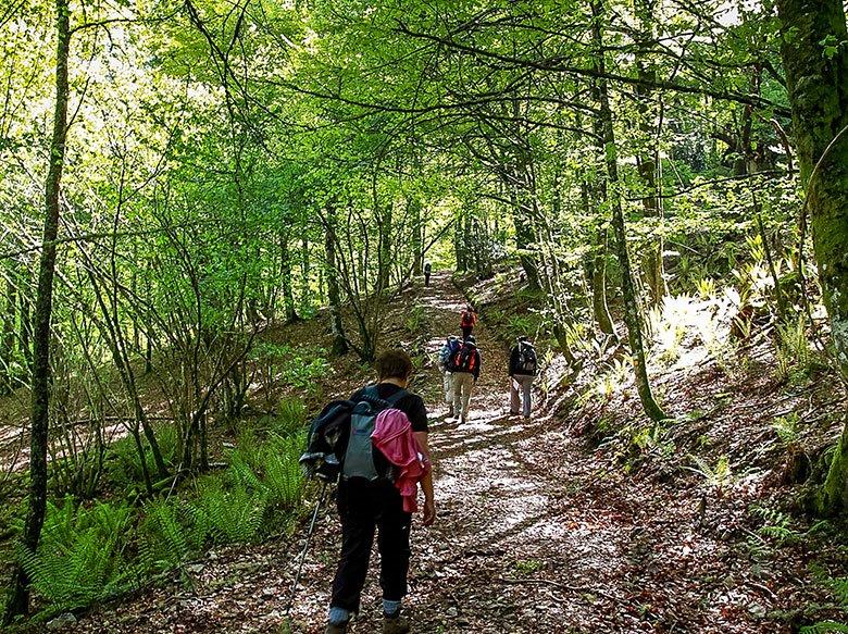
After crossing the beech forest, the path continues ascending towards the Montecín viewpoint. Once you reach the summit, your reward will be wonderful: from the viewpoint you will see the Mual valley, the El Connio pass and the lower part of the Muniellos Integral Nature Reserve.
When you return to the main path, continue the route along the path on the left, going back into a beech forest, to reach the Chanu La Collada, where there is a crossroads. Take the left-hand turn-off, descending steeply until you come to a track, which is the same as the one you used on the way up, and so you return to Mual along the same path.
In the surroundings of this route is the Mual - Las Tablizas walk, the entry point to Munieḷḷos, an ideal plan to go with children or to do by bicycle. You can also get a close-up view of such unique and traditional structures as the cortinos, circular constructions with two-metre stone walls and no roof, inside which the beehives, called truébanos or trovos, are placed. And the most curious thing is that these constructions were designed to protect the honey from the greedy attacks of bears.
El Cabril (Xinestosu - Los Corros - Las tres lagunas - Fanarrionda - Xinestosu)
Starting point: Xinestosu
Duration: 5 h. 30 min.
Distance: 14,46 km
Difficulty: Medium
Difficulty : 691 m.
Type: Circuit
Transit allowed from:
June 16 to August 15
From 1 October to 30 November
This route starts from the village of Xinestosu. You will cross the river taking the path that goes off to the left, heading for a long and gentle ascent towards the Los Corros valley. Once there, you will continue the ascent to El Colláu, leaving a beautiful peak on your right: Chao de Bueyes, from where there are splendid views.
However, before reaching this summit, you can see the only permanent lagoon in the area, which is located just below some rocks, a few metres away from the route. Once you resume your ascent, the three lakes will appear before your eyes in the middle of a gentle plain.
From this point, the route turns off to the left, climbing towards the Colláu. Shortly before you get there, you will come across a fountain, the ideal place and time to take a break before reaching the summit.
The old Royal Way runs through the Colláu, which connects the Somedano valley of Las Zreizales with the valley of L'Acebu. You follow this path in a northerly direction, just below the line of peaks, reaching the Colláu Los Secuellos, which separates the peaks of El Cabril and La Penas de Treisa. From here you can easily climb to the top of El Cabril and enjoy an impressive 360º panoramic view.
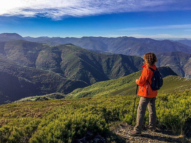
Along the same path you will reach the Fanarrionda hill, under which there is a leafy forest of birch trees, along which runs the path that joins Xinestosu and Villar de Vildas, the latter belonging to the council of Somiedo. At this point, you have two options: Continue along the Camino Real to Xinestosu, or leave it on the left and descend along the Camino de la Polvorosa, which is shorter but more difficult.
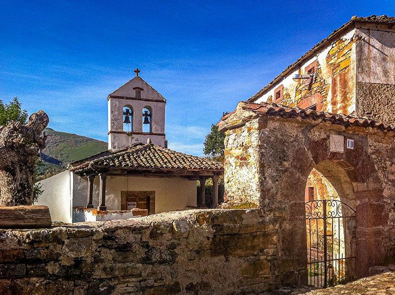
It is interesting to know that, thanks to high mountain shepherding, Xinestosu is famous for producing an excellent artisan cheese with a strong flavour and made from esparto grass moulds. It is known as "The cheese of transhumance", as it was shepherds from Castile and Extremadura who provided the pleitas (plaited esparto hoops used to mould the cheese and drain the whey). This transhumance took place over steep mountain passes on narrow paths that connected, as in this case, the valleys of Somiedo and Cangas del Narcea with León.
Pomar de las Montañas (El Pumar) (Bisuyu - Pomar de las Montañas - El Pozu - Bisuyu)
Starting point: Bisuyu
Duration: 3 h. 46 min.
Distance: 10,7 km
Difficulty: Low
Elevation gain: 333 m.
Type: Circuit
The route starts in Bisuyu, a peculiar village hidden in the mountains, well known for being the birthplace of the playwright Alejandro Casona and also for its ironworks tradition. It is a route of little more than 10 kilometres to discover the mountains where gold was extracted in Roman times and later its forests supplied the numerous forges and mallets that the village had.
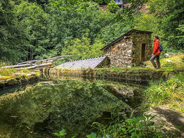
Your route will start on a track at the end of the village that heads upstream of the river Pumar. A few metres into the route, you can take a diversion to visit the restored Mazo d'Abaxu.
Back on the track, you will have to continue in the same direction, on a pleasant walk in the shade of the trees and with the river as a backdrop. After crossing the river over a beautiful wooden bridge, you will reach the village of El Pumar, which is in a state of semi-abandonment but where you can see the typical architecture of the villages in this area of south-western Asturias.
To the left of this village, take a left turn, and after a short climb, you will reach San Fliz. From here you will continue on to El Pozu, from where you can enjoy a marvellous panoramic view of the councils of Cangas del Narcea, Allande and Tineo.
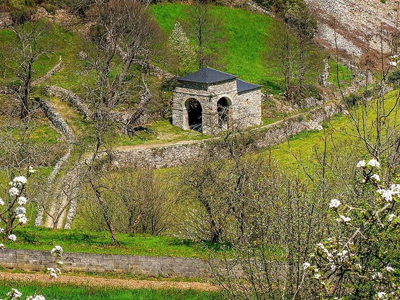
From this point you could link up with another route, which is the Ruta del Oro (CN-3). But if you wish to return to Bisuyu, simply turn left, continuing in the same direction and without taking any crossroads.
4 short routes to enjoy the gentle nature of Cangas del Narcea in peace and quiet!
Subscribe to our newsletter and take advantage of offers, discounts, and news
Subscribe
