Back The spectacular views from the route to Paradiella Peak
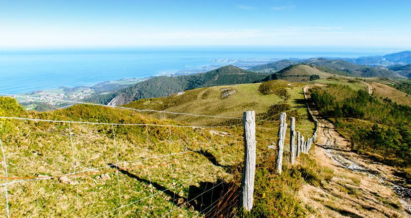
The spectacular views from the route to Paradiella Peak
Pico Paradiella, in the Las Palancas mountain range, stands 716 metres above the municipalities of Cudillero and Valdés, its peak serving as a geographical boundary between the two.
Pico Paradiella, in the Las Palancas mountain range, stands vigilantly at 716 metres above the municipalities of Cudillero and Valdés, its peak serving as a geographical boundary between the two.
At its feet, the rugged Cantabrian coast and the abrupt south-western mountains of Asturias accompany the walker at all times as he ventures along the route that leads to this peak.
We are talking about a mountain that could be proudly considered the little sister of Pico Pienzu, since, despite not reaching its height, the beauty of the views that can be seen from here is undoubtedly comparable.
It is the perfect vantage point from which to make out a large part of western Asturias!
Everything you need to know before you put on your boots.
The route to Pico Paradiella(also called Pico Palancas, although this is actually the peak that can be seen next to it to the west) is linear. It is 6.5 kilometres long, takes approximately 2 hours and 30 minutes and has a difference in altitude of around 360 metres.
It is not technically difficult, except for the loose stones along much of the route, with which you have to take special care to avoid slipping.
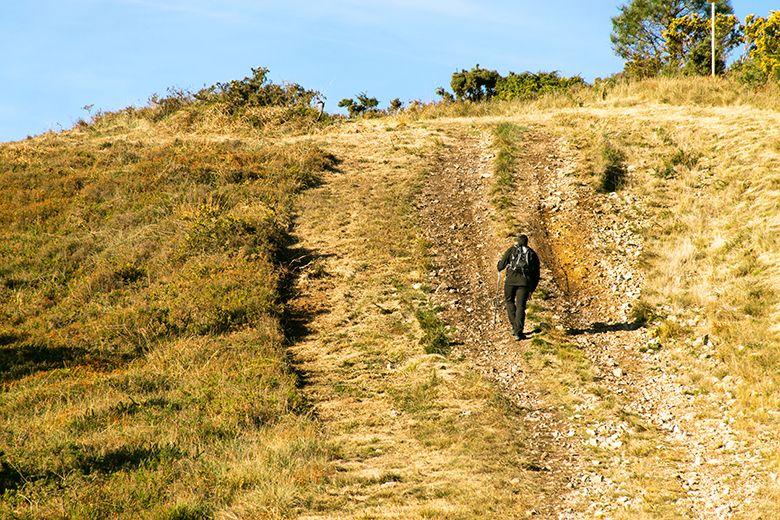
However, there are three climbs in the form of firebreaks that are a little demanding, so it is essential to consider your physical condition before attempting it.
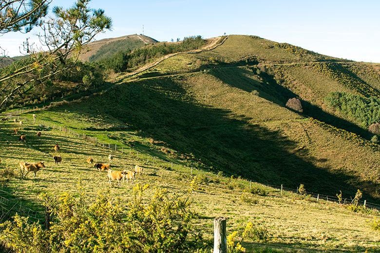
It is also important to bear in mind (especially if you suffer from joint pain in your legs) that these climbs will be descents on the way back, which will mean an added effort.
Therefore, the best thing to do is to wear good hiking boots that support your ankles well, and don't forget to take your walking poles to support you, both on the climbs and on the descents, so that you can enjoy the route much more!
It is also essential, as with all mountain hikes, that you check the weather forecast beforehand to prepare yourself properly. In fact, it is a somewhat delicate route in terms of weather, due to its location off the coast.
You should be very cautious with the wind, as on cloudy days it tends to blow strongly, and it can be quite cold. It is even highly probable that fog will appear and complicate the ascent.
As a popular saying in the area goes: "Fog in Paradiella, water in the escudiella". So, if you don't want to be caught by surprise by the mist that turns into rain on the coastal rasa, be foresighted and spend some time at home preparing the route.
Likewise, as the route runs along the crest of the mountain, there are not many trees to provide shade on the toughest sections, although there are some areas of pine trees to go to in case you need shelter. That is why you should take special care if you do the route to Pico Paradiella in summer, or on very hot and sunny days.
As for almost everything in Asturias, dress in layers (more or less warm depending on the time of year), pack a mackintosh and water in your rucksack, leave a change of clothes in the car... and enjoy the walk! and enjoy the ride!
In the footsteps of vaqueiros and pilgrims to Pico Paradiella
To get to the point where the route to Pico Paradiella begins, take exit 455 (Ballota-Tablizo) off the Cantabrian motorway (A-8). Then, at the roundabout, follow the signs to the hermitage of San Roque, going up a winding road for 1.5 kilometres.
Once at the top, we will have reached the hermitage of San Roque, which is accompanied by a granary, and where the traditional pilgrimage in honour of this saint is held in August.
We can stop to enjoy the beauty of the surroundings and the views for a while, or perhaps it would be better to leave it for the return journey, because it is an unbeatable place to have lunch or a snack, especially if we go with children or dogs.
To begin the route, continue along the road for another 1.5 kilometres (approximately) until you reach La Cruciada, the crossroads where you can leave your vehicle and set off on foot.
Although there is no car park as such, there is plenty of parking space. However, we must be careful, and do so in the best possible way, without getting in the way, and leaving space for those who may arrive later.
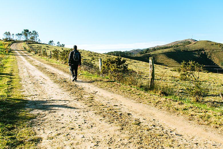
Once we have put on our rucksacks, we take the central track, which is wide, between pine trees and in very good condition, marked with the Camino de Santiago's own signs (cairn and shell).
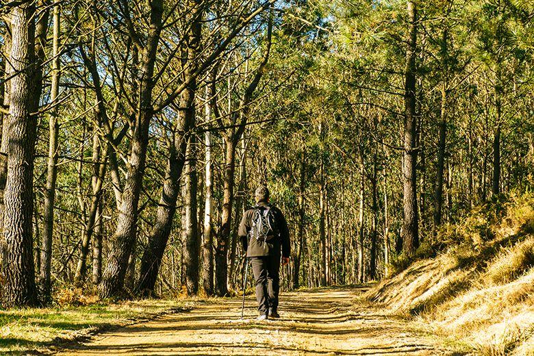
The route to Pico Paradiella is a small part of stage 26 of the Camino de la Costa, which runs between the towns of Soto de Luiña in Cudillero, and Villademoros in Valdés (19.8 km).
Although for us it is simply a walk with a certain level of difficulty, for the pilgrim it is a tough stage, as there is no water, fountains or shops.
The route that leads to the summit of Paradiella does not get lost, as once at the pass of Outar de Mujeres (485 m), having left the Pico Carbonín on the right, we will walk along the crest of the mountain at all times, following the gas pipeline markers.
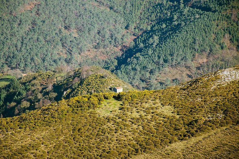
From this pass, as well as from the top of Cogruzas (577 m) and from the top of Peñas del Bolado (634 m), we can make out some of the "brañas vaqueiras" (cowherd huts) (Busmarzo, Resellinas...) that give their name to this area: the Comarca Vaqueira, an association made up of the municipalities of Cudillero, Valdés, Salas, Tineo and Allande.
In fact, this path is part of the route formerly used by the "vaqueiros de alzada", to take the cattle from the winter pastures to the summer pastures and vice versa.
If we look further ahead we can also observe, throughout the crossing, one of the most spectacular views of the Asturian coast, with the towns of Ballota and Tablizo in the foreground, and an almost perfect panoramic view of the Protected Landscape of the Western Coast of Asturias.
But other interesting places can also be seen very well, such as Cape Peñas, the island of La Deva and Cape Vidrias, Cape Vidío, the walls of Silencio (or Gavieiro) beach, the Dionisio Fierros viaduct, the hermitage of La Regalina in Cadavedo, Cape Busto and even several projections of the Galician coast.
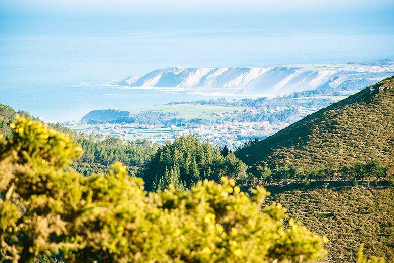
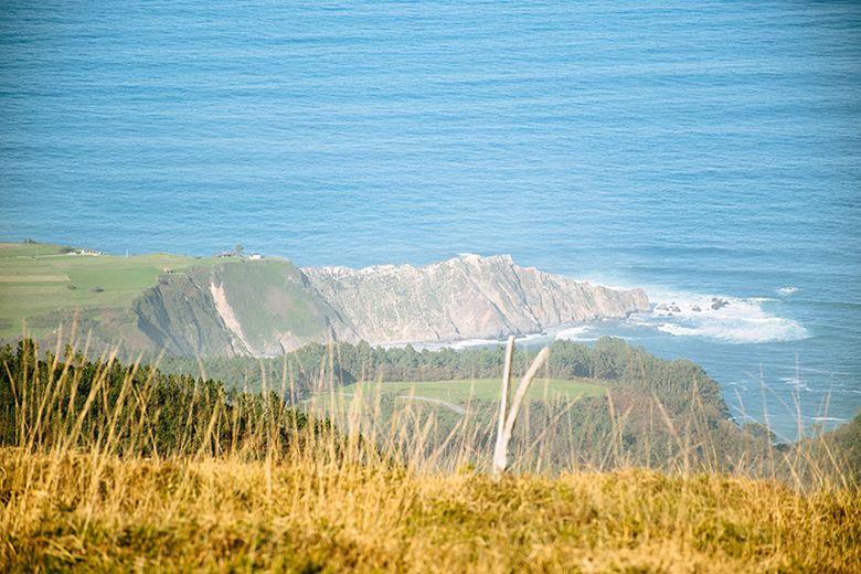
Although it will be difficult not to stop at every step to contemplate the landscape, we must fight the temptation and continue walking if we want to reach the summit.
Just before the second firebreak, there is the possibility of taking a left-hand fork that skirts the mountain, avoiding the climb, following the signs for the Camino de Santiago.
This path rejoins the track that runs along the crest of the mountain at the beginning of the third firebreak, so it is a good option if you are very tired and need a break. If you are in good shape, the best way to continue enjoying the incredible scenery is to go up the slope.
Whichever way you go, you will reach the intersection between the two, where the Camino de Santiago turns off to the right, crossing the gate of a cattle ranch.
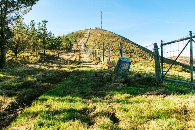
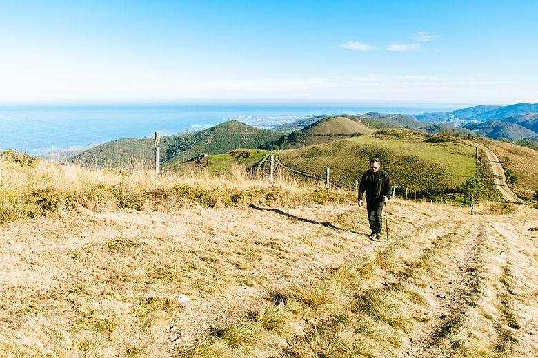
The route to Pico Paradiella leaves at this point of sharing the route, to continue uphill towards our destination, which we can already see very close. One last effort, and we will have reached our destination.
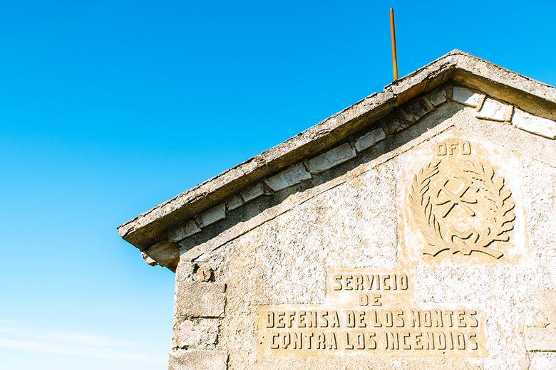
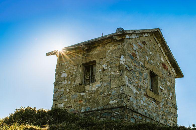
We are greeted at the top by several large antennas and two huts, one for television and the other for the "Servicio de Defensa de los montes contra incendios" (as we can read on its façade).
Right next to it is the geodesic vertex that marks the peak of the mountain, and a little further north, its characteristic sword-shaped summit letterbox, which inevitably reminds us of King Arthur's legendary Excalibur.
And so, like kings and queens, we will feel when we look up and see how far our steps have taken us.
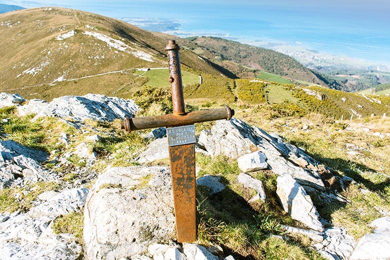
The beauty that surrounds us at this point is overwhelming, with views of the mountains of the neighbouring councils (Cudillero, Valdés, Salas, Tineo, Villayón, Allande...), and even some more distant ones such as the Aramo and Los Vientos mountain ranges or even the Picos de Europa on the horizon.
The landscape is also dotted with numerous wind farms, such as Baos y Pumar Fase II, Cordel-Vidural, Capiechamartín, Panondres, Curiscao and Pico Gallo.
We will take the time we need to take a deep breath, contemplate the panorama and say goodbye to this marvellous view of the Asturian coast. Afterwards, we will only have to retrace our way back, step by step, leaving Pico Paradiella behind us.
Subscribe to our newsletter and take advantage of offers, discounts, and news
Subscribe
