Back Route to the Partial Nature Reserve of Barayo and the Fero Well
Route to the Partial Nature Reserve of Barayo and the Fero Well
The route to the Barayo Partial Nature Reserve and the Fero well is one of the best kept secrets in Asturias. Here you will discover the pure essence of western Asturias.
The route to the Barayo Partial Nature Reserve (declared as such in 1995) and the Fero well is one of the best kept secrets in Asturias. And it is curious that it is not better known because the environment is of unique beauty and singularity in the Principality, for its scenic and ecological value.
The best way to discover these two natural wonders of western Asturias - an estuary and a waterfall - is by following the route that starts from the car park at Barayo beach, located in Sabugo (council of Valdés).
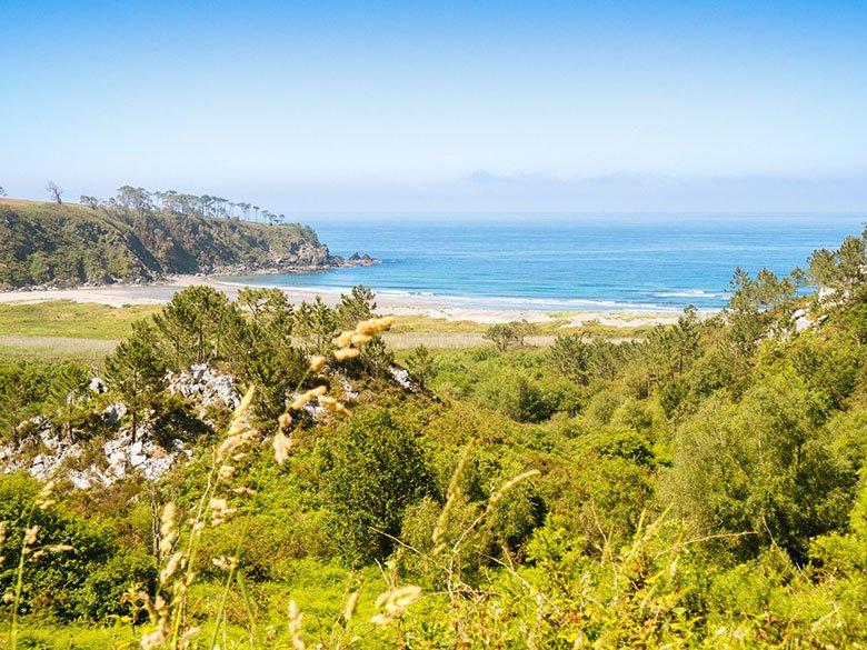
This is the longest option but also the most beautiful and recommendable. This way you will be able to take a complete walk through all the variety of landscapes offered by this protected area located between the councils of Navia and Valdés.
Everything you need to know before you put on your boots.
The route is fairly easy, although there are some sections that can be a little difficult due to the fall of a tree, the detachment of part of the path or simply the humidity of the ground.
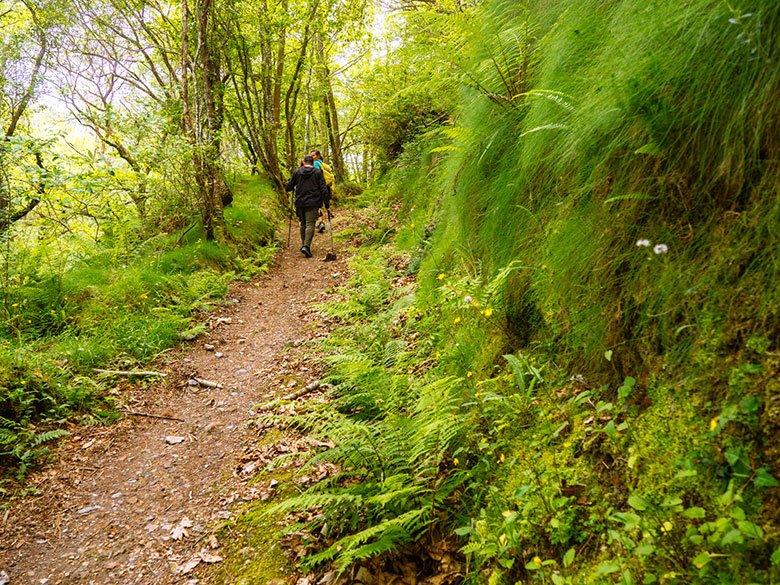
In any case, itis enough to be cautious and to be sufficiently equipped with boots that support our ankles and insulate us from water and mud. If we want to feel a little more secure, some walking sticks to help us overcome those small obstacles will also come in handy.
Oh, and don't forget to leave a change of socks and another pair of trainers or boots in the car. Just in case...
Although the route is not entirely linear, it is not quite circular either, the length is about 8 kilometres, the duration is approximately 3 hours and the difference in altitude is around 400 metres, although it is very bearable.
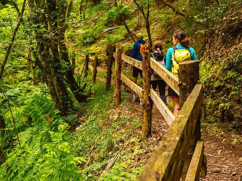
In short, this is a perfect plan for all those people (including children, but always with caution) who like to walk without too many complications, while enjoying the beauty of a diverse landscape.
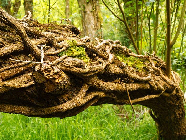
In addition, those who enjoy birdwatching (telescope, binoculars or camera in hand) will find in Barayo a small paradise.
In fact, the Barayo Partial Nature Reserve belongs to the Natura 2000 Network, being a Special Area of Conservation (SAC) and a Special Protection Area for Birds (SPA).

Unfortunately, the route is not suitable for pushchairs (but can be carried without any problem). It is also not suitable for wheelchair users.
Without a doubt, the best time to do it is in late spring or early summer because at that time the vegetation is in full bloom and the greenery is at its most intense.
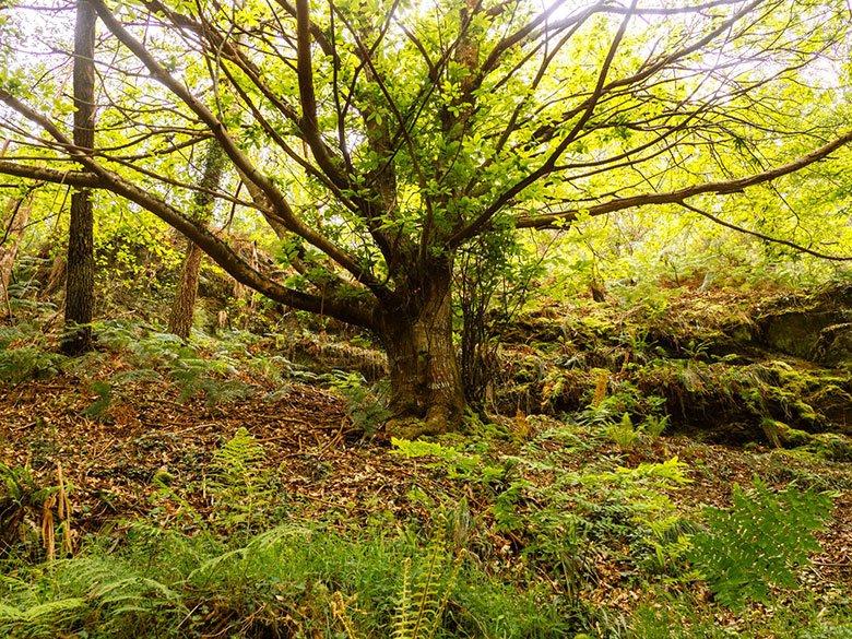
It is also the season with the most hours of sunshine, therefore less shady and wet, so the passage through certain parts of the route will be a little less cumbersome at that time.
The Barayo Partial Nature Reserve, between dunes and meanders
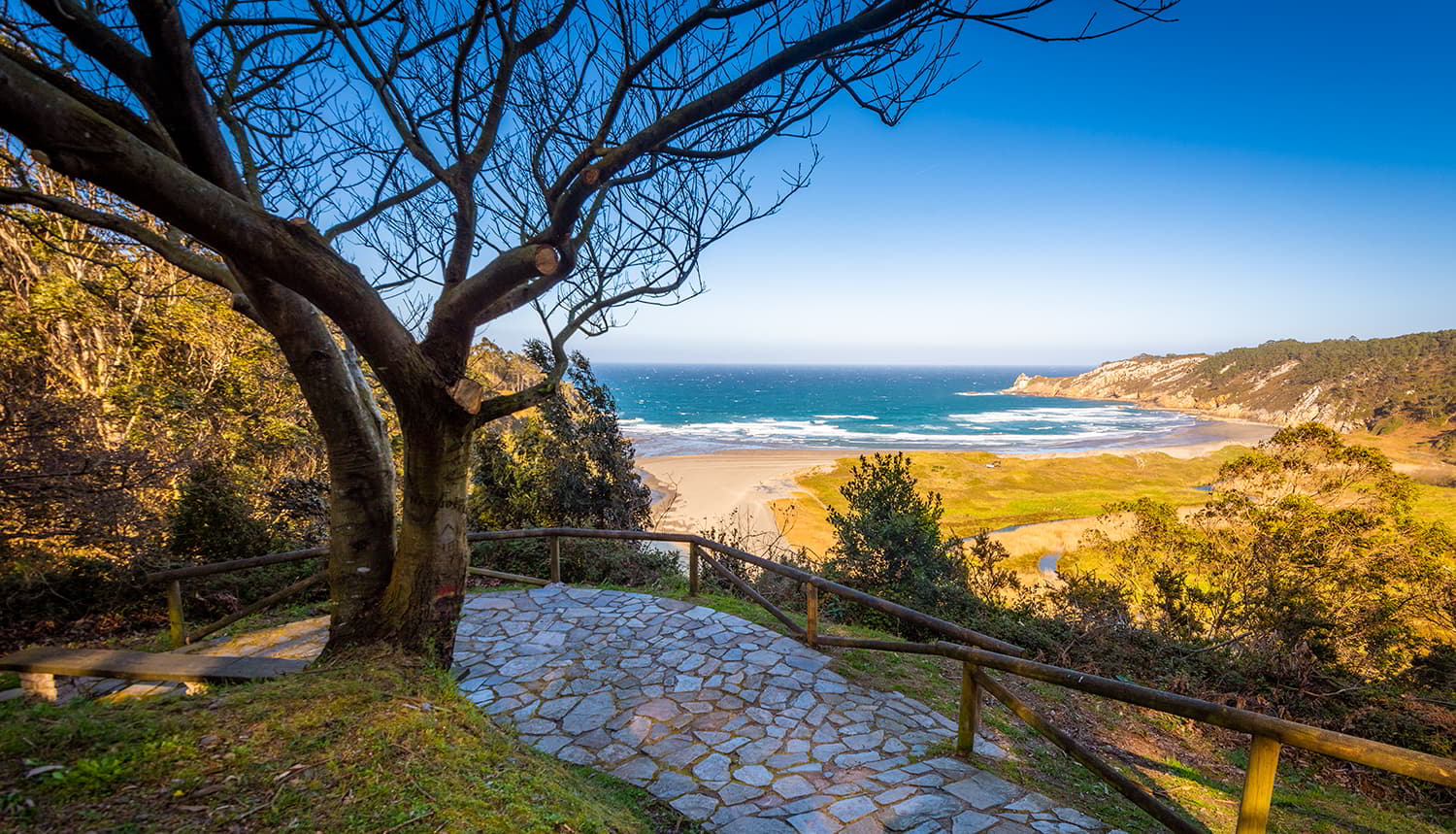
Once at the Sabugo car park, we descend along the track that shows us the direction to follow to reach Barayo beach. On the way down we will have a spectacular panoramic view, with the Cantabrian Sea tinginging the horizon with blue and the characteristic meanders and dunes of the reserve.
It is precisely these, the dunes, that have been the ecosystem that has required most attention in recent years, as they are very sensitive and essential for the development of the biodiversity of the area.
Moreover, regeneration work has been carried out recently because numerous trees had grown and destroyed not only the vegetation but also the dynamics of the wind, which is responsible for their formation and constant transformation.
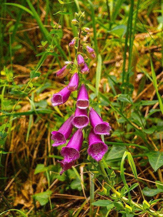
Thanks to 'Arcos Life', the project for the recovery of dunes on the Cantabrian coast, these pines were felled and different species were planted to repopulate them, such as barron, sea lily or sea holly.
Another characteristic variety of Barayo is the milkweed (Euphorbia peplis), which is present on very few beaches in Asturias.
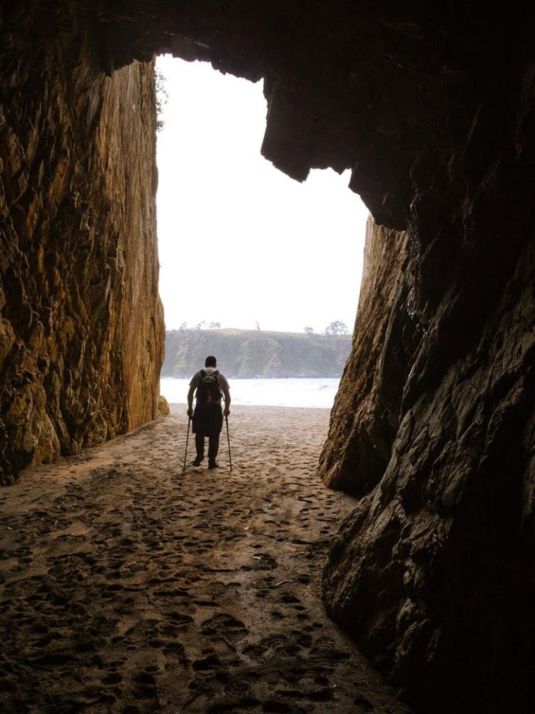
After a 1-kilometre descent you will reach the beach, where you can visit, at the eastern end, several caves known as Las Sántinas, whose erosion is the result of the action of the waves on the cliff.
It is also striking that this part of the cliff is made of quartzite, with grey, brown and even reddish tones, while the western end is made of slate.
You can walk to the other side of the sandy area (approximately 650 metres) and inspect the area to see the difference between the two, but you should know that to continue with this route you will have to retrace part of the path that led you to the beach.
If you go to the western side (the one belonging to the council of Navia), you'll see that there are steep stairs that run along the side of the cliff and give access to a car park just above, in the town of Vigo.
Crossing the river and climbing them and then continuing along the wide track that goes inland (in the opposite direction to the coast and the Naviega Coast Path) could also be a variation on this route. The views during the ascent are marvellous, but we should bear in mind that it involves a great deal of effort.
This section does not form part of the route recommended in this post as the footbridges to cross the Barayo River at this point are not always in place or accessible.
That is why the general recommendation is to retrace our steps back to the first bend in the track we came along, until just before starting the ascent that would take us to the car park where we started the route.
Just there we must take a path that leads off to the right into the forest and which is usually a little closed, although don't worry because it is easy to pass.
At this point we will enter the muddiest part of this route, as we have to border an area very close to the marshes, a slightly marshy and waterlogged environment.
You will see that in this section the path is not very well marked on the ground because people use the most suitable path for them depending on how wet the ground is. However, some white and yellow markings (PR) on the trees and the lack of alternative paths make it difficult to get lost.
The reeds, reedbeds, alders, willows and ferns are the predominant vegetation in this spot and, if we get close to the water, it is also possible to see animals such as eels, trout, black-green lizards and even otters.
As for the birds, the gull, the mallard, the moorhen and the grey heron are easily visible on the beach and in the marshes, spaces that they share with other frequent visitors such as the shag and the oystercatcher.
After crossing this small marsh of exuberant nature, you will come to the wooden bridge that crosses the Barayo river, with a course of barely 12 kilometres from its source in Busmargalí (Navia).
What's more, did you know that the name "Barayo" is believed to come from a word of Indo-European origin? In Sanskrit "var" means "water" and everything seems to indicate that it derives from it.
A few metres further on, next to an old stone building, we will see a narrow path on the right. Here we turn off the main track (the one we will use on the way back) to go along this path that zigzags upwards.
Climb up until you reach a wide track, ignoring the fork that heads towards the beach (by the footbridge). Once here, continue climbing for a few more metres until you reach a viewpoint.
Then, having spent a few minutes (or as much time as you feel like) contemplating the Barayo Partial Nature Reserve from another perspective, we will resume our walk down the wide track that led us here.
This time we walk along it until the end, when at a bend there is a narrower turn-off to the right, through which we enter a leafy landscape that will lead us to the Fero well and its waterfall.
The Fero well, the bucolic waterfall of the river Barayo
Forests of eucalyptus, oak, chestnut, willow, alder, ash and maple trees (among many others) will accompany us for almost 2 kilometres along a wet (and sometimes even slippery) path that runs along the bottom of the valley carved out by the river Barayo.
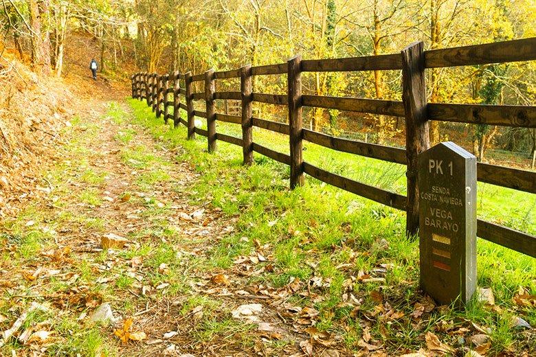
Halfway along the route, we border the enclosure of a farmhouse set in the middle of a meadow and cross the wide track that leads to the house to continue our route along the tree line.
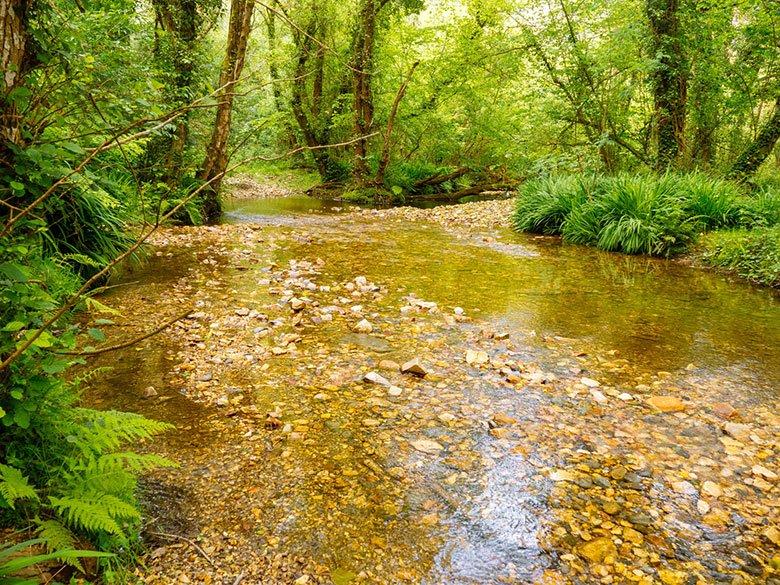
A few metres further on, take the path on the left that descends again towards the river, and from here you will begin to hear the suggestive roar of the water.

From this point the track narrows little by little until it reaches the ruins of an old power station and, finally, a few metres further on... you will see the bucolic Fero (or Cero) well with its charming waterfall!
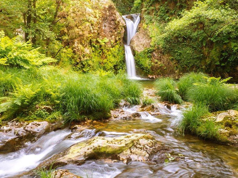
It is not very high, but its characteristic two-stage drop and the spacious surroundings that allow you to get quite close to it (you can even get wet when it drops so close!) make it a very special hidden corner.
But you have to be very careful because the stones that give access to this part of the well are soaked and it is very easy to slip. Certainly, if you decide to approach it, you'd better be prepared to get a bit dirty, because you'll probably have to hold on to the ground or even sit down to minimise the risk.
Further up towards the railway bridge, there are more waterfalls, but there is no open path to access them. Or at least not easily.
The locals say that many years ago, in the vicinity of the well, there was a lazaretto, a hospital where people suffering from leprosy were isolated.
And, certainly, due to the hidden and concealed nature of the place (although it is close to towns such as El Bao, Villapedre or Tox), it is not surprising that they chose this location.
Once we have decided that we have enjoyed this idyllic setting sufficiently, we will have to start the return journey, which will take us an hour (more or less).
To do so, we will go back the way we came, but when we reach the crossroads that would lead us to the viewpoint along the wide track, we will continue straight on to the right.
We will go parallel to the river, delighting us with forests that sometimes (especially in spring and summer) look like jungles, and pools that on hot days invite us to take a refreshing dip.
Shortly afterwards you will reach the area of the wooden bridge over the river, and from here to the car park the path will be exactly the same as the way you came (although obviously in the opposite direction).
As you walk the last few metres of this extraordinary route through the Barayo Partial Nature Reserve and the Fero well, you will surely need to turn around several times to enjoy the views once again and say goodbye to this curious and unknown spot in the west of Asturias.
And to do any route safely, don't forget to follow this advice
Subscribe to our newsletter and take advantage of offers, discounts, and news
Subscribe
