


Family hiking: 6 routes with recreational areas in Asturias
“Asturias offers nature lovers plenty of easy walking routes, but not all of them start from pleasant recreational areas. Here are five easy routes for the whole family that tick this box.”
Asturias boasts large recreational areas and natural spaces where families can enjoy a lovely day out in the countryside. The extensive coastline, dotted with spectacular sandy beaches stretching from east to west, is complemented by idyllic mountain landscapes, where gentle meadows give way to dense forests of beech and silver oak. These protected areas are perfect spots for family hiking trails, catering to all tastes, and offering fun activities with children in idyllic settings.
Below, we’ll explore together six easy walking routes where nature takes centre stage, all of which can be started from one of the many recreational areas found throughout Asturias.
The source of the River Infierno (La Pesanca leisure area)
Route details:
Distance: 14 km
Difficulty: Medium
Total elevation gain: 600 m
Route type: Out and back
Starting point: La Pesanca leisure area
End point: Foz de Moñacos
We’ll immerse ourselves in the beauty of the Foces del Río Infierno, exploring the natural surroundings from the idyllic La Pesanca Recreation Area. Indeed, one of the best things to see in Piloña, near the village of Riofabar, is this area, which is reached via a local road. It is situated in a fertile valley surrounded by lush vegetation of ancient oaks, chestnut trees and hazel bushes, giving way to an endless landscape.
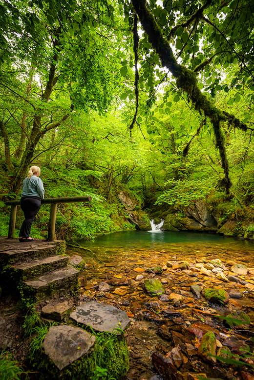
But, without a doubt, the best way to discover this little corner of paradise and fall in love with it is by taking an easy walk from the La Pesanca leisure area. Several walking routes set off from La Pesanca, leading to various natural sites via a main track that branches off towards the Collado de Traslafuente and the Vízcares peak; Los Tornos de Pandemules, in the Redes Natural Park, or towards the Foz de los Moñacos, also in Caso. It is not necessary to tackle the full length of any of these routes, as the easiest one covers a total of 14 km with a 600-metre elevation gain. It is enough simply to plan a short walk with the children through the Foz del Río Infierno, depending on the conditions and the level of physical exertion you wish to undertake. To do so, you simply need to follow the crystal-clear waters of the river as they plunge into a stunning gorge with slate walls, where water and wind erosion have carved the gorge as they pleased, and through which small waterfalls and cascades of overwhelming beauty flow.
Camín de la Reina (Trambesagües leisure area)
Route details:
Distance: 12 km
Difficulty: Low
Total elevation gain: 200 m
Route type: Out and back
Starting point: Dobra Bridge, Argolibio
End point: Dobra Bridge, Argolibio

We’ll discover the Camín de la Reina, setting off on this route from the Trambesagües Recreation Area – in the municipality of Amieva – and exploring its historical and natural attractions. The first thing that catches the eye at this recreational area is its size, and the fact thatit features picnic tables, barbecues, a children’s play area and a fountain. There are also a large number of old Asturian buildings known as ‘corripas’. These structures, built on circular foundations, were traditionally used to store chestnuts in their husks. They were covered with leaves and chaff in October, allowing the chestnuts to be eaten right through until spring.
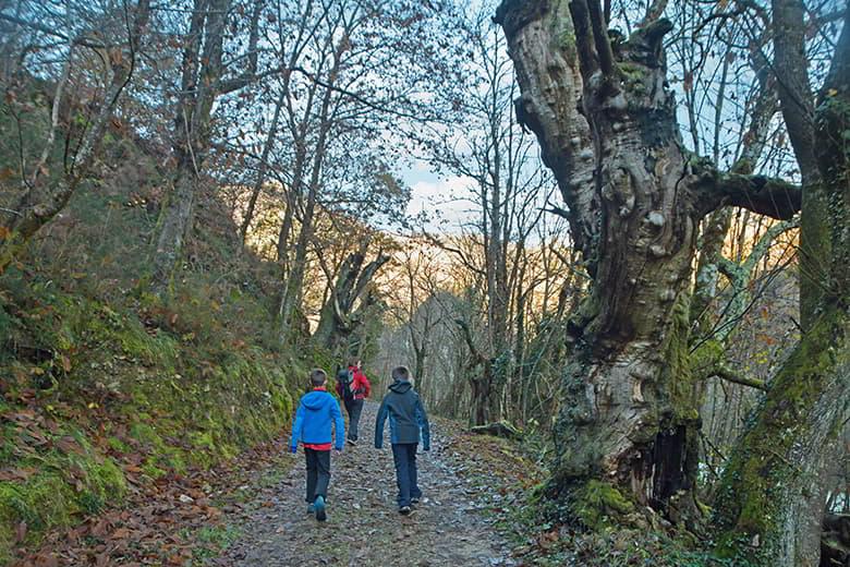
Taking advantage of this ethnological relic, we’ll set off along the pleasant Camín de la Reina, which owes its name to the fact that Queen Isabella II of Castile used this ancient Roman road to travel to Covadonga. And, whilst there’s no need to venture right into the heart of the Picos de Europa National Park, we can certainly enjoy a walk surrounded by oak, beech and ash trees to the nearby hamlet of Precendi, following the course of the River Ponga, which flows into the River Sella a few metres further down. In this way, we’ll pass by the Beyu Pen gorge , near the village of Santillán, which is another route through Asturias that we recommend, although this one is more physically demanding than the Camín de la Reina.
Deva Trail (La Brañona leisure area)
Route details:
Distance: 14.5 km
Difficulty: High
Total elevation gain: 150 m
Route type: Circular
Starting point: Panes (Peñamellera Baja)
End point: Panes (Peñamellera Baja)
We’ll set off along the Deva trail, exploring its enchanting landscapes from the La Brañona Recreation Area, situated on a bend in the River Deva and tucked away amongst lush vegetation. Asturias offers many easy hiking routes for families, and one of them starts at the Panes recreational area, which features wooden tables, swings, a fountain and barbecue pits.

This is a circular route of around 15 km with virtually no elevation gain and excellent signposting, which follows both the left and right banks of the River Deva-Cares, passing by some of Asturias’ most notable natural sites, such as the Palaeolithic cave of La Loja, the Palace of San Román and the Romanesque church of San Juan de Ciliergo, which dates from the late 13th century.
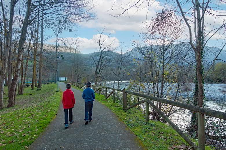
However, if you don’t want to go on such a long walk, there is the option of a 2.5 km circular route starting from the recreation area along the riverside path through the Deva Arboretum, which features a forest ecosystem typical of the Picos de Europa. This option is much easier than the previous one and can be done by bike, with very young children, with a pushchair or by people with reduced mobility.
Muros de Nalón coastal path (Espíritu Santo viewpoint recreation area and La Atalaya recreation area)
Route details:
Distance: 12.6 km
Difficulty: Medium
Total elevation gain: 286 m
Route type: Out and back
Starting point: Puerto de San Esteban (Muros de Nalón)
End point: Puerto de San Esteban (Muros de Nalón)
We’ll explore the Muros de Nalón Viewpoint Trail from the Espíritu Santo Viewpoint Recreation Area and the La Atalaya Recreation Area, enjoying panoramic views and unique experiences. From both of these areas – which are, in fact, two marvellous vantage points overlooking the Cantabrian Sea – we can enjoy an easy walking route that follows the coastline along a footpath. It doesn’t matter whether we head east or west, because, either way, unrivalled panoramic views are guaranteed.
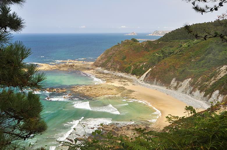
On the eastern side of the path lies the mouth of the River Nalón where it flows into the Cantabrian Sea, and the wide beaches of El Sablón and Los Quebrantos. Meanwhile, if we head west, the Miradores del Nalón trail offers breathtakingly beautiful views of the islets of El Paso and La Ñera, before ending at Aguilar beach. This coastal path runs along one of the most spectacular stretches of the central and western Asturian coast.
Cabo Blanco Route (Porcía Beach Leisure Area)
Route details:
Distance: 7.28 km
Difficulty: Low
Total elevation gain: 112 m
Route type: Circular
Starting point: Porcía Beach
End point: Porcía Beach
We’ll start the Cabo Blanco route from the Porcía Beach Recreation Area (in the municipality of El Franco), exploring this Asturian headland and its surroundings. Although the sandy beach practically disappears at high tide, it is one of the most beautiful spots on the west coast of Asturias. The panoramic views of the coastline from the picnic tables scattered along the mountainside that drops down to the sea are truly stunning.
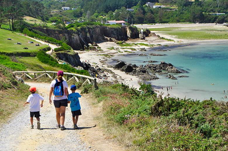
What’s more, if you fancy a walk, there’s an easy, well-signposted hiking trail that starts at the recreational area and heads towards the Atalaya viewpoint. From this headland jutting out into the sea, you’ll enjoy stunning views of the islets of Castelos and Chisliqueira and the cliffs of Amortiza. You can then continue along the coastal path – which is very easy to follow – to the vicinity of the defensive hill fort at Cabo Blanco, which dates from the 8th – 1st centuries BC, which is not the only fortified settlement from Roman Iberia in the area, as the Coaña hill fort is also nearby. Once this walk from the Cabo Blanco headland is complete, all that remains is to return to the Porcía beach recreation area. If you prefer a longer route (13 km), you can also take the Castello–Porcía Coastal Path, which also ends at the recreation area.

This is one of the most beautiful walks you can do in Asturias with children; the path runs far enough away from the cliffs to be safe, whilst still offering stunning views of the Cantabrian Sea.
Castro Trail (La Malva leisure area)
Route details:
Distance: 6.91 km
Difficulty: Low
Total elevation gain: 235 m
Route type: Circular
Starting point: La Malva recreation area (Somiedo)
End point: La Malva leisure area (Somiedo)
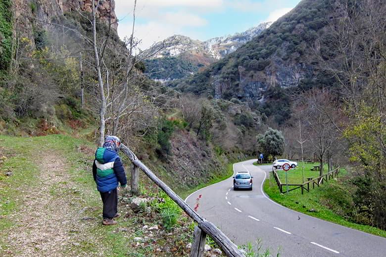
We’ll finish by exploring the Castro Route from the Malva Recreation Area – one of the best things to see in Somiedo – and discovering the charms of this historic route, which is situated near the Malva hydroelectric power station, which is over 100 years old. On certain dates throughout the year, you can visit this building, which is an outstanding example of early 20th-century industrial architecture.
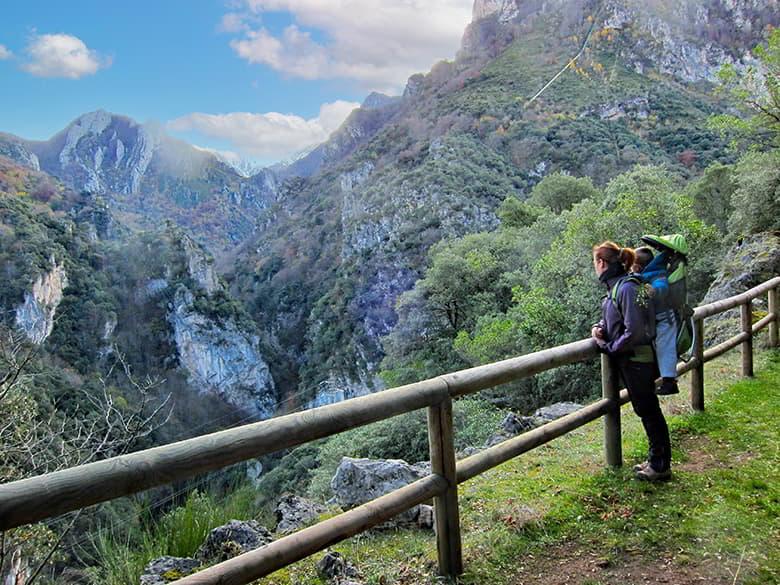
In any case, we encourage you to walk at least part of the Castro trail, which begins by climbing through an arboretum. In doing so, you’ll discover numerous species of trees that have adapted to the climate and soil of this part of the Somiedo Natural Park, where holm oak woodlands and deciduous forests of ash and chestnut trees predominate. With hardly any difficulty, you’ll reach the Malva Cave, from where you’ll enjoy splendid views of the Pigüeña river valley and where you can bring the route to an end, unless you wish to continue on to the charming village of Castro. However, bear in mind that it is 4 km from the recreational area to the village, and that the return journey must be made either by retracing our steps or via the road linking the two locations.

As you can see, Asturias is a paradise for lovers of nature and the great outdoors. Here we’ve listed six easy walking routes that are suitable for young children, starting from pleasant recreational areas, but there are many more. Fancy discovering them?
If you enjoy walking and discovering landscapes of breathtaking beauty, find new trails in our section on hiking routes in Asturias.
Subscribe to our newsletter and take advantage of offers, discounts, and news
Subscribe
