
The Guadamía river path, between Llanes and Ribadesella
The Guadamía river path, which straddles the municipalities of Ribadesella and Llanes, shows us in just four kilometres all the beauty of the eastern coast of Asturias.
At the westernmost end of the council of Llanes we find one of the most popular tourist towns in eastern Asturias, Llames. This Asturian village attracts hundreds of visitors at any time of the year, either to enjoy the natural spectacle of the Bufones de Pría or to relax on the spectacular beach of Guadamía.
However, in this post I propose an alternative plan, suitable for all ages and without difficulty: walking the Guadamía River Path, one of the most attractive river routes in Asturias.

Exploring the river path between Ribadesella and Llanes
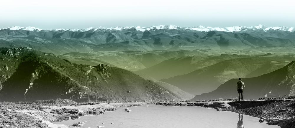
The river Mía, Aguamía or Guadamía is the natural boundary between the municipalities of Ribadesella (left bank) and Llanes (right bank). The river path, approved as a Short-Distance Route (PR-AS-2649), and signposted with white and yellow markings, forms part of the old Agrippa Maritime Way that ran along the Cantabrian coast. A circular route of just 4 kilometres, where we find old mills, Roman bridges, small waterfalls and a landscape that changes with the rhythm of the tides...

The path step by step
After leaving our vehicle in the large car park at the entrance to Llames, we must go back on foot eight hundred metres, and descend along a secondary road marked with the Camino de Santiago del Norte milestone, which we will find on our right.
Two hundred metres separate us from the beginning of the river path. You can't miss it! You will know you have arrived when you see the old bridge, of Roman origin, rebuilt in the Middle Ages, where the river Guadamía was crossed until the road was built.

Next to it we find the memorial to Samuel Cachero, a much-loved neighbour who prevented slurry from being dumped into the waters of the river Guadamía. Samuel was also the man behind the creation of the river path, and it was his neighbours who carried out the work on sextaferias days. For these reasons, the Senda Fluvial del Río Guadamía is also known as "La Senda de Samuel Cachero" (Samuel Cachero's Path).
After the bridge there is a small gate that gives access to the route -remember to close it again-. This is a good moment to remember that the entire route passes through private estates, so it is common to find neighbours doing housework, tending the garden or livestock, or simply enjoying the peace and quiet of Asturian nature. For this reason it is essential that you do not leave the path - it always runs parallel to the river - and try to respect the privacy of the owners as much as possible.

At the end of the estate there is a second gate that we have to cross. We enter the riverside forest, full of oak and hazelnut trees. The lush vegetation that grows on the banks of the river Guadamía and the murmur of its waters will accompany us all the way, while the sun shines through the branches of the trees. A most bucolic landscape at any time of the year.

Bear in mind that the Guadamía river path is not adapted and, although it does not require great effort, it is necessary to have good mobility to walk between the roots of the trees and to negotiate the odd rock.

A few steps further on there is an old mill channel, the first of the four we will see on this route. The Molinu del Picu, which has been restored as a house, is the best preserved, and the other three are in a state of ruin. A millstone placed as a footbridge indicates that we must cross the canal and go down the wooden stairs.

A succession of very colourful waterfalls and a pool that invites you to swim form an idyllic and inspiring picture-taking scene.

We follow the dirt track parallel to the river and cross from one bank to the other on several occasions, using the footbridges provided for this purpose. This is how we reach the last stretch, which is entirely on the bank of the river.


The presence of sand on the path and an alternative vegetation, which grows adapted to the high salinity, create a totally different landscape to the previous one.

We soon reach the mouth of the Guadamía River into the Cantabrian Sea, a point known as the Fiordo de La Xatera (the Siatera). Here, exclusively at low tide, we can enjoy a secluded river beach surrounded by wetlands. If you have squared the route at low tide, enter the fjord on foot, and you will walk to Guadamía Beach, an incredible moment!

The cliffs of Ribadesella and the Bufones of Pría
With the river beach as a reference point and, depending on the tide, you have several options for returning and/or extending the route. Take note!
- Return by the same route. Such a short route allows us to go and return by the same route, it is not an overexertion and... You will always discover new places!
- Do the circular route. All you have to do is follow the sign "Senda Samuel", and go up the only path on your right, marked with the milestone of the Senda Costera de San Antolín - Guadamía GR- 204. After a short walk with views of the Sierras del Cuera and Cueva Negra, you will reach the centre of the village of Llames.

- Discover the cliffs of Ribadesella. If you do the route at low tide you can ascend to the recreational area of Guadamía, which belongs to the council of Ribadesella. You will find the path on the left bank, and it quickly connects with the road leading to the area. The terrain near the cliffs is full of large cavities. The Bay of Biscay is below our feet. These vertical cavities are not signposted, so it is advisable to take extreme precautions, especially if you are with children or pets. If the tide prevents you from crossing to the other side, you can always make the journey by car.
- Contemplate the natural spectacle of the Bufones de Pría. You already know that at low tide you can go into the fjord until you reach Guadamía beach. Once there, go up towards the village and follow the signs to the bufones. These cavities of karstic origin on the coast of the llanisco are smaller than those on the shore of Ribadesella. This natural phenomenon is spectacular and occurs when there is a swell, as the large waves of the Cantabrian Sea create an ejection of air and water like an Icelandic geyser. The most striking of these jesters has a name of its own, the "Bramadoiro". If the tide prevents you from walking to the beach of Guadamía, do the circular route and cross the village until you reach the cliffs, adding one kilometre each way until you reach the car park at the start.
Inany case, before leaving Llames, take a stroll through the village. The Asturian bowling alley and the Chapel of San Saturnino stand out, as well as the beautiful old and new mansions. In one of them you will find La Pumarada, a great restaurant to recharge your batteries with its homemade food, or to "rehydrate" by drinking some cider in the picnic area.
If you still want more, take the opportunity to visit the Asturian towns of Llanes and Ribadesella/Ribeseya. As well as strolling through its streets, you can take other hiking routes along the coast, such as the Cliffs of Hell route, the Coastal Path from Po to Llanes, the Jurassic coast, etc. Or if you prefer to venture into the mountains, combine it with excursions to Spain's first National Park, the Picos de Europa.
Subscribe to our newsletter and take advantage of offers, discounts, and news
Subscribe