Back Penouta Route, discovering the millenary charms of Boal
Penouta Route, discovering the millenary charms of Boal
The Penouta route, in the municipality of Boal, holds marvellous secrets. The Navia Historical Park is probably one of the most enigmatic regions of Asturias, and this route will give you the chance to see for yourself.
The Penouta route, in the municipality of Boal, holds marvellous secrets. Some of them are ancient historical vestiges, traces of past cultures that have stood the test of time.
Neolithic burial mounds and castreña archaeology, the legacy of ancient settlers who inhabited these lands bathed by the river Navia and its tributaries thousands of years ago, will meet us along the 23 kilometres of the route.
The Navia Historical Park is probably one of the most enigmatic regions of Asturias, a fact that is made clear on this route through this small piece of south-western Asturias.
What's more, there are few trails in Asturias that combine so many different attractions and landscapes as the Penouta route. How? You don't believe it? Well, read on and you'll see.
Everything you need to know before you put on your boots.
The Penouta route (PR. AS-250) is of medium difficulty, not because it is technically complicated, but because of the difference in altitude (786 metres positive) and the physical effort involved in the constant slopes over uneven terrain in the last kilometres of the route.
To give you an idea, we start the route at an altitude of 470 metres, and in 5 kilometres of ascent we reach 808 metres, the highest point of the route.
The trail is circular, the distance covered is approximately 23 kilometres (counting the detour to the Penedo Aballón), and in time it takes about 7 and a half hours more or less.
Until you reach the AS-12 road (around kilometre 18) the tracks are generally wide and in good condition. From this point onwards the paths narrow and become more stony and steep, alternating with concreted country roads.
Itis not recommended for small children, and for older children only if they are used to walking and are fit enough to cover so many kilometres. It is also not advisable to do it carrying a baby, unless you are very strong and have a good command of walking on uneven ground.
Likewise, it is not suitable for pushchairs or for people with reduced mobility who use external support elements. As always, though, these are somewhat subjective assessments, so it is best to assess your own case and situation carefully.
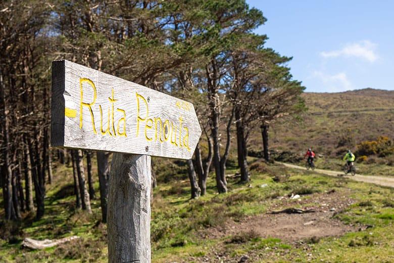
Itcould be done by bicycle but shortening the route, ending when we reach the AS-12 road at the height of the castro of Pendia, and returning by road to Boal.
The Penouta route is also a route in which we must take into account, due to its duration, the hours of daylight (especially in winter), and the weather. On the mountain side because of the fog, and on the valley side because of the high temperatures that can occur on very hot days.
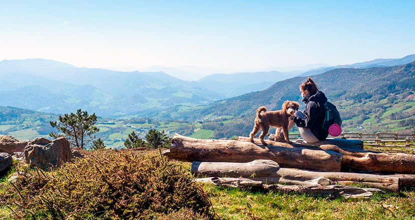
This, together with the limited availability of water, can be dangerous, so don't forget to carry plenty of water and hydrate frequently. Oh, and if you go with a dog, you'll have to carry extra water, because until after kilometre 18 there are hardly any puddles for them to drink from.
Fortunately, there are shady areas thanks to the numerous pine forests and native forests of chestnut and oak trees (among many other species). But don't be overconfident and take a cap with you just in case.
Penouta route, walking between the Navia and Porcía river basins.
The Penouta route starts in the centre of the village of Boal/Bual, opposite the church. From there, take the stairs next to a discreet fountain (or the ramp next to it), and turn left into Alonso Rodríguez street. Soon you will see a sign on the right indicating the start of the route.
At all times continue in an upward direction towards the cemetery, first leaving the washhouse on the left. Once we have passed the cemetery, a few metres further on, we leave the concrete track to go right into the Barreiro mountain, following the signs to "Ruta de Penouta".
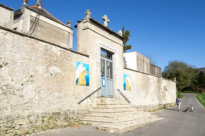
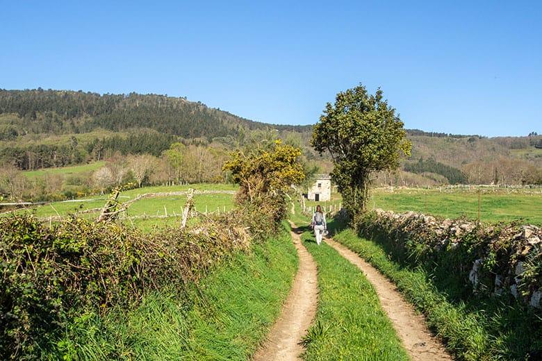
During this climb you will walk along the old royal road. In fact, if you look closely, in some sections you can even see in the stone the tracks of the country carts that used to travel along this road.
Once we have reached the Alto de Penouta, we will cross the AS-22 road. In any case, before continuing your walk, you can make a brief stop at the recreational area on the roadside to contemplate the landscape towards the coast.
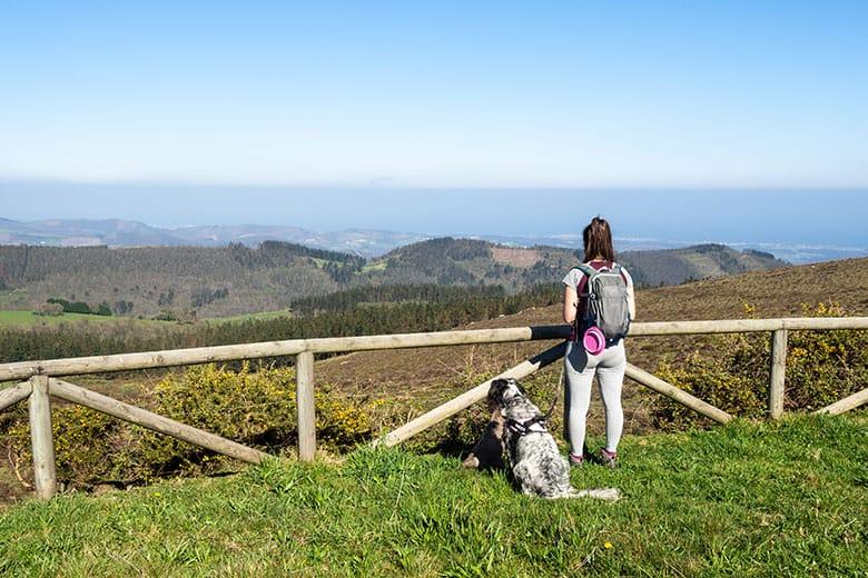
A little further on, towards the side of the road where we came following the main track through the pine forest, is the viewpoint of Penouta interior. Also, in this area you will find the Pena Queimada picnic area, a very pleasant space, especially if you are with children, because there is plenty of room to play and run around.
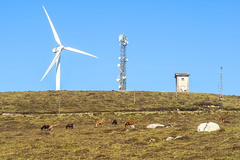
The Penouta mountain range is also home to a wind farm, whose asphalted track leads to the Penouta costa viewpoint. To get there, you have to walk another 2.2 kilometres, so perhaps it's best to leave it for another time, because you still have a lot of walking to do.
However, this whole environment is a fantastic place to see horses in the wild. Not only that, but it is also home to a tomb necropolis, which extends over a large part of the sierra, and whose construction dates back some 5,000 years.
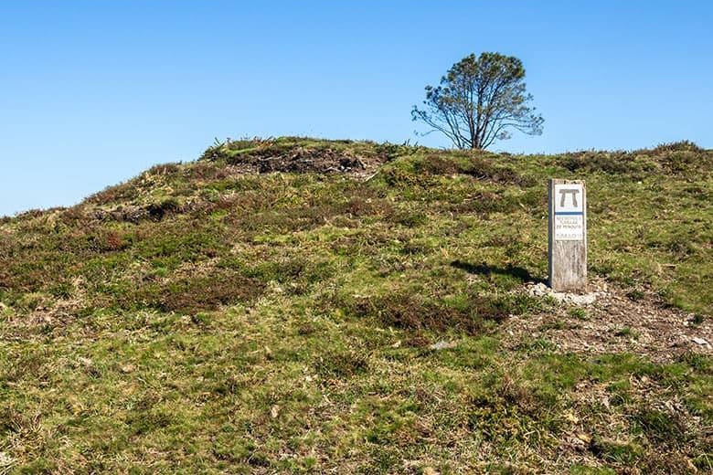
Some of these remains can be seen without having to go too far from the path, such as burial mound II, located next to the recreational area, and on one side of the path that we will have to take to continue the route.
Continue for a few metres along a path that runs parallel to the tarmac track. Little by little, it will become more distant, and a few metres further on the path forks towards the imposing Penedo Aballón, an essential stop on the Penouta route.
It is 1.1 kilometres from the main route, a distance that is already included in the 23-kilometre route.
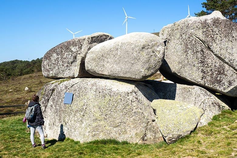
But what is Penedo Aballón? Well, it turns out that, in addition to burial mounds, different granite formations have been found in Penouta, the origin and use of which are yet to be determined. This is believed to have been an element of Celtic or Roman worship, and which allowed oscillation on minuscule points of support.
If you feel like going on for a few metres, you can also visit Crag a Montura, another curious granite formation. And if you don't want to, then it's time to retrace your steps back to the crossroads and continue the route.
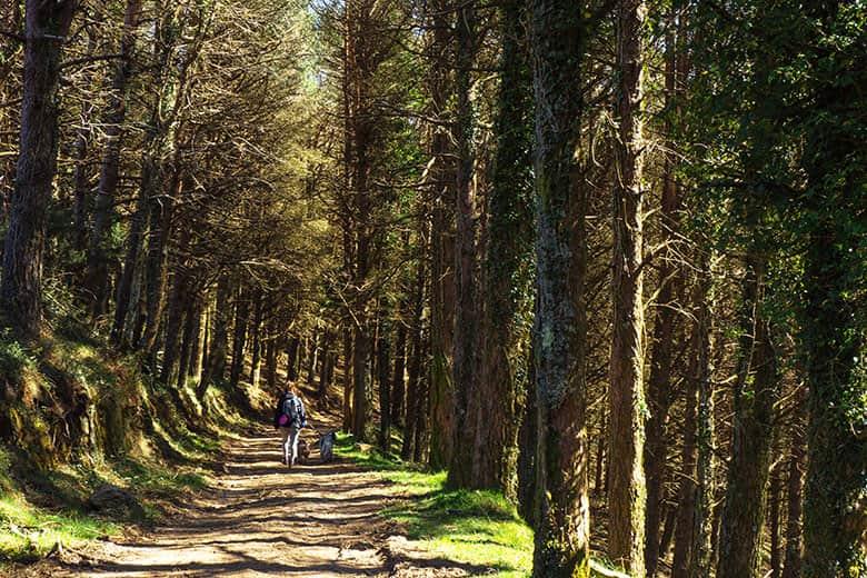
For several kilometres we will walk through beautiful pine forests, alternating with spectacular panoramic views of the village of Boal and the surrounding area.
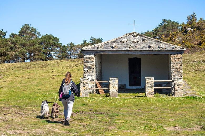
We will soon reach the plain where the chapel of San Isidro is located, a perfect place for a short refreshment stop.
We then walk along a short stretch of tarmac until we see the signs for the route again, which will take us around the Xugos peak, which is not very steep but ascending.
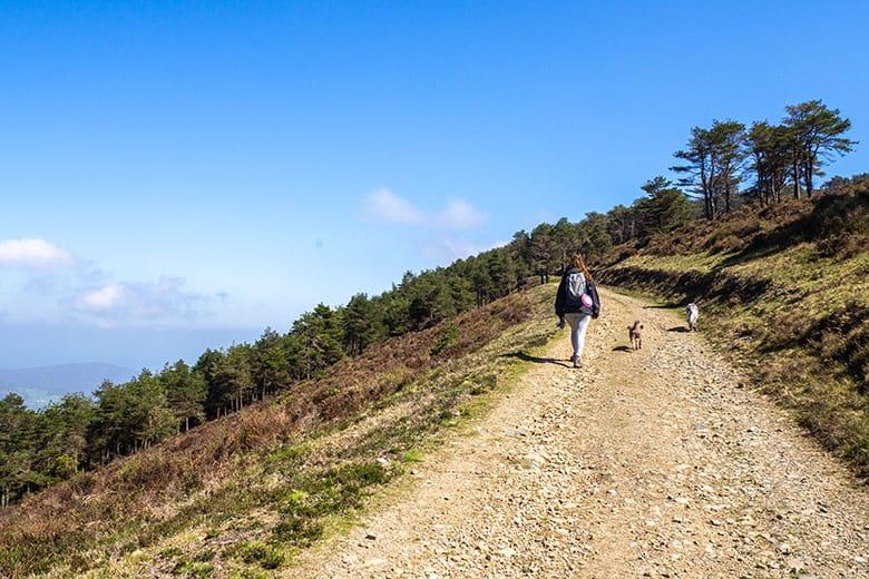
We will cross some meadows known as As Llamiceiras, and later begin to descend along another stretch of tarmac, before leaving it for a track on the left that winds down the mountainside until we reach the AS-12 road.
It is possible that in spring and early summer this whole area is covered in heather and toxos, which dye the mountains pink and yellow, respectively, and attract numerous insects, especially bees!
Shortly before reaching the road, we will have a fantastic view of the castro of Pendia, founded in the Iron Age, still inhabited in Roman times, and perhaps even several centuries later. It is also one of the first archaeological sites to be excavated in Asturias, together with the hillfort of Coaña.
We will cross the AS-12 road with great caution, especially if we are travelling with children or dogs, towards the viewpoint of the castro of Pendia. However, the views are much better from the track that leads down the route, as you will see...
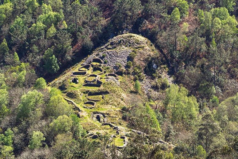
We will walk a few metres along the hard shoulder of the road, and then take a detour on the left hand side down to Llouxeira, an old slate mine that is still perfectly visible today.
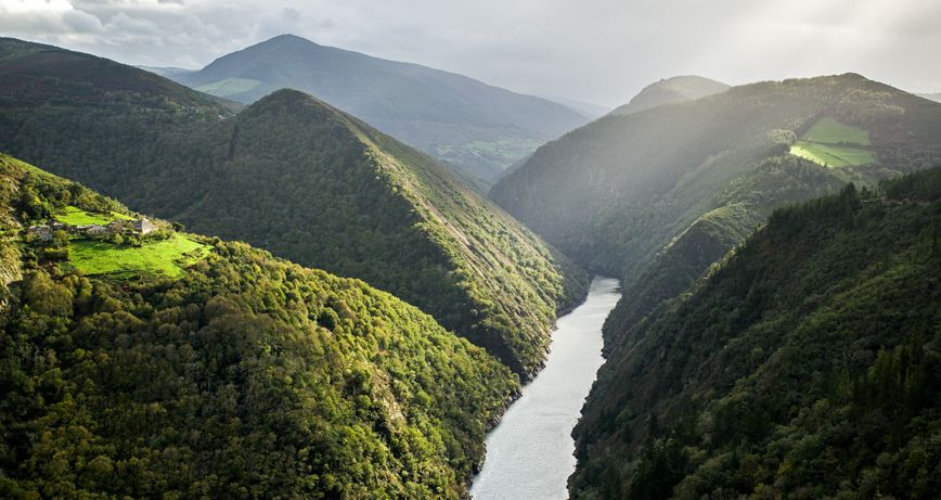
We will now enter an area completely different from what we have travelled through so far. After crossing a couple of small bridges, we will reach a deep green valley along which we will be constantly going up and down.
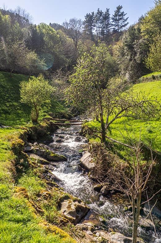
This last part of the route can be the most tiring, especially if it is hot, as the wind is not usually blowing (although there is plenty of shade). Although there are no steep slopes, you are likely to arrive tired and find it a little difficult to walk the last 5 kilometres.
Although the route is well signposted, in this section we must be attentive at every junction or turn because the markings are not always very visible.
Once you reach the concrete track of As Viñas, turn left onto a path that passes over the water treatment plant, without going up the steep slope towards the village.
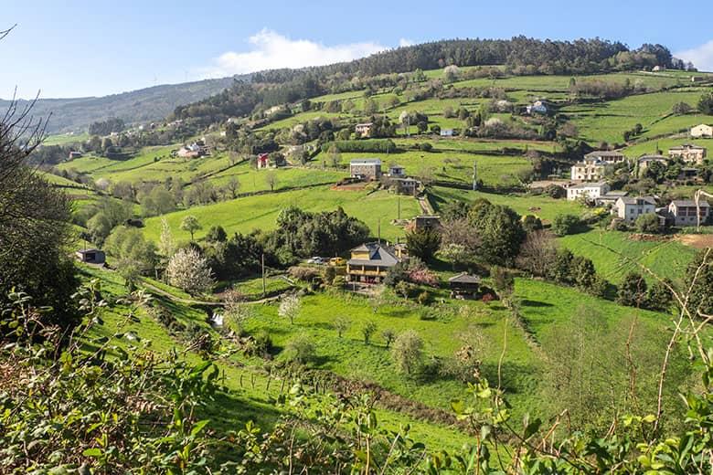
Later we will pass through Os Mazos and, just before reaching Boal, Armal. Two beautiful villages where you can see numerous examples of traditional architecture such as manor houses, granaries and mills.
This last part of the route is no longer signposted, but the only thing you should bear in mind so as not to get lost is that you should not leave the road (AS-12) until you reach the schools (C.P. Carlos Bousoño), after passing the hamlet of Rozas.
Once you have reached the road you will be in Boal/Bual, the end of the Penouta route.
Now you can relax while you take a stroll around some of the houses of the indianos, or recharge your batteries in one of the village's bars. What better way to end an intense day's walk?
Subscribe to our newsletter and take advantage of offers, discounts, and news
Subscribe

