Brañagallones Route

- Bezanes Central Asturias
- Distance: 20.72 kms
- Difficulty: Very difficult
- Cumulative difference in altitude: +829 m
- Cumulative difference in altitude: -829 m
- Maximum altitude: 1238 m
- Minimum altitude: 654 m
- IBP index: 87
- Modality: Mountaineers
- Type of route: Round trip
- Route type: Mountain
- Return by Train: No
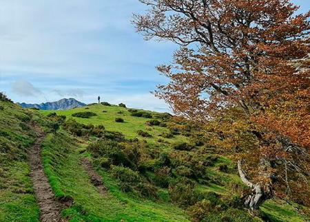
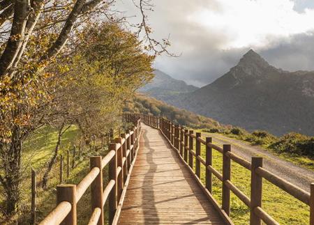
Through a constant ascent between forests, sheepfolds and viewpoints such as Texu la Oración or Escobiu Colorao, you reach the Brañagallones valley, a glacial paradise surrounded by beech forests and livestock tradition.
The route to Brañagallones from Bezanes is one of the most classic and emblematic routes in the Redes Natural Park. This linear route, always ascending, connects the town of Bezanes with the spectacular plain of Brañagallones, crossing forests, sheepfolds and viewpoints that allow you to discover the rich landscape and culture of this natural area declared a Biosphere Reserve.
The route begins in the heart of Bezanes, next to the river Nalón. From here, take a path to the left that zigzags up the hillside. After two kilometres of walking, you reach the Texu la Oración viewpoint, from where you can enjoy impressive panoramic views of Bezanes, the Nalón basin and the Cascayón peak.
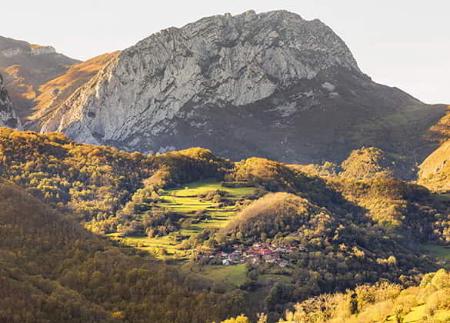
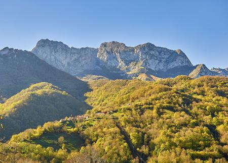
The route continues between meadows, apiaries and centuries-old texos, such as the Texu de los Carrascales or the Texu de la Grandiella, dotted between the traditional sheepfolds of La Cardosa and Andurviu, witnesses to the area's livestock farming past. To the south, the silhouette of Cantu del Oso, the great peak that watches over the Brañagallones meadow, begins to loom on the horizon.
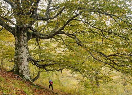
Shortly after kilometre 8, the path crosses the Crestón tunnel, a historic pass carved out of the rock, which marks the beginning of one of the most breathtaking sections of the route: the leafy beech forest that accompanies us to the end of the route. Very close to the tunnel is the Escobiu Colorao viewpoint, an excellent natural balcony from which to stop and contemplate the protected landscape of the Redes Park.
After 10.2 kilometres, the path suddenly opens out onto the Brañagallones meadow, at an altitude of 1215 metres. This wide meadow of glacial origin, surrounded by beech and blueberry woods, was once home to numerous cattle-raising families who lived in the high pastures during the summer. The name "Brañagallones" refers to the capercaillies that lived in the surrounding area, where up to six rookeries of this emblematic species have been documented.
In Brañagallones you will find the Pandiu Quemao spring and the modern Brañagallones refuge, the starting point for many routes through the high mountains of Redes.
This route is not only an immersion in nature, but also a journey through time: from the glaciers that shaped the plain, to the livestock use organised by family shifts (interius), to the present day, where you can walk up or spend the night in the refuge to explore the area. A complete experience, ideal for enjoying the landscape, history and traditional Asturian mountain life.
- It runs through the Redes Natural Park and Biosphere Reserve, which is also a SAC and SPA of the Natura 2000 Network.
- PR-AS 066
Basic tips before going into the mountains
- If you go with a dog, always keep it on a leash.
- Avoid approaching livestock.
- If you find mastiffs protecting livestock, do not approach them, do not pet them and do not feed them. Do not allow them to follow you or stray from their herd. They are working.
- Don't leave a trail. Collect all your waste, including organic waste. Nature is not a dumping ground.
- Act with prudence. Plan your route well, take everything you need and make sure it is adapted to your physical capacity.