Picol Pierzu

- Collada Llomena Eastern Asturias
- Distance: 10.16 kms
- Difficulty: Moderate
- Cumulative difference in altitude: +617 m
- Cumulative difference in altitude: -617 m
- Maximum altitude: 1549 m
- Minimum altitude: 1000 m
- IBP index: 61
- Modality: Hikers
- Type of route: Round trip
- Route type: Mountain
- Return by Train: No
This route is ideal for those seeking hiking in Asturias with moderate effort and great rewards. Its summit offers a unique panoramic view of the Picos de Europa, the Peloño forest and the Ponga and Sella valleys.
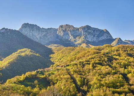
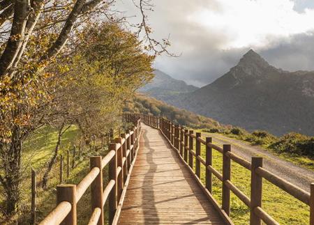
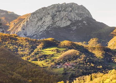
The route to Pico Pierzu (1,552 m) is one of the most emblematic ascents in the Ponga Natural Park and an exceptional viewpoint in eastern Asturias. The round trip starts at Collada Llomena, at an altitude of 1,000 metres. There you will find a small car park and an information sign marking the start of the route.
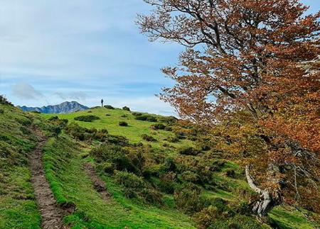
For the first two kilometres, a wide, well-signposted track allows you to acclimatise to the surroundings. The landscape alternates between meadows, ash trees and gentle hills as you head towards the Excueño quarry. Just before reaching it, a narrow path leads off to the right, starting the real ascent up the slope of the Sierra de Excueño. This section, which is steeper and more technical, leads us to the Llano Canto pass, where there is a panoramic view of Lake Aranga and La Mota de Cetín Peak.
We continue on to Majada de Cerboes, where we find three traditional huts surrounded by ash trees. From here, the path narrows and climbs up the ridge to the summit. El Pierzu, an isolated vantage point between deep valleys, offers one of the most impressive views of the north of the peninsula. To the east rises the Cornión Massif (Picos de Europa), to the south the deep cuts of the Arcenorio valley stand out, sheltering the Peloño forest, and to the west the profiles of the Maciedome, the Tiatordos and the Canto del Oso can be seen. To the north, the Sueve and Cuera mountain ranges stretch out, and Arriondas and Cangas de Onís can be seen further down.
The descent follows the same route, allowing you to rediscover the landscape from a different perspective. The entire route can be completed in 4.5 to 5 hours, and is considered of medium difficulty due to the gradient and some uneven sections, although it is well signposted and has no technical steps.
- It runs through the Natural Park and Biosphere Reserve of Ponga, as well as through the ZEC and ZEPA Ponga-Amieva of the Natura 2000 Network.
- PR-AS 211
Basic tips before going into the mountains
- If you go with a dog, always keep it on a leash.
- Avoid approaching livestock.
- If you find mastiffs protecting livestock, do not approach them, do not pet them and do not feed them. Do not allow them to follow you or stray from their herd. They are working.
- Don't leave a trail. Collect all your waste, including organic waste. Nature is not a dumping ground.
- Act with prudence. Plan your route well, take everything you need and make sure it is adapted to your physical capacity.