Back 6 routes through Asturias to disconnect from the hustle and bustle of everyday life
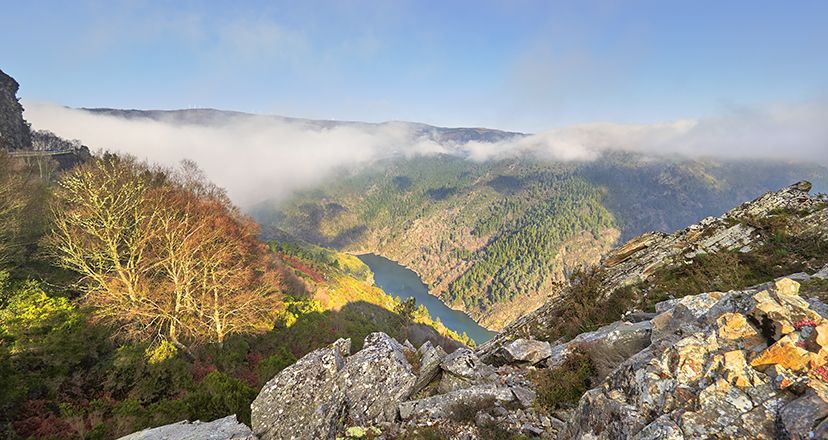
6 routes through Asturias to disconnect from the hustle and bustle of everyday life
A whole world of sensations awaits you when you set off on a route through Asturias. Here we suggest 6 routes to disconnect from stress and the hustle and bustle of the world!
Hiking is an ideal activity to make the most of your free time in a healthy way. They say that if you move your legs, you move your heart, and Asturias is your destination to fulfil this maxim. Because your heart will be moved by the physical exercise, and also by the many emotions aroused by its landscapes, its magical corners, its rural atmosphere, its people...
Hundreds of trails criss-cross the map of Asturias, and the options are endless. You'll walk looking out to sea, through forests, across meadows, between mountains, contemplating rivers, waterfalls and streams...
A whole world of sensations awaits you when you set off on a route through Asturias.
Here are 6 routes to disconnect from stress and the hustle and bustle of the world!
The Ñora river route, to discover a hidden sandy area.
The simple and beautiful Ñora river route starts in the vicinity of the La Lloreda Municipal Golf Course, on the outskirts of the city of Gijón/Xixón. The path winds its way down through a riverside forest until it reaches the beach of La Ñora.
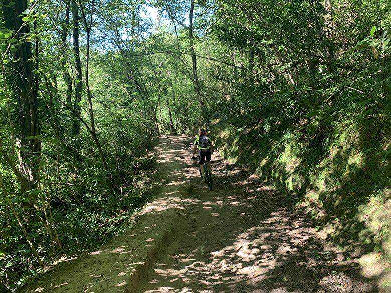
And so, between woods, bridges and the constant murmur of the Llorada stream, you will reach the beach of La Ñora, where you can contemplate dunes and curious geological formations.
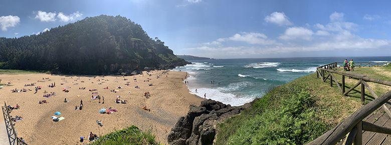
This semi-urban sandy beach, with good waves for surfing, is also ideal for children because it has small puddles where the youngest members of the family have a great time. La Ñora is the perfect place to recharge your batteries and have a swim after the route.
Almost 5 kilometres to enjoy a route with a coastal vocation, which will allow you an intense contact with nature and an immersion in such thick vegetation that at some point you may even have the feeling that you are not in Asturias but in warmer and more humid latitudes...
Route Arnao beach (Castropol) - A Veiga/Vegadeo, pure occidente
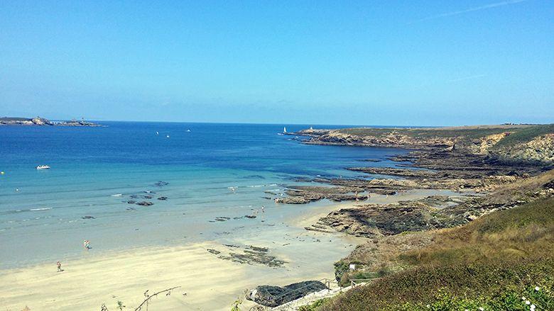
This route starts at the westernmost beach in Asturias: Arnao, in Castropol. A quiet and idyllic beach from where you can enjoy the beautiful scenery of the Asturian coastline that is bathed in the Eo estuary, with the Galician lands in the background.

This beach is part of the Oscos-Eo and Terras de Burón Biosphere Reserve. The route passes through the beautiful fishing village of Figueras, where you will find a tide mill and see the Torres de Donlebún palace.
Barres, Becharro Salías, Cal, Cornayo and Vilavedelle are some of the villages along the route, until it reaches its end point: A Veiga/Vegadeo.
A route to enjoy the flora, fauna, the Eo estuary and the sea breeze, as well as the rural life and architecture of western Asturias.
The Nonaya waterfalls, to cool off on the Way of St James
The route of the Nonaya river waterfalls is undoubtedly very Jacobean, for several reasons.
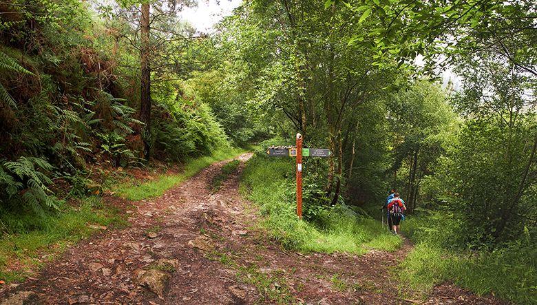
The first of these starts in the town of Salas, one of the most notable enclaves on the Primitive Way of St. James.
The Collegiate Church of Salas and the Palace of Valdés Salas or the tower of Salas, contemplate the beginning of the path to the Nonaya Waterfall and the passage of thousands of pilgrims who every year walk this part of the Way of St. James.
A walk full of history, of old mines, of pilgrims passing through, of stone bridges that represent the engineering of the past, of vegetation that floods everything and that follows the course of the river Nonaya, full of trout and eels, from the moment you leave the town of Salas.
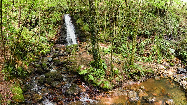
From Salas to the waterfall of the river Nonaya - a tributary of the Narcea - it will take you about an hour, but it is well worth the effort: the lush green surroundings and the murmur of the waterfalls in the middle of the forest create a simply magical atmosphere...
Pimiango Cliffs Route, with Prehistory as a backdrop
At the easternmost tip of Asturias, in Ribadedeva, this route of the Pimiango cliffs brings together parietal art, Romanesque remains, sea and mountain viewpoints, and, in short, nature and dream landscapes.
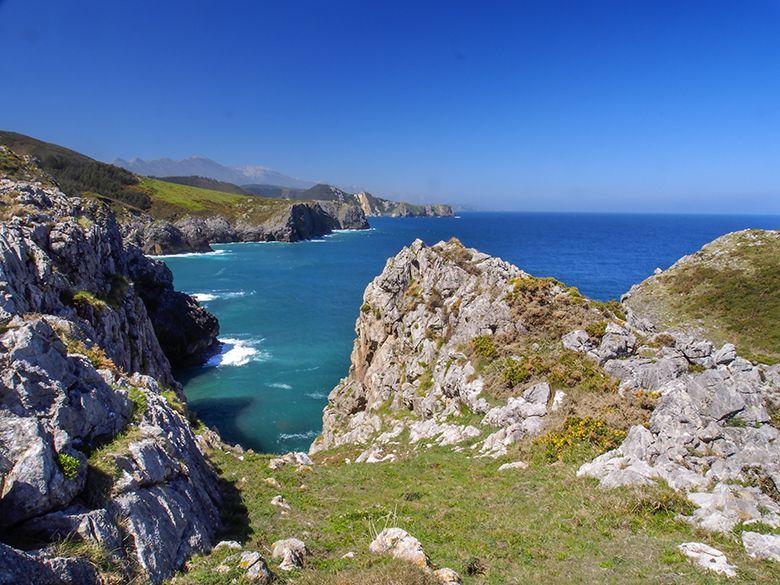
The Pindal Cave, facing the sea and, at the same time, sheltered from it by a fine Atlantic holm oak grove, has been a World Heritage Site since 2008. You will walk alongside cave paintings thousands of years old, and the path, at the foot of the cliff, will lead you to the remains of the Romanesque monastery of Santa María de Tina.
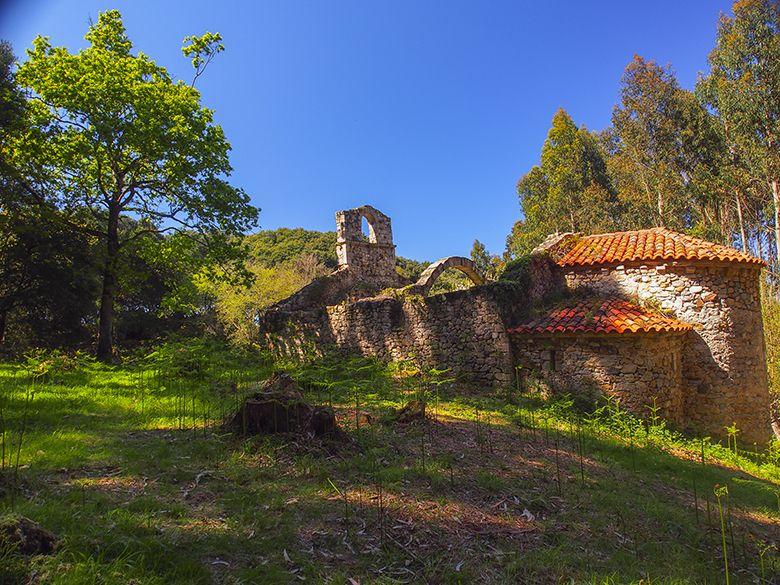
And so, amidst the woods, you will come to the point of Tina, and you will be on the border between Asturias and Cantabria. You will then come to the beautiful Tinamayor estuary, the natural boundary between the two communities.
From there you continue to the beautiful village of Pimiango, and you can enjoy the view at the Picu viewpoint, where, if the day is clear, you will have a good view of the Picos de Europa. And then back to the hermitage of San Emeterio (near the Pindal Cave).
You will have done a wonderful circular route!
The Illano suspension bridge route or the charm of progress
The combination of human progress and nature has generated spectacular landscapes in Asturias, a magnificent example of which is the Doiras dam in Illano.
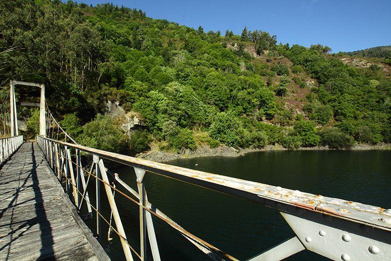
The Illano suspension bridge route is circular and covers 14 kilometres, starting at the Folgueiróu recreation area. You will pass through forests of carob trees, pine and eucalyptus plantations, and you will see terraced vineyards in the village of Lantero.
Its most striking point is the suspension bridge over the reservoir, where cormorants often perch, and from which you will have an idyllic view of the forests reflected in the stillness of the water, which is only broken by the fish jumping to "hunt" the insects that fly over the water...
Moreover, the route will offer you breathtaking views once you pass Illano.
It will be a river experience in the west of Asturias!
San Esteban coastal path - Aguilar beach, the combination of estuary and sea
This route combines like no other the double charm of starting right next to the mouth of the Nalón River into the sea, that is, at the port of San Esteban, and continuing parallel to the Cantabrian Sea.
Once you have walked the first two kilometres, you will come to the most difficult part of the route: no less than 420 steps to reach the viewpoint and the hermitage, but it will be well worth the effort.
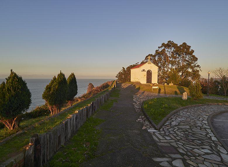
Once you reach the top, you will find a recreational area and, next to it, the white hermitage of Espíritu Santo, as well as the first of the viewpoints, with the same name as the hermitage.
From here you will have beautiful views of the cliffs, with the beach of Los Quebrantos and the island of Deva to the right and Cape Vidio to the left. A few metres further on, the path passes through chestnut and eucalyptus woods, and little by little you will reach the different viewpoints.
When you have covered approximately three kilometres (of the 6 or so kilometres of the route), the path skirts the Focarón beach and reaches the L'Atalaya viewpoint. After another kilometre and a half, the path skirts the beach of Cazonera and reaches the viewpoint of Los Glayos. We are now close to Las Llanas beach.
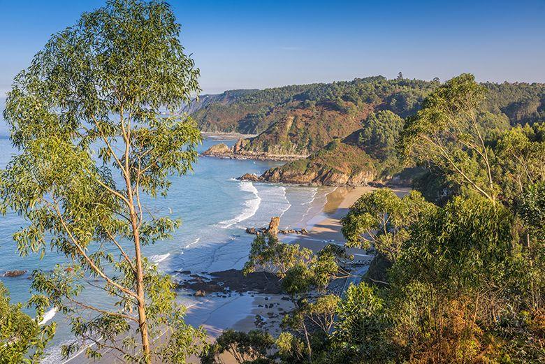
Almost at the end of the route, at the top of Las Llanas, you will see wonderful coastal views. You will soon reach the beach of Xilo or Veneiro, and right next to it is the beach of Aguilar, a splendid end to the route.
Subscribe to our newsletter and take advantage of offers, discounts, and news
Subscribe
