Chemin de la rivière Ñora

- Distance: 9 kms
- Difficulté: Facile
- Dénivelé cumulé: +121 m
- Dénivelé cumulé: -121 m
- Altitude maximale: 126 m
- Altitude minimale: 9 m
- IBP index: 29
- Modalité: Familles
- Type de parcours: Aller-retour
- Type d'itinéraire: Côte
- Retour avec le Chemin de fer: Non
Il relie le terrain de golf de La Llorea à la plage de La Ñora, traversant un environnement naturel idéal pour se promener en famille et profiter du paysage fluvial à quelques minutes de Gijón/Xixón.
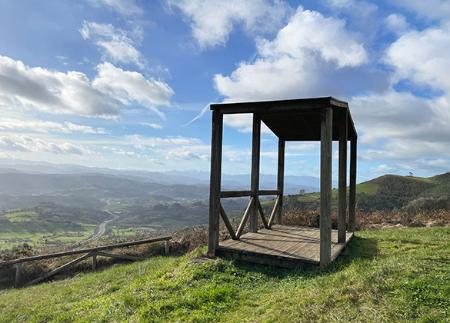
À quelques minutes de Gijón/Xixón, le sentier de la rivière Ñora offre une promenade paisible parmi les bois, les ponts en bois et le murmure constant de l'eau, jusqu'à ce qu'elle se jette dans la belle plage de La Ñora. L'itinéraire commence à proximité du terrain de golf municipal de La Llorea, d'où il entame une descente confortable à travers des paysages d'une grande valeur environnementale.
Le sentier suit le cours du ruisseau Llorea et de la rivière Ñora, dans un environnement naturel caractérisé par ses forêts riveraines, avec des espèces telles que les aulnes, les saules, les chênes et les sureau. La luxuriance et l'ombre de la végétation font de ce sentier une option idéale même pendant les chaudes journées d'été. Le long de l'itinéraire, plusieurs ponts en bois sont traversés et de petits détours permettent de rejoindre des fermes, des chemins ruraux et des aires de repos.
L'itinéraire, bien balisé et peu escarpé, comprend des points d'intérêt tels que les vestiges du Molín de Pilo, l'ancien barrage et le canal qui l'alimentait, ou les panneaux d'information sur la faune locale, où il est possible d'identifier des traces de sangliers, de renards, de chevreuils ou de blaireaux. La promenade se déroule toujours le long de la rivière, dans une ambiance sereine, avec des tronçons qui combinent une végétation dense et des clairières où l'on peut faire une pause.
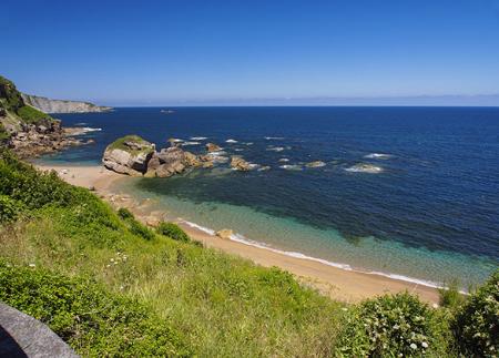
L'itinéraire se termine après environ 4,5 km à la plage de La Ñora, une enclave naturelle entourée de végétation et de falaises. Là, en plus de profiter du paysage côtier, vous pourrez observer le système dunaire en cours de récupération et les formations géologiques jurassiques qui donnent leur nom à la formation de La Ñora. Le retour s'effectue par le même chemin, ce qui permet de redécouvrir l'itinéraire en sens inverse avec une perspective différente.
Parfait pour la marche et adapté aux familles, le sentier de la rivière Ñora est l'une des meilleures façons de se déconnecter de la ville sans la quitter, en explorant un environnement naturel riche, frais et vivant.
- PR-AS 170
Conseils de base avant de partir en montagne
- Si vous partez avec un chien, tenez-le toujours en laisse.
- Évitez d'approcher le bétail.
- Si vous trouvez des mastiffs qui protègent le bétail, ne les approchez pas, ne les caressez pas et ne les nourrissez pas. Ne les laissez pas vous suivre ou s'éloigner de leur troupeau. Ils travaillent.
- Ne laissez pas de traces. Ramassez tous vos déchets, y compris les déchets organiques. La nature n'est pas un dépotoir.
- Agissez avec prudence. Planifiez bien votre itinéraire, prenez tout ce dont vous avez besoin et veillez à ce qu'il soit adapté à votre capacité physique.