Arnao-Vegadeo Beach

- A Veiga/Vegadeo, Castropol, As Figueiras Western Asturias
- Distance: 20 kms
- Difficulty: Moderate
- Cumulative difference in altitude: +197 m
- Cumulative difference in altitude: -207 m
- Maximum altitude: 69 m
- Minimum altitude: 51 m
- IBP index: 51
- Modality: Hikers
- Type of route: Crossing
- Route type: Coast
- Return by Train: No
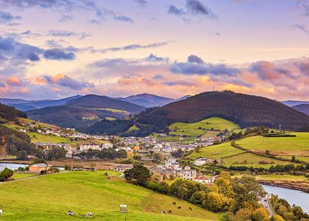
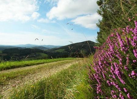
The route offers spectacular views of the Eo estuary, a protected natural area that is home to migratory birds and native fauna, making it the perfect route to enjoy nature and the historical heritage of western Asturias.
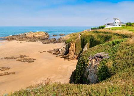
The coastal path that connects Arnao beach with A Veiga/Vegadeo offers a fascinating route that combines the beauty of the Asturian coastline with the historical charm of small riverside towns. The start of the route is at Arnao beach, in Castropol, a sandy area of great natural beauty located in the Ría del Eo Partial Nature Reserve. This environment offers a landscape characterised by calm, crystal-clear waters, fine white sand and an interesting dune flora that makes the beach a unique space on the western coast of Asturias.
The route continues towards the Puente de los Santos Recreational Area, where the San Román del Buen Viaje Chapel is located, a place of seafaring devotion for centuries. From here, the path advances towards As Figueiras, a town that stands out for its Figueras Palace, a construction with Indian influence that reflects the history of emigration in the area.
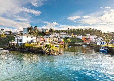
Following the path, the itinerary continues towards Castropol, meeting on the way with the Palacio de los Pardo Donlebún, a building linked to the local nobility. On reaching Castropol, the possibilities for exploration multiply. The Mirandilla Viewpoint offers spectacular views over the Eo estuary and the neighbouring town of As Figueiras, while the Castropol Historic Site allows you to walk through cobbled streets and discover buildings such as the Palace of the Marquis of Santa Cruz, the Vicente Loriente Park or the Chapel of Santa María del Campo, all of which bear witness to the rich past of this fishing village.
Leaving Castropol behind, the path continues parallel to the Eo estuary, passing through small rural villages and natural spots where the eucalyptus and oak groves that line the path stand out. The surroundings are ideal for birdwatching, as the estuary acts as a habitat for a multitude of species, especially during the winter, when it hosts migratory birds such as herons and curlews.
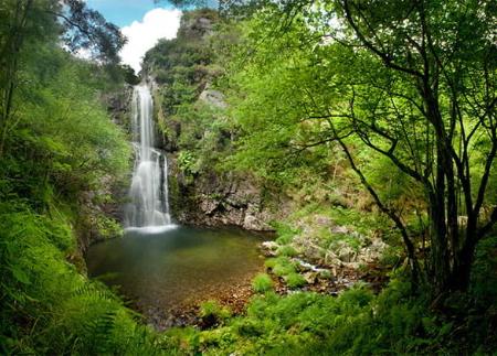
The route then enters meadows and rural paths, where it is possible to come across local fauna, such as roe deer and small mammals. In its final stretch, the trail passes next to the Dos Caleiros Recreational Area, a perfect place to rest before completing the route.
Finally, the path reaches A Veiga/Vegadeo, where the Eo estuary once again takes centre stage. This town, which has traditionally been linked to trade and navigation, is the end point of a route that has merged the coast with the interior, allowing the walker to discover western Asturias in all its essence.
This coastal path combines the charm of the coast with the cultural heritage of villages steeped in history, offering an accessible and enriching route for both walkers and families who wish to enjoy the region's rich landscape and ethnography.
- It runs through the Biosphere Reserve Río Eo, Oscos and Terras de Burón, and partially through the ZEC and ZEPA Ría del Eo of the Natura 2000 Network.
- The route partially coincides with the GR-204.
Basic tips before going into the mountains
- If you go with a dog, always keep it on a leash.
- Avoid approaching livestock.
- If you find mastiffs protecting livestock, do not approach them, do not pet them and do not feed them. Do not allow them to follow you or stray from their herd. They are working.
- Don't leave a trail. Collect all your waste, including organic waste. Nature is not a dumping ground.
- Act with prudence. Plan your route well, take everything you need and make sure it is adapted to your physical capacity.