Nonaya Waterfall Trail

- Rooms Western Asturias
- Distance: 7.17 kms
- Difficulty: Easy
- Cumulative difference in altitude: +203 m
- Cumulative difference in altitude: --203 m
- Maximum altitude: 419.8 m
- Minimum altitude: 225.01 m
- IBP index: 29
- Modality: Families
- Type of route: Round trip
- Route type: With waterfall
- Return by Train: No
Starting from Salas, where history can be breathed in every corner of the town through its impressive historical-artistic heritage, we will follow the course of the Nonaya river until we reach the waterfall located in a natural environment of great beauty.
The route to the Nonaya Waterfall begins in Salas, under the imposing gaze of the Collegiate Church of Santa María la Mayor (a 14th century architectural jewel), the majestic Palace of Valdés Salas and the Tower of Salas. This monumental ensemble bears witness to the rich history of the town and welcomes thousands of pilgrims who constantly cross it on this part of the Primitive Pilgrim's Way to Santiago de Compostela.
After exploring the streets of Salas and its rich historical and artistic heritage, we will start the route from the local hostel, a key reference point for pilgrims. To take the path, we head northwest, passing by the Collegiate Church of Santa María la Mayor.
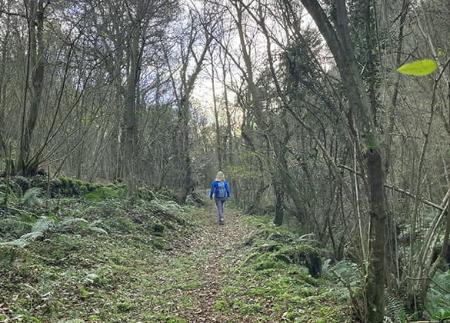
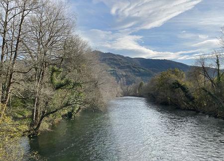
From the moment we leave Salas, the path enters a natural corridor that faithfully follows the river Nonaya. This river, full of trout and eels, is the protagonist of the landscape.
After approximately 1.2 kilometres, you will come to the Paín spring. This is the perfect place to make a brief stop and enjoy the surroundings and the murmur of the river.
A kilometre and a few metres further on, the path will lead us to cross the river on several occasions by means of old stone bridges. Of particular note are the Puente de Borra bridge, located at this point, and the Puente de Carcabón bridge, a little further on. After crossing these bridges, the path continues along the bottom of the valley, close to the river, immersing us even more in the natural atmosphere of the place.
Finally, when you reach kilometre 3.5, the reward awaits you: the Nonaya waterfall. Although it is not of very large proportions, its beauty is undeniable. It is a surprising waterfall, with jets of water that seem to emerge from nowhere, both on the left and on the right, emerging from the dense forest. Before returning along the same path towards Salas, it is worth taking the time to enjoy the natural surroundings.
SL22
Basic tips before going into the mountains
- If you go with a dog, always keep it on a leash.
- Avoid approaching livestock.
- If you find mastiffs protecting livestock, do not approach them, do not pet them and do not feed them. Do not allow them to follow you or stray from their herd. They are working.
- Don't leave a trail. Collect all your waste, including organic waste. Nature is not a dumping ground.
- Act with prudence. Plan your route well, take everything you need and make sure it is adapted to your physical capacity.