Naviega Coast Path

- Puerto de Vega Western Asturias
- Distance: 15.8 kms
- Difficulty: Easy
- Cumulative difference in altitude: +145 m
- Cumulative difference in altitude: -193 m
- Maximum altitude: 60 m
- Minimum altitude: 3 m
- IBP index: 42
- Modality: Hikers
- Type of route: Crossing
- Route type: Coast
- Return by Train: No
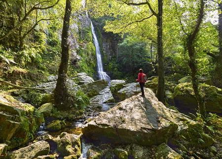
Along the route you can discover unspoilt beaches such as Frexulfe and natural viewpoints that offer views of the Bay of Biscay. The route ends at Navia Beach, where the estuary joins the sea, in a setting of great scenic and cultural value.
Officially, the Senda Costa Naviega starts in the village of El Bao but, as there is no car park, we will start from the car park next to the Mirador Playa de Barayo, from where we can enjoy spectacular views of the Barayo Partial Nature Reserve and its surroundings. This beach, declared the best in Spain by The Times in 2023, stands out for its dunes and marshes formed at the mouth of the Barayo River, making it one of the most valuable natural spaces in Asturias.
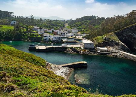
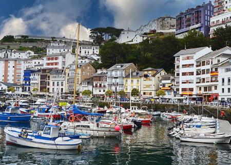
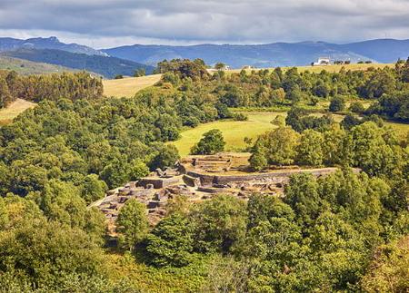
The route runs parallel to the coast, offering panoramic views of the Cantabrian Sea as it crosses cliffs and meadows. After several kilometres of coastal path, you reach Castro de Vigo, an ancient pre-Roman settlement that preserves archaeological remains of great historical interest. From this point, the path descends towards Puerto de Vega, a picturesque fishing village with a rich fishing tradition and a notable historical heritage. It is advisable to take a break to visit the Paseo del Baluarte, with its 18th century cannons, and the Atalaya Chapel, located in a privileged position overlooking the port.
Leaving Puerto de Vega behind, the route continues along the coast, passing small pebble coves such as La Losera and beaches such as Frexulfe Beach, declared a Natural Monument. This sandy area, with its dunes and protected ecosystem, has become a meeting point for surfers and lovers of the natural environment.
The route continues in the direction of Fabal Beach, passing through small paths that connect rural areas with the coastline. From the natural viewpoint of Soirana Island, there is a panoramic view of both the sea and the surrounding cliffs. Further on, the route reaches Puerto de Panes, a small inlet surrounded by rock formations.
The last part of the route approaches Navia Beach, the end point of the path. This urban beach has a promenade from which you can see the Navia estuary, where the sea and the river meet in an environment that changes with the tides. Here you will find the Monument to the Emigrant, a tribute to the Asturians who left in search of new opportunities.
This path is an excellent option for getting to know the coast of Navia in depth, enjoying spectacular landscapes and the authenticity of its coastal villages.
- It runs partially through the Penarronda-Barayo SAC and SPA of the Natura 2000 Network and through the Barayo Partial Nature Reserve.
- The route partially coincides with the GR-204.
Basic tips before going into the mountains
- If you go with a dog, always keep it on a leash.
- Avoid approaching livestock.
- If you find mastiffs protecting livestock, do not approach them, do not pet them and do not feed them. Do not allow them to follow you or stray from their herd. They are working.
- Don't leave a trail. Collect all your waste, including organic waste. Nature is not a dumping ground.
- Act with prudence. Plan your route well, take everything you need and make sure it is adapted to your physical capacity.