Courias walk to El Puelu

- Courias, El Puelu, Retuertas Western Asturias
- Distance: 12.18 kms
- Difficulty: Easy
- Cumulative difference in altitude: +306 m
- Cumulative difference in altitude: --306 m
- Maximum altitude: 535.83 m
- Minimum altitude: 339.61 m
- IBP index: 35
- Modality: Families
- Type of route: Round trip
- Route type: Mountain
- Return by Train: No
This round trip allows you to immerse yourself in the cultural and natural wealth of this area of Western Asturias, from medieval vestiges to agricultural landscapes and mining tradition.
The route from Paseo Courias to El Puelu is an easy route that invites you to immerse yourself in the history, culture and nature of the Cangas del Narcea area.
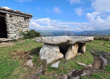
The starting point for this walk is in the village of Courias, just at the entrance to the medieval bridge that rises majestically in front of the Monastery of Corias. To begin the walk, cross this ancient stone bridge. On the other side, the path crosses the village. You can admire traditional granaries and granaries, as well as extensive fields of crops, vineyards and livestock, which offer an insight into the economic and cultural activity of the area.
After leaving the village of Courias behind, the route continues following the signs that lead to the village of Retuertas. On this stretch of the route, you can stop to visit the Malatería de San Lázaro, an old leper colony that has been preserved over the centuries. Inside, you can still admire a valuable 18th century altarpiece.
Once this visit to Retuertas is over, the route retraces its steps until it reaches a crossroads. At this point, take the path that leads to the old Camino Real.
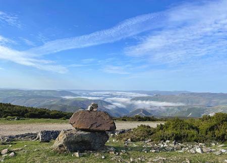
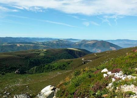
From here, the route enters a landscape dominated by leafy chestnut trees and offers a natural and shady environment. As the path heads towards El Puelu, you can take in the panoramic views and contemplate the beauty and uniqueness of the surroundings. During this stretch, you can find traces of the mining tradition of the area, such as abandoned prospecting sites, some of which are located to the left of the path. You can also see corripas, circular stone constructions that surround the chestnut trees to facilitate the harvesting of chestnuts, an ancestral tradition of the region. The trail also passes through places full of mystery and legend, such as the enigmatic cave of Los Moros.
On reaching El Puelu, the final destination of the walk, you can see several traditional buildings that are still in very good condition. This point is the end of the route, offering a last glimpse of rural architecture and local culture. From there, the return is by retracing the route back to the starting point in Courias.
Basic tips before going into the mountains
- If you go with a dog, always keep it on a leash.
- Avoid approaching livestock.
- If you find mastiffs protecting livestock, do not approach them, do not pet them and do not feed them. Do not allow them to follow you or stray from their herd. They are working.
- Don't leave a trail. Collect all your waste, including organic waste. Nature is not a dumping ground.
- Act with prudence. Plan your route well, take everything you need and make sure it is adapted to your physical capacity.