Sierra de Carondio Archaeological Route

- Bustantigo Western Asturias
- Distance: 14.82 kms
- Difficulty: Easy
- Cumulative difference in altitude: +178 m
- Cumulative difference in altitude: --178 m
- Maximum altitude: 1177.47 m
- Minimum altitude: 1034.83 m
- IBP index: 41
- Modality: Hikers
- Type of route: Round trip
- Route type: Mountain
- Return by Train: No
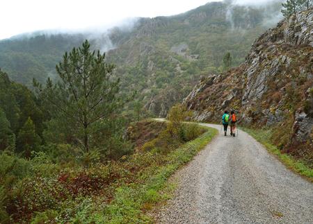
The route, there and back, runs along a comfortable track, which makes it accessible to all levels. Along the way, you can discover the remains of tomb necropolises, cazoletas (small cavities carved into the rock) and ancient Roman settlements.
The route of the Sierra de Carondio archaeological route follows a forest path that follows the profile of the mountain range in the Carondio area, dominated by heathland and gorse and some pine forests on the highest peaks. The route runs parallel to the Camino de Santiago, whose path can be glimpsed on the mountain further south, at the height of the Palo pass, descending towards Montefurado.
The route begins at the Alto de Bustantigo or Collado de Cruces (1,028 metres), accessible by the ALL-5 route from the Alto de la Marta (ALL-4), both coming from kilometre 38.5 of the AS-14 road.
After the first 450 metres, the path reaches the parking area, where a signpost indicates the village of Zaporrel. From here, it continues along a dirt track, an old royal cow track known as La Carreiriega de los Gallegos, which ascends to the left.
Approximately 1.5 kilometres into the route there is an intersection. Here, the path turns left to continue straight on and meets the imposing Pico Agudo (1,143 metres), recognisable by the metal cross that crowns its summit.
When you reach kilometre 4, the route continues turning right. A kilometre further on, you will enter the Veiga de Abades, an important tomb area. This is the site of the famous "dolmen stone" of Allande, one of the most prized pieces in the Oviedo Archaeological Museum, measuring 1.95 metres long, 0.35 metres wide and 0.12 metres thick.
After 7 kilometres, we reach the final stretch of this route, where we can contemplate the splendid panoramic views of the Sierra de Carondio. To return to the starting point, simply retrace the route, returning along the same track in the opposite direction.
What makes this route unique is its archaeological value. Along the path, there are remains of tomb necropolises, cazoletas (small cavities dug into the rock) and ancient Roman settlements.
More than two dozen mounds have been inventoried along this route, with the dolmen located at the foot of Pico Carondio, popularly known as A Llastra d'Afiladoira, being one of the most outstanding.
Basic tips before going into the mountains
- If you go with a dog, always keep it on a leash.
- Avoid approaching livestock.
- If you find mastiffs protecting livestock, do not approach them, do not pet them and do not feed them. Do not allow them to follow you or stray from their herd. They are working.
- Don't leave a trail. Collect all your waste, including organic waste. Nature is not a dumping ground.
- Act with prudence. Plan your route well, take everything you need and make sure it is adapted to your physical capacity.