Demo Cave

- Doiras Western Asturias
- Distance: 10.8 kms
- Difficulty: Moderate
- Cumulative difference in altitude: +492 m
- Cumulative difference in altitude: -492 m
- Maximum altitude: 436 m
- Minimum altitude: 112 m
- IBP index: 56
- Modality: Mountaineers
- Type of route: Circular
- Route type: Mountain
- Return by Train: No
The route crosses chestnut forests and mountainous landscapes, crossing the Urubio river and the Doiras reservoir. A fascinating itinerary that unites nature and history in a unique setting.
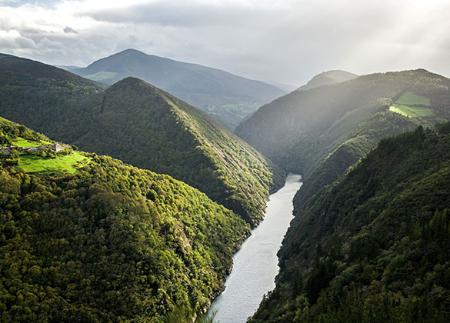
The route starts in Doiras, combining stretches of narrow path, tracks and road, so it is important to respect the traffic rules and take extreme precautions. A few metres below the bus stop, we take a tarmac road that heads towards Froseira. To the left, we can admire a bend in the Doiras reservoir, where the Urubio river flows into it, and further on, the steep slope of Pico del Cuco, with its characteristic quartzite edges.
The route starts out flat, but after overcoming a small crest, we leave the main path and continue parallel to the Urubio River. Shortly after, we see Froseira, which we leave on our left to go on to the Llanza bridge, where we cross the river.
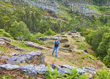
From here, the path becomes steeper, starting the ascent towards the Cova del Demo. The first part of the ascent, although steep, does not present any difficulties, but further on the terrain becomes rocky and uneven, so extreme caution is recommended.
When you reach the Cova del Demo, a natural shelter 15 metres deep, you will find an enclave of great archaeological and cultural interest. Inside, protected by a fence, you can see cave paintings from the Bronze Age (1500-1100 BC), with zoomorphic and anthropomorphic representations of a schematic nature, linked to the naturalistic schematic trend of the Spanish Levant. These paintings, which have been declared an Asset of Cultural Interest, make the cave a highlight of the historical heritage of the Principality of Asturias. Although protection prevents access, it is possible to make out some of the figures from the outside, arousing the curiosity of hikers.
After enjoying this archaeological treasure, we start the descent along the same path to Froseira, where this time we turn right and cross a metal gate to go through the village, made up of some traditional dwellings.
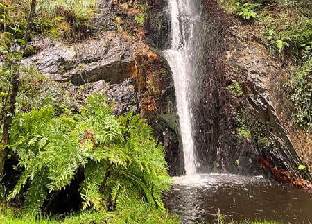
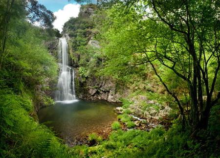
On leaving Froseira, the route follows a beautiful path parallel to the river Urubio, surrounded by chestnut trees and with views that contrast with the previous mountainous landscape. This section is considered one of the most beautiful on the route. After leaving the AS-12 road, we cross the Urubio bridge and follow the road up a slight slope.
Finally, we take a detour towards the BO-3, skirt the Doiras reservoir and reach the dam, where we turn left to begin the final ascent towards Doiras. On this stretch, it is possible to see the hydroelectric power station, the old school and the church of Santa María Magdalena, before completing a route that combines nature, archaeology and landscapes of great beauty.
- It is advisable to wear suitable footwear due to the slippery steps, steep slopes, and it is even recommended to carry walking sticks.
- Road sections
- PR-AS 200
Basic tips before going into the mountains
- If you go with a dog, always keep it on a leash.
- Avoid approaching livestock.
- If you find mastiffs protecting livestock, do not approach them, do not pet them and do not feed them. Do not allow them to follow you or stray from their herd. They are working.
- Don't leave a trail. Collect all your waste, including organic waste. Nature is not a dumping ground.
- Act with prudence. Plan your route well, take everything you need and make sure it is adapted to your physical capacity.