Majadas de Onís

- Demués Eastern Asturias
- Distance: 28.61 kms
- Difficulty: Very difficult
- Cumulative difference in altitude: +1521 m
- Cumulative difference in altitude: -1521 m
- Maximum altitude: 1488 m
- Minimum altitude: 430 m
- IBP index: 123
- Modality: Mountaineers
- Type of route: Circular
- Route type: Mountain
- Return by Train: No
Ideal for experienced hikers who are looking to delve into the life of the high altitude shepherds, walking through the sheepfolds that came to life in summer when the shepherds used to take their livestock up to the mountain passes to make the increasingly scarce Gamonéu del Puertu cheese. Pure nature, tradition and unique views of the Western Massif.
The Route of the Majadas de Onís is a circular mountain route that takes us through some of the most emblematic sheepfolds of the council of Onís, allowing us to follow in the footsteps of generations of shepherds who for centuries went up to the high pastures every summer to look after the livestock and make the famous Gamonéu del Puertu cheese.
The itinerary begins in Demués, ascending a livestock track with restricted traffic. As you gain height, the views open up until you reach the Camba viewpoint, where a wide panoramic view of the valley and the mountains sets the tone for what is to come: a route of wide open spaces and untamed beauty. From here we continue on to Majada de Soñín, with its traditional stone huts, and move on to Vega Las Mantegas, where we briefly link up with the well-known Ruta de la Reconquista (GR-PNPE 202).
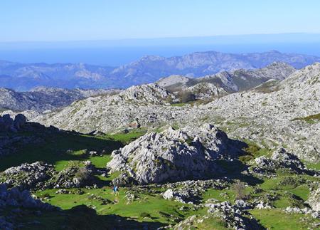
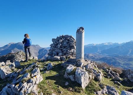
Further on, after crossing the Majada de Vega Maor (also called Vegamayor), we reach one of the most spectacular points on the route, from where we enjoy privileged views of the Western Massif of the Picos de Europa, with its sharp peaks and deep channels. Near this point is the Pozo los Texos, a place linked to the oral memory of traditional shepherding.
The route continues eastwards, crossing Vega Los Corros before turning off to the north towards Majada Las Fuentes, where it leaves the GR route and enters less travelled areas. From here the route passes through the sheepfolds of Camplengu Vieyu and Espines, the latter with a strong historical link to the production of Gamonéu cheese. Along this stretch there are also springs such as Las Reblagas or Friero Espines, essential for cooling off on the hottest days.
The last section leads to Majada de Brañarredonda, from where the return to Vega Las Mantegas begins and, from there, the track that leads to Demués is taken again.
With a demanding route and sections of considerable slope, this route is designed for hikers in good physical shape and with experience in the mountains. In exchange, it offers a total immersion in the landscape and livestock culture of the Picos de Europa, in a setting dotted with huts, meadows, springs and panoramic views that sum up the essence of life at altitude.
- Part of the route runs through the Picos de Europa National Park and Biosphere Reserve, as well as the Picos de Europa SAC and SPA (Asturias) of the Natura 2000 Network.
- Partially coincides with the GR-202 and the S12.
Basic tips before going into the mountains
- If you go with a dog, always keep it on a leash.
- Avoid approaching livestock.
- If you find mastiffs protecting livestock, do not approach them, do not pet them and do not feed them. Do not allow them to follow you or stray from their herd. They are working.
- Don't leave a trail. Collect all your waste, including organic waste. Nature is not a dumping ground.
- Act with prudence. Plan your route well, take everything you need and make sure it is adapted to your physical capacity.