Braña de Mumian

- The Coutu Central Asturias
- Distance: 12.2 kms
- Difficulty: Moderate
- Cumulative difference in altitude: +725 m
- Cumulative difference in altitude: -725 m
- Maximum altitude: 1442 m
- Minimum altitude: 988 m
- IBP index: 70
- Modality: Hikers
- Type of route: Round trip
- Route type: Mountain
- Return by Train: No
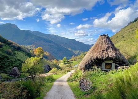
From El Llamardal, the route climbs up to Mumián, one of the most representative groups of teitos in the council, allowing us to get a close-up view of the livestock farming lifestyle that has shaped the Somedano territory for centuries. The route continues through the beech forest of La Enramada before descending towards El Coto, where it ends.
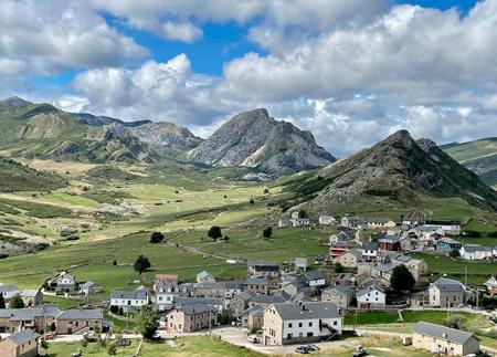
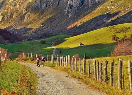
The route begins at the car park next to the AS-227 road, at kilometre 46.5, in the direction of Puerto de Somiedo. From this point, a wide track ascends gently towards the rural centre of El Llamardal, surrounded by meadows and scrubland. The path follows a gentle slope halfway up the side of Peña Gúa, alternating open areas with shady stretches, and affording ample views of the valley.
The path continues between stone walls until it reaches the Braña de Mumián, one of the most representative groups of teitos in the council of Somiedo. These constructions, with broom or pyorn roofs and stone walls, bear witness to the pastoral past of the area. Among the buildings, the Fuente el Caño stands out, where you can see old "olleras", structures that were used to preserve fresh milk thanks to the running water. The braña maintains its traditional layout, with the huts scattered around the meadow, and from this point you can contemplate the mountain landscape that surrounds the enclave, with views of Picu'l Mocosu and the Sierra'l Páramu.
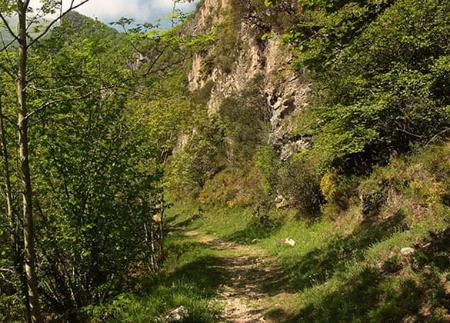
From Mumián, the route continues towards the beech forest of La Enramada, one of the best preserved forests in the Somiedo Natural Park, classified as a restricted use area. The path descends in zigzag, crossing the beech forest in which you should walk in silence so as not to disturb the local fauna. During the descent, it is possible to see roe deer and chamois, especially if the walk is done early in the morning or at dusk.
On leaving the beech forest, the landscape changes again and opens out into mown pastures lined with hazelnut, hawthorn and ash trees, marking the proximity of the Coto de Buenamadre. Here, it is advisable to visit the parish church of San Miguel and a recently restored hórreo with teito, which preserves the essence of traditional architecture.
The return journey follows the same route, allowing you to appreciate the landscape from another perspective. This route, of moderate difficulty, combines history, nature and ethnographic heritage, offering an immersion in the pastoral landscape of Somiedo and allowing you to discover the charm of its centuries-old brañas and forests.
- It runs through the Natural Park and Biosphere Reserve of Somiedo, as well as through the ZEC and ZEPA Somiedo of the Natura 2000 Network.
- The route coincides with PR-AS 011.
Basic tips before going into the mountains
- If you go with a dog, always keep it on a leash.
- Avoid approaching livestock.
- If you find mastiffs protecting livestock, do not approach them, do not pet them and do not feed them. Do not allow them to follow you or stray from their herd. They are working.
- Don't leave a trail. Collect all your waste, including organic waste. Nature is not a dumping ground.
- Act with prudence. Plan your route well, take everything you need and make sure it is adapted to your physical capacity.