Lake of the Valley Route

- El Vaḷḷe/Lake Valley Central Asturias
- Distance: 14.6 kms
- Difficulty: Moderate
- Cumulative difference in altitude: +422 m
- Cumulative difference in altitude: -422 m
- Maximum altitude: 1587 m
- Minimum altitude: 1211 m
- IBP index: 58
- Modality: Hikers
- Type of route: Circular
- Route type: Mountain
- Return by Train: No
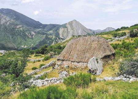
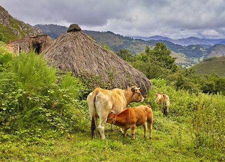
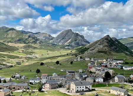
The route offers spectacular views of the valley and allows you to get to know the livestock tradition through the brañas, especially the Gabitón.
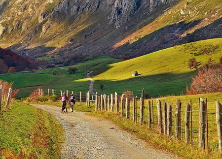
The route starts at the car park at the end of the village of Valle de Lago, where there is a fountain. Just a few metres further on, the El Outeiro fountain is located, just before the start of the track restricted to road traffic that leads to Lago del Valle. After a comfortable climb of about two and a half kilometres, you reach a fork where you take the right-hand branch. On this stretch, the first teitos, traditional constructions with vegetable roofs that bear witness to the livestock farming past of these mountains, begin to appear.
Shortly after, a new fork takes us back to the right, in the direction of the "braña del Gabitón", one of the highlights of the route. In this enclave there are several well-preserved teitos, integrated into a setting of great scenic value. From here, the route continues towards the meadow of El Valle and Lago del Valle, a lake of glacial origin surrounded by peaks that are reflected in its calm waters.
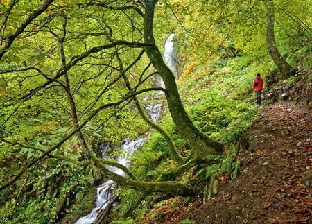
Once you reach the lake, the path continues along its retaining wall to the opposite slope, from where it is possible to make a short detour to Teito Cobrana, before starting the return. The return follows the same initial itinerary until shortly after the turn-off to the Gabitón hut, where we cross the river to continue along its right bank, outside the PR-AS 15.1. This section offers new perspectives of the valley and allows us to enjoy the route in a different light and with different views.
At the height of the village, you reach the church of Santa María Magdalena. At this point, you can cross the river directly to shorten the route, or continue to the Malva reservoir, bordering it to return to El Val.le/Valle de Lago and thus complete this circular route, ideal for getting to know the natural and cultural essence of Somiedo.
- It runs through the Natural Park and Biosphere Reserve of Somiedo, as well as through the Somiedo ZEC and ZEPA of the Natura 2000 Network.
- The route partially coincides with PR-AS 015.1
- It crosses with PR-AS 016
Basic tips before going into the mountains
- If you go with a dog, always keep it on a leash.
- Avoid approaching livestock.
- If you find mastiffs protecting livestock, do not approach them, do not pet them and do not feed them. Do not allow them to follow you or stray from their herd. They are working.
- Don't leave a trail. Collect all your waste, including organic waste. Nature is not a dumping ground.
- Act with prudence. Plan your route well, take everything you need and make sure it is adapted to your physical capacity.