Cibea Valley

- Vaḷḷáu, Sigueiru, Riegla de Cibea, Sonande, Western Asturias
- Distance: 14.2 kms
- Difficulty: Difficult
- Cumulative difference in altitude: +595 m
- Cumulative difference in altitude: -595 m
- Maximum altitude: 1265 m
- Minimum altitude: 771 m
- IBP index: 66
- Modality: Hikers
- Type of route: Circular
- Route type: Mountain
- Return by Train: No
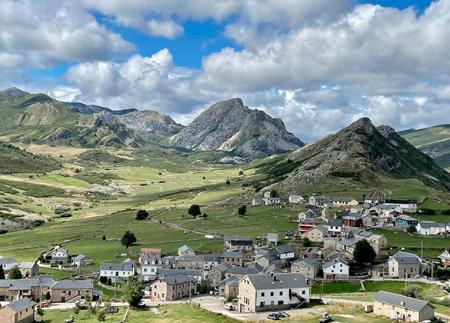
From La Chabola, a former muleteers' inn, the route climbs up to Sigueiru, where a 17th and 18th century wooden hórreo stands out. After passing through Riegla de Cibea and its medieval church, the route ends at the Lindelauvecha hut.
The Cibea Valley Route begins at La Chabola, an old inn that, since the 12th century, offered shelter to muleteers and walkers who travelled the old royal road between the southwest of Asturias and the plateau. From this historic enclave, the route takes a small road towards Vaḷḷáu. A few metres further on, a turning to the left marks the beginning of a dirt track towards the village of Siero.
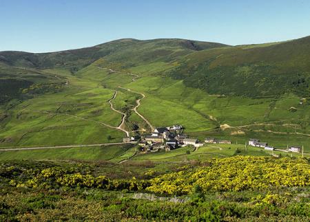
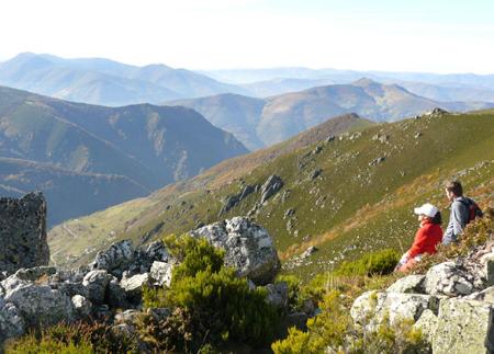
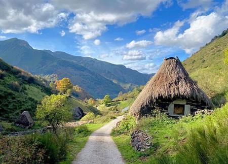
The path ascends progressively, going around the slope of Picu Sigueiru and offering panoramic views of the neighbouring valleys. When you reach Sigueiru, you can appreciate elements of rural heritage, such as the hórreo (granary) with a wooden structure from the 17th and 18th centuries and a cereal straw roof, known as a "teito". This ensemble reflects the survival of traditional building techniques in the area. In addition, the small hermitage of Sigueiru adds a historical component to the rural complex.
Before entering the village, the path takes a detour to the right that descends steeply towards Regla de Cibea, where the church of Santiago, of medieval origin and modified over time, is located. This is one of the historical landmarks of the route and a place of reference in the valley.
The route continues along a half-slope path that ascends towards the Serrantina valley, crossing meadows and scrubland, and joins the local road that connects Vaḷḷáu with Sonande. At the entrance to Sonande, on a sharp bend, take a path to the right that leads to the Lindelauvecha hut, the last milestone on the route.
From the braña, the path ascends again to close the loop and return to the starting point at La Chabola. The Cibea Valley Route is an experience that combines history, landscape and rural tradition, covering places that preserve the authentic character of the council and allowing you to discover the essence of the southwest of Asturias.
- It runs through the Muniellos Biosphere Reserve, the Natural Park of Fuentes del Narcea, Degaña and Ibias, and the SCI Fuentes del Narcea, Degaña and Ibias of the Natura 2000 Network.
- PR-AS 112
Basic tips before going into the mountains
- If you go with a dog, always keep it on a leash.
- Avoid approaching livestock.
- If you find mastiffs protecting livestock, do not approach them, do not pet them and do not feed them. Do not allow them to follow you or stray from their herd. They are working.
- Don't leave a trail. Collect all your waste, including organic waste. Nature is not a dumping ground.
- Act with prudence. Plan your route well, take everything you need and make sure it is adapted to your physical capacity.