Peña Cabrera

- Santolaya Asturie orientali
- Distanza: 10 kms
- Difficoltà: Media
- Dislivello cumulativo: +492 m
- Dislivello cumulativo: -492 m
- Altitudine massima: 492 m
- Altitudine minima: 152 m
- Indice IBP: 51
- Modalità: Escursionisti
- Tipo di percorso: Circolare
- Tipo di percorso: Montagna
- Ritorno in treno: No
- Punto di partenza: Parcheggio Santolaya
- Punto di arrivo: Parcheggio Santolaya
- Epoca: Tutto l'anno
- Durata stimata: Più di 5 ore
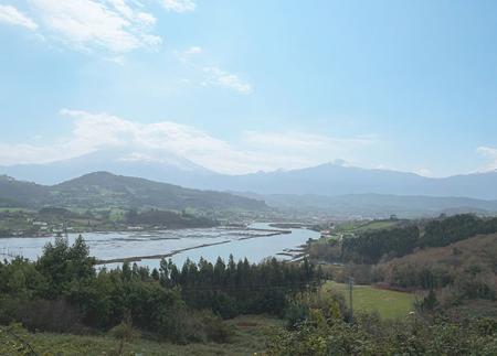
Dalla cima e dall'area ricreativa si gode di un'ampia vista panoramica sull'estuario di Villaviciosa. L'itinerario può essere completato con un percorso circolare, passando per Viñón e il suo museo rurale. Un'opzione accessibile e molto completa tra natura, cultura e paesaggio tradizionale asturiano.
L'itinerario verso Peña Cabrera inizia a Santolaya de Cabranes, accanto alla chiesa di Santa Eulalia, uno dei migliori esempi di architettura religiosa asturiana. Da questo punto, il sentiero entra nel paese e sale progressivamente lungo sentieri rurali, tra fattorie, prati e boschi misti di querce, castagni ed eucalipti.
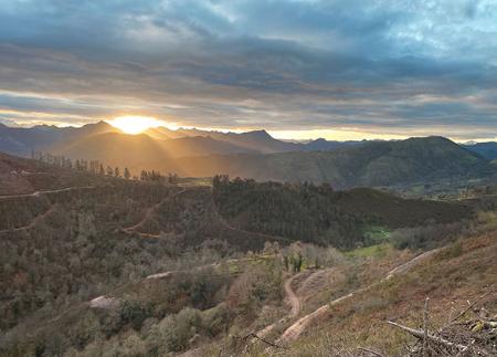
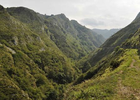
Dopo aver superato il primo tratto in salita, il paesaggio si apre, rivelando scorci sulle valli formate dai fiumi Viacaba e Profundo.
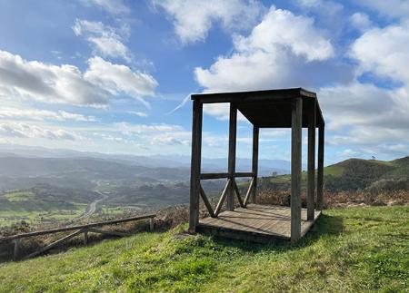
All'altezza di Valbuena, il sentiero prosegue attraverso zone alte e chiare, offrendo panorami aperti su entrambi i lati del percorso. Infine, si raggiunge la cima di Peña Cabrera, uno dei punti più alti della zona, con una vista eccezionale sulle Asturie centro-orientali. A pochi metri di distanza si trova l'area ricreativa di Peña Cabrera, attrezzata con tavoli, panchine e un punto di vista naturale sull'estuario di Villaviciosa.
Da qui, le opzioni sono due: tornare sui propri passi lungo lo stesso sentiero o proseguire verso Viñón, rendendo il percorso circolare. Questa seconda opzione permette di visitare il Museo della Scuola Rurale delle Asturie, un affascinante spazio che ricrea la vita quotidiana di un villaggio asturiano. Al piano terra sono esposti mobili tradizionali e utensili della casa rurale, mentre al piano superiore si trova una "classe di ieri", con banchi, mappe, enciclopedie e materiale scolastico originale, che offre ai visitatori uno sguardo nostalgico sulla scuola di un tempo, fedele alla memoria di chi vi ha vissuto.
Sempre a Viñón si può visitare la chiesa romanica di San Julián, dichiarata Monumento Provinciale di Interesse Storico-Artistico nel 1965, esempio del ricco patrimonio religioso della zona.
Il ritorno a Santolaya avviene lungo un tratto tranquillo e ombreggiato che corre parallelo al fiume Viacaba, chiudendo così un itinerario che unisce natura, cultura e memoria rurale. Senza grandi difficoltà tecniche e con una buona segnaletica, è un itinerario molto completo per scoprire l'identità dell'interno asturiano.
- PR-AS 52
Consigli di base prima di andare in montagna
- Se andate con un cane, tenetelo sempre al guinzaglio.
- Evitare di avvicinarsi al bestiame.
- Se trovate dei mastini che proteggono il bestiame, non avvicinatevi, non accarezzateli e non date loro da mangiare. Non permettete loro di seguirvi o di allontanarsi dalla mandria. Stanno lavorando.
- Non lasciate tracce. Raccogliete tutti i vostri rifiuti, compresi quelli organici. La natura non è una discarica.
- Agite con prudenza. Pianificate bene l'itinerario, portate con voi tutto il necessario e assicuratevi che sia adeguato alle vostre capacità fisiche.