Back Walking along the Castello-Porcía coastal path
Walking along the Castello-Porcía coastal path
The Castello-Porcía coastal path runs along the coastline of the council of El Franco, in the west of Asturias, from one end to the other, and is an ideal walk for hiking enthusiasts.
The Castello-Porcía coastal path runs along the coastline of the council of El Franco, in western Asturias, from one end to the other.
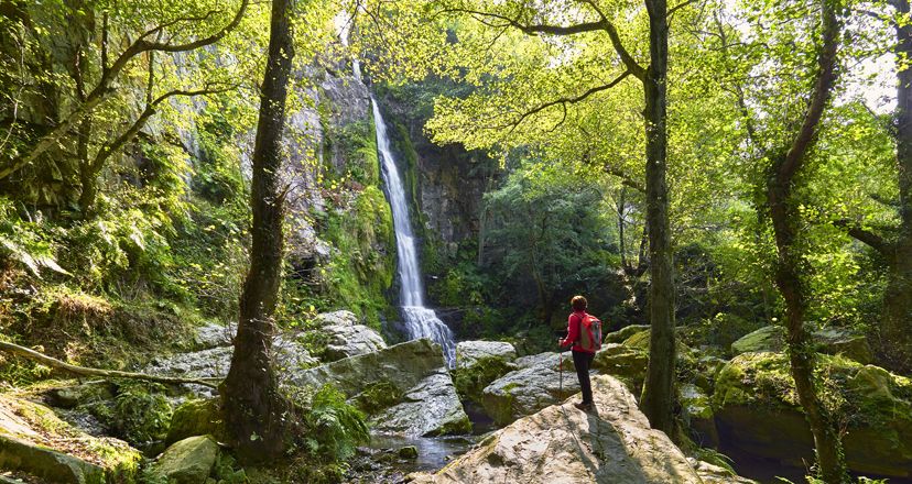
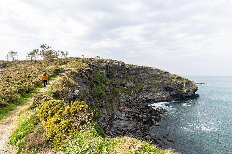
Along its 13 kilometres, this route guides walkers along a rugged coastline full of viewpoints, waterfalls that vanish into the sea, fishing villages with a whaling past and ancient settlements built on the edge of the cliffs.
The untamed landscapes, agitated by the waves and the wind, are the protagonists of this route, one of the least travelled and most unknown coastal stretches of the region.
Would you like to discover all the secrets hidden in this journey through western Asturias? Let's get to it!
Everything you need to know before you put on your boots.
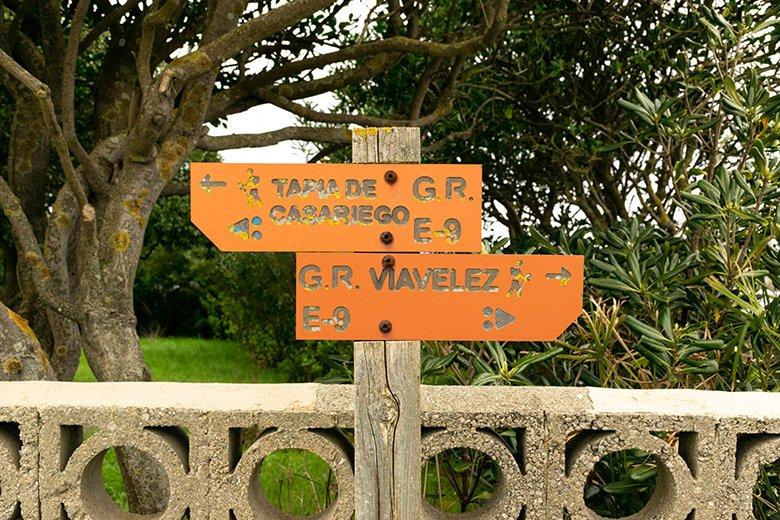
The Castello-Porcía coastal path is a small part of the Atlantic Coast Path, a European route of about 5000 kilometres (catalogued under the acronym GR E-9), which starts at Cape St. Vincent in Portugal and goes all the way to Estonia (or vice versa).
Specifically, this section forms part of stages 26 and 27 of the GR 204 (although not in its entirety), which runs along the Asturian coast from end to end.
The route is easy, without any technical difficulties apart from the occasional steep slope, and has no danger other than the proximity of the cliff in some sections, and its course on asphalt in others.
It is 13 kilometres long, takes approximately 4 hours, has a positive difference in altitude of 266 metres and the route is linear.
It is important to bear this in mind as one of the first decisions you will have to make is whether to do it one way, or whether to do it there and back. In the first case you will have to have two cars. In the second case you will have to take into account that the total length of the route will be 26 kilometres and the duration will be around 7 or 8 hours.

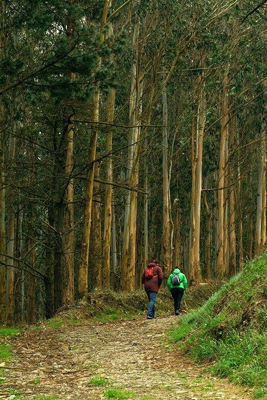
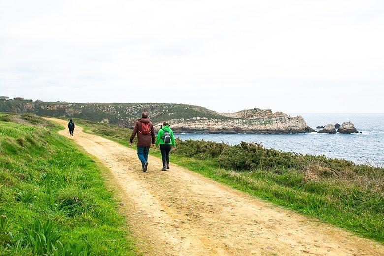
The tracks are wide and well surfaced, except for some parts closer to the cliffs where the path narrows. During the course of the route we will alternate between the high cliff coast and a lower ridge towards the westernmost part.
For all these reasons, and if you have two cars, it is a good option to do with children who are not too young, to carry or even to do with a pushchair, suitable for uneven terrain.
Ah! If you like pedalling, you can also do it by bike, although some sections are very steep, and you will probably have to climb uphill. However, it is precisely because of the steep ramps and narrow passages that, unfortunately, it is not suitable for people with reduced mobility.
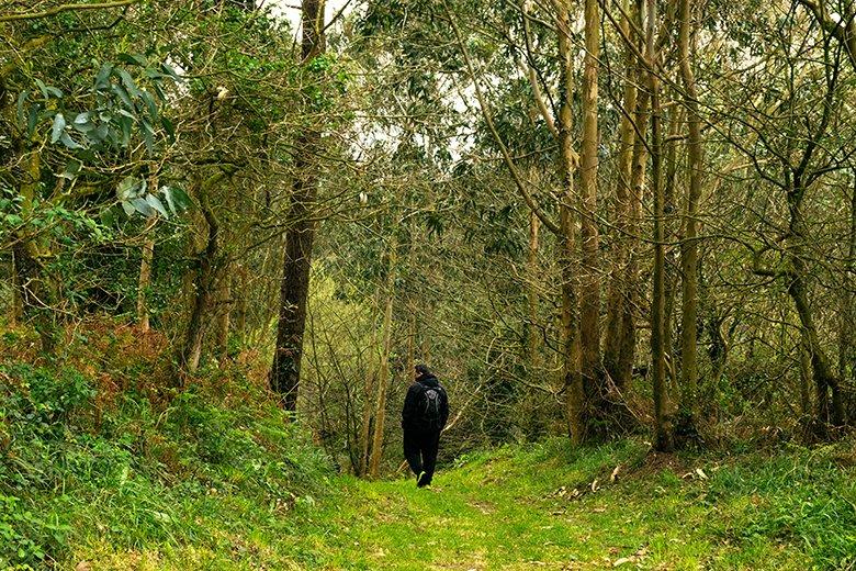
Are you going to do the route with your dog? Bear in mind that although salt water is present all along the route for them to splash around and have fun, there is not much fresh water available for them to drink. You'll only find it in a couple of streams and fountains.
Also remember that in summer dogs are not allowed on the beaches along the route. Except for Cambaredo beach, which is open to dogs all year round.
Discovering the coast of El Franco along the Castello-Porcía trail
Although the Castello-Porcía coastal path is linear and could be walked in both directions, in this case we will walk from the Castello beach car park to the Porcía beach car park.
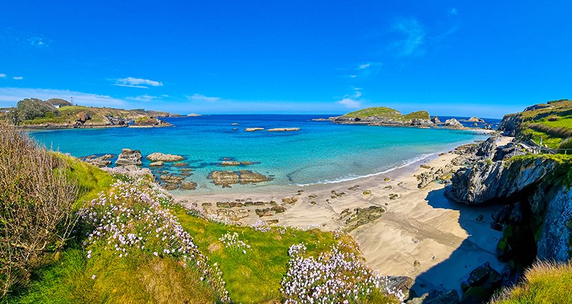
The route starts uphill on the west side of Castello beach and soon heads towards the Cambaredo beach viewpoint, which is accessible to dogs all year round.
Behind it, there is a spacious recreational area with several tables, and presided over by the work "Ventana" (Window), by the sculptor Ernesto Knorr.
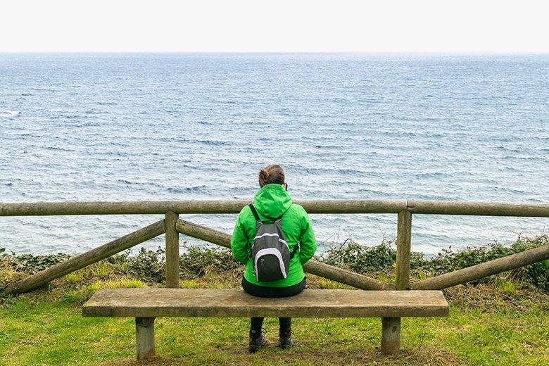
We will walk along the edge of the cliff, and shortly after we will pass the beach of Pormenande, where there are two more recreational areas, including one with swings!
It's not long now until we reach one of the jewels in the crown of this route: the fishing village of El Porto/Viavélez, a former whaling port located in a picturesque inlet.
But before strolling through its winding, steep streets, you can visit the Palacio de Jardón (or Villa San Jorge), a gigantic Indian house built between 1914 and 1917. Although you'll have to stray a few metres from the path, it's easy to spot it if you're attentive, because it's quite a sight!
You will pass by the old schools, whose construction was financed by the Indianos Eduardo Jardón (yes, the same man who built the palace) and Máximo Santamarina. They date from 1917 and are a mixture of neoclassical and colonial style.
A little further on, after leaving the fishermen's warehouses behind, you will finally have a beautiful view of El Porto/Viavélez, with its photogenic breakwaters guarding the mouth of the port.

Just before entering the village, on the right hand side, is the viewpoint of La Atalaya, with a picnic table that is perfect for eating. From there you can imagine the hustle and bustle that this welcoming village, bathed by the waters of the river Vío and the Cantabrian Sea, must have had years ago.
El Porto/Viavélez can also boast of having seen the birth of one of the most illustrious Franquinas, the writer Corín Tellado (1927-2009). In fact, as could not be otherwise, even the street where her house is located bears her name.
To continue along the route you will have to cross the village from one end to the other, bordering the entire inlet, until you reach a steep slope that climbs up to a viewpoint. There you will find the sculpture "Litoral", also by Ernesto Knorr, which reflects the fighting character of this town and its inhabitants.
About 1.2 kilometres from there, you will see a small turn-off to the right along a narrow canal. You can walk along it for a few metres if you feel like it, and then retrace your steps. It is well worth it, and if you are with dogs, it is perfect for them to take a dip.
Shortly after, a small stretch of asphalt begins, which runs through the surroundings of the village of San Pelayo. We will pass by the hermitage of San Pelayo, marked with the characteristic cross of Santiago, which indicates that the coastal Pilgrims' Route to Santiago de Compostela runs through here.
One of the most surprising spots on the Castello-Porcía coastal path is the one that runs around the beaches of Monellos and Torbas. You really have to go a little off the main route (300 metres or so) to enjoy this bucolic spot dominated by the Ribeira de Torbas mill.


Although to follow the official route we would have to retrace our steps, there is also the possibility of skirting the coast in a westerly direction until we reach Cabo Blanco. It is a short stretch but well worth it for the beauty of the landscape, so rugged and fierce.
However, if we take a shortcut there, we would miss a beautiful walk that leads us, among eucalyptus trees, towards Valdepares. This path skirts the wall with crenellated towers of the Casa del Cerradín, and then takes us to the road, where you can turn off to the left a few metres to visit the exterior of the Palace of Fonfría (16th century).

The path continues to the right in the direction of the cemetery, and it is precisely from here that another of the most beautiful stretches of the Castello-Porcía coastal path begins, the one that runs around Cabo Blanco.
It must be said that, whether you decide to walk along the coast or to go as far as the palace, you will have made the right choice because both options are well worth the walk.
The tip of Cabo Blanco is home to the remains of a hillfort that was inhabited during the 1st-2nd centuries AD. Although the latest research has revealed that it may have been occupied even earlier, from the 8th-6th centuries BC.
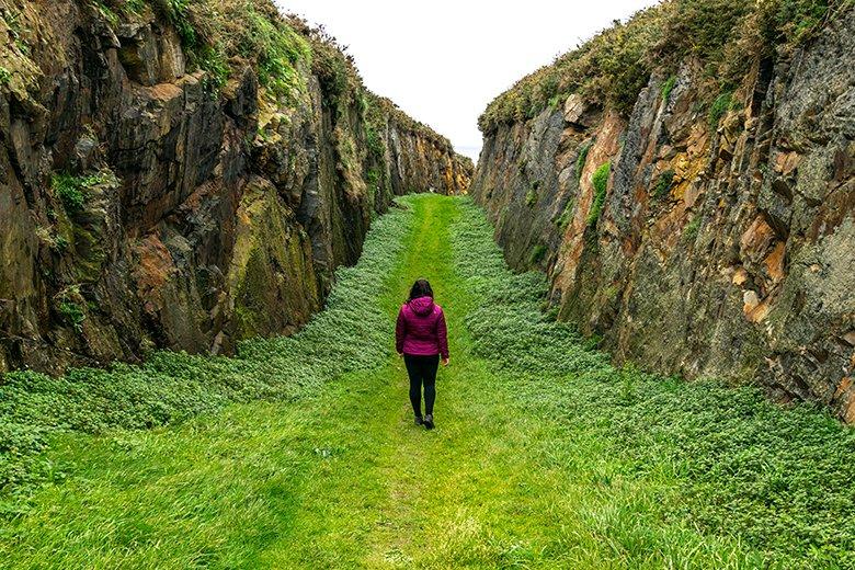

The castro occupied the small peninsula of the cape and extended inland. In the highest parts it was up to 4 metres high and had several moats. One of them is very striking, and can easily be seen as a scar that marks the separation between the mainland and the beginning of the cape.
Very close by, if we continue along the path, we will reach a viewpoint overlooking the western part of the castro. If we walk a little further, we reach the Talaya viewpoint, on the point of the same name.
Both balconies overlooking the Cantabrian Sea are perfect for watching birds such as seagulls and cormorants. Also some migratory birds, and even cetaceans if you are patient enough!
And yes, it is all about viewpoints around here, as just before we start to descend the last stretch of the route, we will come across the viewpoint of Porcía beach.
From here you can still see, on the cliffs that border it, the remains of an old iron ore wharf. In fact, in 1929 a Dutch cargo ship (the Valkenburg) wrecked off this beach, with more than 3,000 tonnes of iron ore on board.
This is precisely where the legend of "A pedra imán" comes from, which is said to attract electrical discharges during storms. Right? Myth? Just in case, if I were you, I would stay away from Porcía beach on stormy days...
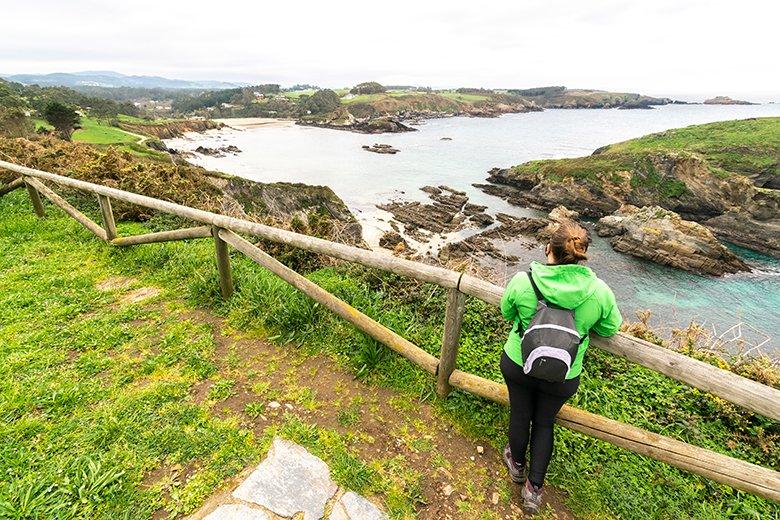
The estuary of Porcía beach marks not only the boundary between the municipalities of El Franco and Tapia de Casariego, but also the end of our route.
If you have chosen to do it both ways, you will only have to retrace your steps. But wait. Before heading back to the car park or resuming your walk, give yourself a break and enjoy the views and the surroundings for a while longer. Because you have before you one of the most beautiful stretches of coastline in the whole of Asturias.
Subscribe to our newsletter and take advantage of offers, discounts, and news
Subscribe

