Oneta Waterfalls

- Oneta Western Asturias
- Distance: 3 kms
- Difficulty: Very easy
- Cumulative difference in altitude: +104 m
- Cumulative difference in altitude: -104 m
- Maximum altitude: 310 m
- Minimum altitude: 210 m
- IBP index: 22
- Modality: Families
- Type of route: Round trip
- Route type: With waterfall
- Return by Train: No
The route is ideal for those looking for a simple walk in the middle of nature, enjoying the calm and the constant murmur of the water in a privileged environment.
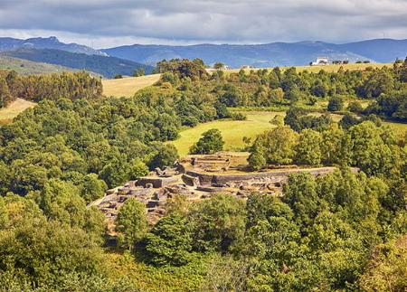
The route starts in the small village of Oneta, located in the council of Villayón, famous for its waterfalls and natural surroundings. From the centre of the village, the route heads south, passing by the Hermitage of Santa María de Oneta and the hostel, until it reaches a crossroads where a signpost indicates the start of the route. The first section is a wide track that runs between "praos" (meadows), where you can see "hórreos" (raised granaries) and stone houses typical of the area.
As you go on, the path narrows and begins to descend towards the river Oneta. The sound of the water becomes more and more present, while the surroundings become more sombre, protected by a canopy of ash, oak, alder and chestnut trees. After a few minutes, the path crosses a small wooden bridge and leaves on the left the remains of the old Abajo mill, which once used the power of water to grind grain.
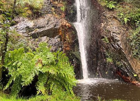
The first waterfall that appears on the route is La Firbia, a spectacular 38-metre waterfall that descends down a rock wall covered with moss. From the natural viewpoint, you can see how the water falls forcefully into a pool of crystal-clear water, surrounded by lush vegetation. This first waterfall is the best known and most visited of the three that make up the complex.
Continuing along the same path, the path follows the course of the river and heads towards the second waterfall, known as Ulloa. To reach it, it is necessary to go back a little way to the crossroads and take the path that runs alongside the river. On this route, you cross a small stone bridge and skirt the ruins of the Casa Real mill, whose structure still conserves part of the original machinery.
The Ulloa waterfall, although less high than the Firbia, has a special attraction due to its more isolated location and its curtain-shaped fall that pours the water into a quiet pool. Access to this waterfall is somewhat more complicated, as the path becomes narrower and requires more attention, which adds an element of adventure to the route. However, the effort is rewarded when you reach this second waterfall, where the sound of the water and the natural surroundings create an atmosphere of calm and serenity.
Although there is a third waterfall known as Maseirúa, it is not currently accessible.
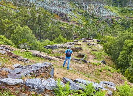
Along the route you can see various elements of the local ethnographic heritage, such as the traditional mills that used to use the power of the river to grind cereal, and small abandoned farming areas that reflect the traditional way of life in the area.
This short but intense route combines the beauty of the waterfalls with the historical interest of the hydraulic infrastructures that once sustained the region's economy. It is ideal for those looking for a simple walk in the heart of nature, enjoying the calm and the constant murmur of the water in a privileged setting.
- Own signage
Basic tips before heading out into the mountains
- If you’re taking a dog with you , always keep it on a lead.
- Avoid approaching livestock.
- If you come across mastiffs guarding livestock, do not approach them, stroke them or feed them. Do not allow them to follow you or stray from their herd. They are working.
- Leave no trace. Pick up all your rubbish, including organic waste. Nature is not a rubbish tip.
- Be sensible. Plan your route carefully, take everything you need and make sure it’s suitable for your fitness level.
 Further recommendations for planning your route
- Please note: The route description is for guidance only and reflects the conditions of the route at the time of writing. The condition of the paths, their accessibility and signposting may vary over time due to natural causes, maintenance work, access restrictions or other circumstances. Before setting off, it is advisable to check the current conditions of the route, consult the weather forecast and assess whether it is suitable for each person’s experience and physical fitness.