Megaliths of Padrún

- Bo, Bustiyé Central Asturias
- Distance: 15.3 kms
- Difficulty: Difficult
- Cumulative difference in altitude: +825 m
- Cumulative difference in altitude: --825 m
- Maximum altitude: 1209 m
- Minimum altitude: 416 m
- IBP index: 80
- Modality: Mountaineers
- Type of route: Circular
- Route type: Mountain
- Return by Train: No
The route (PR-AS 266) crosses old mining roads, beech and chestnut groves, and follows sections of the historic Carisa Way. An ideal route for discovering the oldest traces of mankind in Aller, in a natural mid-mountain environment of great scenic and cultural value.
The route to the Megaliths of El Padrún, also known as Cantu les Cruces, is a circular mid-mountain route that allows you to discover one of the oldest vestiges of human presence in Asturias. Located on the border between the councils of Aller and Lena, this route offers a unique combination of archaeological heritage, natural landscape and mining past.
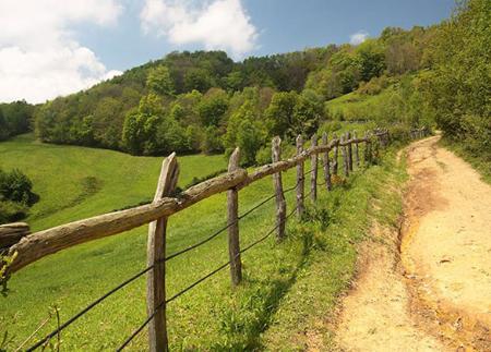
The route begins in the town of Bo (Boo), in the council of Aller, where there is a large square that serves as a starting point. From there, take a local road that leads to the nearby village of Bustiyé, passing by a traditional fountain and washing place. After leaving the urban area, climb up a track flanked by chestnut woods and follow the waymarks of the signposted path, which are easy to follow for most of the route.
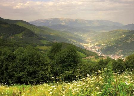
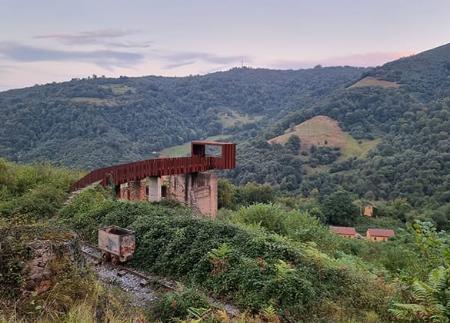
The path continues steadily uphill along the Quentu Marianes, an old enclave linked to mountain mining operations, still visible in some of the surrounding dumps. As you gain altitude, you can enjoy views of the Aller valley and outstanding features such as the small castle of Pozo Santiago. The landscape changes when you reach the beech forest of El Faillín, a setting of centenary trees that provide shade and a cooler and more humid atmosphere to the route.
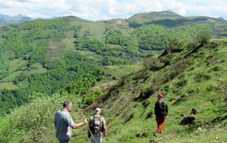
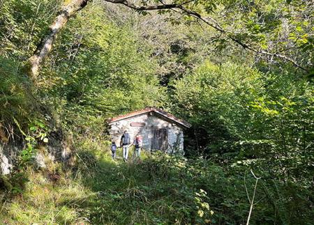
After crossing the forest, you reach Otos, an area of meadows and livestock huts, many of which have been restored. The path continues to La Carrera, where the track makes several zigzag bends to overcome the slope and reach Quentu les Cruces, a point of connection of several historical paths, including that of the Via Carisa, an ancient Roman road.
From this pass, take a detour towards the necropolis of El Padrún, located at an altitude of 1,195 metres. In this mountainous enclave are the remains of three megalithic dolmens from the Neolithic period - although only two remain today - dating from around 4000 BC. The megaliths of El Padrún are the oldest documented vestige of human presence in the council of Aller and are a valuable testimony to prehistoric culture in the centre of Asturias.
After visiting the dolmens, the path returns to the Carisa Way for a stretch and descends through the Espines sheepfold, where there is a fountain and a viewpoint with interpretative signposting that allows you to identify the nearby peaks. The descent continues along a wide track, from where there are new views of the Caudal and Aller valleys.
At the final part of the route, leave the track to take a signposted detour towards Bo, crossing an area of centenary chestnut woods, some of them with the remains of traditional corrals for collecting chestnuts. The path crosses wetter sections, with some mud, and ends in the upper part of the village (Puenxo area), from where it returns to the starting point.
This route is ideal for walkers interested in archaeology, mining history, mid-mountain landscapes and native forests. Of medium difficulty and with good signposts, it is especially attractive in autumn, when the beech and chestnut woods show their best colours.
PR-AS-266
Basic tips before going into the mountains
- If you go with a dog, always keep it on a leash.
- Avoid approaching livestock.
- If you find mastiffs protecting livestock, do not approach them, do not pet them and do not feed them. Do not allow them to follow you or stray from their herd. They are working.
- Don't leave a trail. Collect all your waste, including organic waste. Nature is not a dumping ground.
- Act with prudence. Plan your route well, take everything you need and make sure it is adapted to your physical capacity.