Mina Carmina - San Martín de Oscos route

- Samartin Western Asturias
- Distance: 9.5 kms
- Difficulty: Moderate
- Cumulative difference in altitude: +411 m
- Cumulative difference in altitude: -411 m
- Maximum altitude: 863 m
- Minimum altitude: 617 m
- IBP index: 47
- Modality: Hikers
- Type of route: Circular
- Route type: Mountain
- Return by Train: No
A walk that combines industrial and landscape heritage, ideal for discovering the mining footprint of the Oscos in the middle of nature. All this in a unique setting: the Río Eo, Oscos e Terras do Burón Biosphere Reserve.
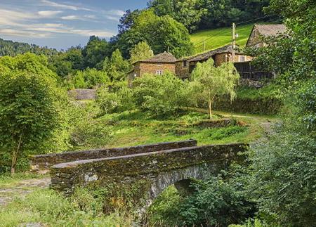
The route begins at the parish church of Samartín (built in 1828), next to which are the hórreo of Casa Curón, with its characteristic slate and thatched roof, and the palace of the Guzmanes, a stately 18th century building belonging to the Rubiera Quindós estate. After its remodelling in the 1990s, it became home to various municipal services, including the Town Hall. Its entrance portico crowned by a coat of arms and its entrance with a baroque coat of arms are outstanding.
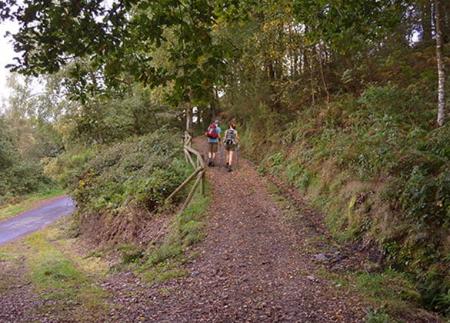
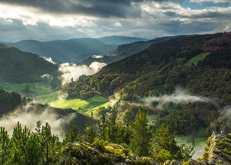
From the square, the path leaves behind the stretches of road and crosses the bridge over the river San Martín, and then ascends the slope of Mount Marón. As we gain altitude, the path winds through birch and oak woods, offering ever wider views of the surrounding area. A little over a kilometre and a half from the start, a detour takes us to the geodesic point of Mount Marón, from where we can enjoy spectacular panoramic views of the municipalities of San Martín de Oscos, Santa Eulalia de Oscos, Illano, Grandas de Salime, Pesoz and A Fonsagrada (Lugo).
On the way back to the crossroads, the path enters a pine forest, with narrow, rocky stretches that require extreme caution, until we reach the Carmina Mine, exploited in the 1950s and 1960s for the extraction of silver, zinc and lead.
The return to Samartín takes us in the direction of Vilarín de Tresmonte, where we find the hermitage of Santa Engracia, located on a detour towards the village. After the visit, the path begins a gentle descent through woods and meadows, allowing us to enjoy beautiful panoramic views before returning to the starting point.
This route combines nature, history and tradition in an accessible and charming route, ideal for all types of walkers.
- It runs through the Biosphere Reserve Río Eo, Oscos e Terras do Burón.
- PR-AS 280
- Road sections
- Narrow and stony path in the vicinity of Mina Carmina.
Basic tips before going into the mountains
- If you go with a dog, always keep it on a leash.
- Avoid approaching livestock.
- If you find mastiffs protecting livestock, do not approach them, do not pet them and do not feed them. Do not allow them to follow you or stray from their herd. They are working.
- Don't leave a trail. Collect all your waste, including organic waste. Nature is not a dumping ground.
- Act with prudence. Plan your route well, take everything you need and make sure it is adapted to your physical capacity.