Mofrechu Peak

- Distance: 8.384 kms
- Difficulty: Difficult
- Cumulative difference in altitude: +649 m
- Cumulative difference in altitude: -649 m
- Maximum altitude: 879 m
- Minimum altitude: 447 m
- IBP index: 73
- Modality: Hikers
- Type of route: Round trip
- Route type: Mountain
- Return by Train: No
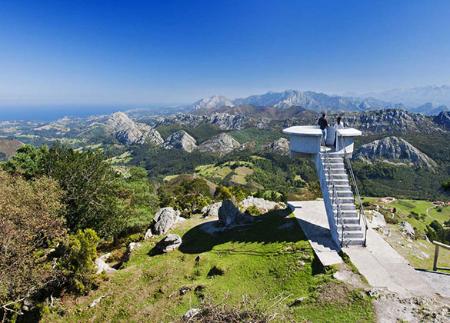
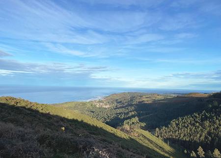
From the summit, the views take in Ribadesella, the Cantabrian Sea and the Picos de Europa. A simple but panoramic route that allows you to enjoy the serenity of the Asturian landscape and its privileged natural environment.
The route to Pico Mofrechu starts at Alto Collado Tresllende, an accessible point between the villages of Ixena and Rinsena. From here, the route follows an asphalted track that, as it ascends, increases the panoramic views of the surrounding area. To the left, Ixena can be seen, and to the right, Rinsena, with the Cantabrian Mountains and Las Ubiñas standing out on the horizon. This initial section offers a first contact with the immensity of the landscape, inviting you to pause and enjoy it.
The path continues to climb moderately until it reaches Majada Hueses, a perfect place to take a break before tackling the last part of the climb. From here, the presence of Pico Mofrechu becomes more evident and the path continues between scattered huts, witnesses of rural life in the Asturian mountains.
The route reaches Vegamayor, where there is a commemorative plaque in honour of a mountain ranger who died in an accident at work, a reminder of the challenge and dedication involved in working in these surroundings. From this point onwards, the slope intensifies and the path becomes a trail, with multiple paths that converge at the summit. This area is covered with mountain scrub and the paths are narrow, so long trousers are recommended for comfort.
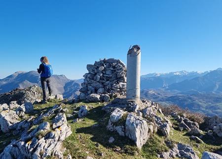
On reaching the summit of Pico Mofrechu (891 m), the effort is rewarded with a breathtaking panoramic view: to the north, the Cantabrian Sea and Ribadesella/Ribeseya, and to the south, the majesty of the Picos de Europa. It is an ideal place to stop, rest and absorb the serenity of the landscape.
The descent follows the same path, allowing you to rediscover the views from a new perspective. Returning to Collado Tresllende concludes a route that not only represents a moderate physical challenge, but also an opportunity to connect with nature and the Asturian mountain tradition. The route to Pico Mofrechu leaves a lasting impression on the memory due to its beauty, accessibility and incomparable views.
Basic tips before going into the mountains
- If you go with a dog, always keep it on a leash.
- Avoid approaching livestock.
- If you find mastiffs protecting livestock, do not approach them, do not pet them and do not feed them. Do not allow them to follow you or stray from their herd. They are working.
- Don't leave a trail. Collect all your waste, including organic waste. Nature is not a dumping ground.
- Act with prudence. Plan your route well, take everything you need and make sure it is adapted to your physical capacity.