Pienzu Peak

- Distance: 11.73 kms
- Difficulty: Difficult
- Cumulative difference in altitude: +700 m
- Cumulative difference in altitude: -700 m
- Maximum altitude: 1145 m
- Minimum altitude: 577 m
- IBP index: 67
- Modality: Hikers
- Type of route: Round trip
- Route type: Mountain
- Return by Train: No
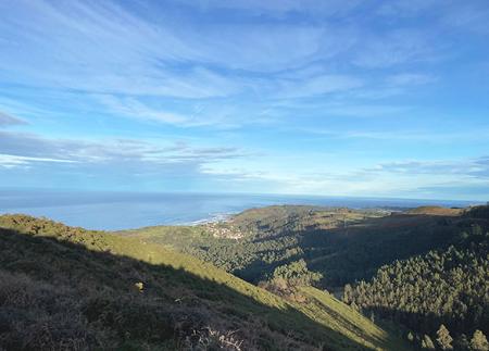
From the cross of the peak, on clear days, you can see more than 200 km of coastline and a good part of the Asturian interior. An accessible and spectacular route.
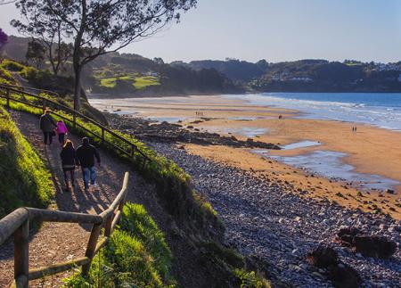
The Pico Pienzu Route is one of the most emblematic of Asturian hiking, both for the accessibility of its route and the spectacular views. It starts from the El Fitu viewpoint, located at an altitude of 597 metres, one of the most impressive scenic balconies in the north of the peninsula. Its elevated, saucer-shaped structure - popularly known as the cazu - affords a 360º panoramic view from the Cantabrian coast, with towns such as Ribadesella/Ribeseya and Caravia L'Alta/Prado, to the mountainous interior, with views of the Ponga Nature Reserve, the Sueve Reserve and the Picos de Europa National Park.
This emblematic viewpoint, inaugurated in 1927 thanks to a citizens' initiative and donations from all over the Principality, is located on an old Roman road, which reinforces its value as a natural and cultural connection point between territories.
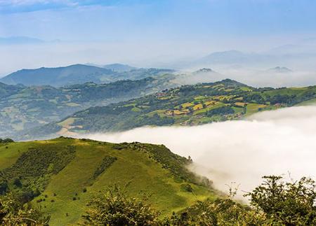
From there, the route begins by crossing the road and taking a path that starts with a flat stretch of about two kilometres between mountain pastures, from which you can see both the sea and the inland valleys. As you gain altitude, the terrain becomes rockier, with limestone formations and high mountain vegetation. It is common to see vultures, choughs, choughs, choughs and fallow deer, the fauna symbol of the Sierra del Sueve.
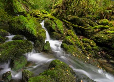
One of the milestones on the route is the Majada de Bustacu, at an altitude of 670 metres, where stone huts are preserved in an old shepherd's settlement. From there, the ascent becomes steeper until you reach the Mergullines spring, surrounded by hawthorn trees, an ideal place to take a break and replenish water before the last stretch.
The final climb, steeper and more technical, culminates at the summit of Pico Pienzu (1,161 m), crowned by a cross. From here, on clear days, the effort is rewarded with one of the most extensive views in Asturias: more than 200 kilometres of coastline, the Picos de Europa, the Sierra del Aramo and even part of the Cantabrian coast.
The return journey follows the same route, allowing you to relive the rich landscape from a different perspective. It is an ideal route for those looking for a complete mountain experience, with a changing landscape, biodiversity, history and views that will remain engraved in your memory.
- It runs through the Sierra del Sueve SAC of the Natura 2000 Network.
- PR-AS 071
Basic tips before going into the mountains
- If you go with a dog, always keep it on a leash.
- Avoid approaching livestock.
- If you find mastiffs protecting livestock, do not approach them, do not pet them and do not feed them. Do not allow them to follow you or stray from their herd. They are working.
- Don't leave a trail. Collect all your waste, including organic waste. Nature is not a dumping ground.
- Act with prudence. Plan your route well, take everything you need and make sure it is adapted to your physical capacity.