La Múa Peak

- Distance: 13.8 kms
- Difficulty: Very difficult
- Cumulative difference in altitude: +835 m
- Cumulative difference in altitude: -835 m
- Maximum altitude: 979 m
- Minimum altitude: 220 m
- IBP index: 93
- Modality: Mountaineers
- Type of route: Circular
- Route type: Mountain
- Return by Train: No
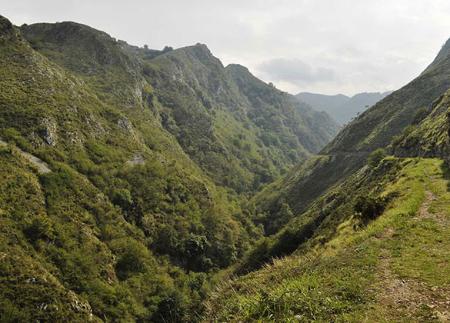
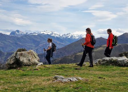
The route to Pico La Múa (PR-AS 46) starts in Frainoquiso and climbs progressively through pine woods and meadows, offering views of the valley of Cuerrias and the plain of Nava. From the summit, one of the best vantage points in the centre of Asturias, you can see emblematic peaks such as Peña Santa, Pico Vizcares and Tiatordos. The circular return route passes through brañas, beech forests and allows you to see the impressive Foces del Río Pendón.
The Route to Pico La Múa is a circular route through the council of Nava that combines pine forests, panoramic crests and traditional "brañas". The route begins in Frainoquiso, from where a concrete track climbs gently up to the village of Cueva Alta. From there, the path begins to gain height rapidly, entering a leafy pine forest.
The path continues along the watershed, giving the walker magnificent views of the Cuerrias valley on one side and the Nava plain on the other. On clear days, the Picos de Europa can be seen, with the Peña Santa de Castilla standing out on the horizon. After crossing hills and ridges, we reach Collado La Verde, a natural pass towards the Pendón River, from where we can already glimpse the summit of Pico La Múa to the south.
To complete the ascent, take a path to the left that runs along a stretch of hill where there is even a seasonal pond, before reaching the summit. From the summit of Pico La Múa, one of the best natural vantage points in the centre of Asturias, the panoramic view is impressive: the Picos de Europa, Vizcares, Tiatordos, Sierra del Sueve, Cordal de Peón or Sierra de Peñamayor, together with wide views over the councils of Nava, Piloña, Siero and Sariego.
The return descends again to Collado La Verde, where we take a path that is not very well marked between heaths that descends steeply down to the Brañabernes huts, where there is still a traditional hut and a watering place for livestock. The path continues between meadows bordered by stone walls and a beautiful beech forest, until it reaches the hamlet of Casielles. From here, there are unbeatable views of the Foces del Río Pendón, a narrow gorge that channels the waters towards the Piloña.
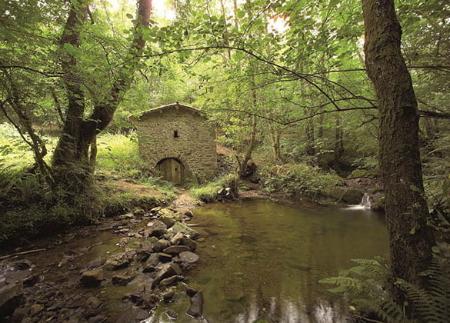
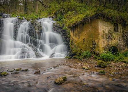
The final section runs along a forest track and connects with the road at the Molín de Frainoquiso, one of the best preserved in the council, thus closing an itinerary that combines nature, tradition and spectacular scenery.
- PR-AS 46
Basic tips before going into the mountains
- If you go with a dog, always keep it on a leash.
- Avoid approaching livestock.
- If you find mastiffs protecting livestock, do not approach them, do not pet them and do not feed them. Do not allow them to follow you or stray from their herd. They are working.
- Don't leave a trail. Collect all your waste, including organic waste. Nature is not a dumping ground.
- Act with prudence. Plan your route well, take everything you need and make sure it is adapted to your physical capacity.