Path of Valdesoto

- Valdesoto Central Asturias
- Distance: 14.5 kms
- Difficulty: Moderate
- Cumulative difference in altitude: +468 m
- Cumulative difference in altitude: -468 m
- Maximum altitude: 355 m
- Minimum altitude: 206 m
- IBP index: 52
- Modality: Hikers
- Type of route: Circular
- Route type: Mountain
- Return by Train: No
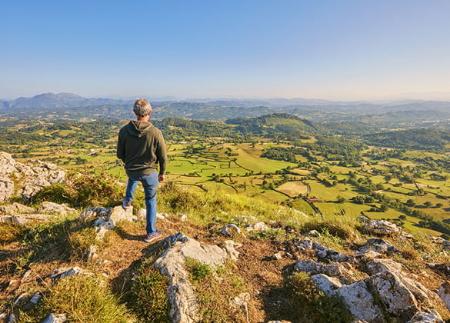
Along the route you will discover viewpoints, chapels, palaces and places with history, such as the station of Adiós Cordera. A complete walk through the rural heart of Siero, ideal for enjoying the landscape, the heritage and the essence of Asturias.
The Senda de Valdesoto is a circular route that allows you to get to know in depth this parish in the council of Siero, combining rural paths, forests, traditional architecture and places full of history.
The route begins next to the parish church of San Félix, from where it descends gently towards the neighbourhood of La Rotella, crossing typical farmhouses and linking up with the SI-16 road, which is followed briefly to visit two fountains of ethnographic interest: the La Riera fountain, hidden among the vegetation, and the Cabricán fountain, which was respected even during the construction of the road due to its age.
Shortly after, we cross a small tunnel under the FEVE tracks and reach the halt at Les Llamargues. From here, the path enters wooded areas and ascends towards Pando, passing through chestnut and oak woods. From El Pinalón, a detour allows us to see Mount Fayes. Further on, you reach Corripos, where the chapel of San José and a fountain stand out, as well as splendid views of Valdesoto, Peña Careses and Picu Fariu.
The path then descends to the Carbonera road (AS-246), next to the Charca, in the area around La Bolera, from where it takes a path down to the Los Bayos river, in a shady and damp environment. Next, a steep climb leads to the hamlet of Tablao, the furthest point in the parish. From here, it is advisable to take a detour to observe a group of traditional bread baskets and a centenary yew tree.
The Senda de Valdesoto is a circular route that allows you to get to know this parish of the council of Siero in depth, combining rural paths, forests, traditional architecture and corners full of history.
The route begins next to the parish church of San Félix, from where it descends gently towards the neighbourhood of La Rotella, crossing typical farmhouses and linking up with the SI-16 road, which is followed briefly to visit two fountains of ethnographic interest: the La Riera fountain, hidden among the vegetation, and the Cabricán fountain, which was respected even during the construction of the road due to its age.
Shortly after, we cross a small tunnel under the FEVE tracks and reach the halt at Les Llamargues. From here, the path enters wooded areas and ascends towards Pando, passing through chestnut and oak woods. From El Pinalón, a detour allows us to see Mount Fayes. Further on, you reach Corripos, where the chapel of San José and a fountain stand out, as well as splendid views of Valdesoto, Peña Careses and Picu Fariu.
The path then descends to the Carbonera road (AS-246), next to the Charca, in the area around La Bolera, from where it takes a path down to the Los Bayos river, in a shady and damp environment. Next, a steep climb leads to the hamlet of Tablao, the furthest point in the parish. From here, it is advisable to take a detour to observe a group of traditional bread baskets and a centenary yew tree.
The route continues descending to the Los Caballeros path, which leads to Bendición, where the train station is located, remembered for having been the setting for the film Adiós Cordera (Goodbye Lamb). Here you can also visit the washing place and the Posagra fountain. It then crosses the Laspra neighbourhood, where a path leads to the fountain of the same name and then goes into the mountains towards Tiroco, among oak, birch, chestnut and eucalyptus trees.
In Tiroco de Arriba, the palace with its chapel and panera, a recreational area and several well-preserved hórreos (raised granaries) stand out. Further on, in Tiroco de Abajo, you can visit another palace that has now been converted into a residence for the elderly, and paneras, which are also in good condition. After crossing a stream over a wooden bridge, we reach the Fuente La Malata fountain.
The path continues through lush vegetation towards La Piniella, where the Cobián Palace and its chapel can be found. Shortly after, the route enters Fayes, one of the most populated villages in Valdesoto. Here you can visit the La Riega fountain, the chapel of Santo Toribio, and Villa Cecilia, a house more than 400 years old. You will also pass by the old schools, which are now in use, the doctor's surgery and the pharmacy.
- PR-AS 202
- This route coincides in a minor section with the GR-105.
Basic tips before going into the mountains
- If you go with a dog, always keep it on a leash.
- Avoid approaching livestock.
- If you find mastiffs protecting livestock, do not approach them, do not pet them and do not feed them. Do not allow them to follow you or stray from their herd. They are working.
- Don't leave a trail. Collect all your waste, including organic waste. Nature is not a dumping ground.
- Act with prudence. Plan your route well, take everything you need and make sure it is adapted to your physical capacity.