Water Trail

- Molleda, Sotu Central Asturias
- Distance: 23.9 kms
- Difficulty: Difficult
- Cumulative difference in altitude: +413 m
- Cumulative difference in altitude: -4233 m
- Maximum altitude: 169 m
- Minimum altitude: 34 m
- IBP index: 67
Inaugurated in 1965 and considered at the time the most advanced hydraulic complex in Europe, this 30 km canal supplies the Trasona reservoir and crosses a rural landscape where engineering, nature and tradition are combined.
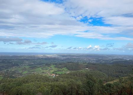
The Water Trail begins in Molleda, in front of the old school building, which today houses the Water Trail Interpretation Centre. From here, the route enters a rural setting typical of the inland valleys of central Asturias, alternating meadows, crops, riverside woods and masses of carob and chestnut trees. Along the route, the Narcea canal accompanies a large part of the route, appearing and disappearing between hills, tunnels and small bridges that cross the canal at different points.
This hydraulic infrastructure, inaugurated in 1965 and considered at the time the most advanced complex in Europe, supplied the Trasona reservoir and stands out for its technical and historical value. Along the route, you can observe stretches where the water flows visibly through the canal, with mallards swimming, and others where the water flows underground or across aqueducts.
The path crosses small rural villages such as La Laguna or El Cuadro, where we find the Piarnu recreational area and the Church of San Cipriano, combining elements of pre-Romanesque architecture with 20th century neo-Romanesque tendencies. Also of note are the hórreos and paneras decorated with traditional motifs, characteristic of this central area of Asturias, as well as some restored wash houses, vestiges of the communal use of water before the arrival of washing machines.
One of the highlights of the route is the Castañalona aqueduct, the largest of all those forming part of the canal, which is impressive for its height and its integration into the landscape. The path also crosses urban centres such as La Corrada, where you can visit the Church of San Lorenzo and the Chapel of San Ildefonso. Near the end, we find the Virgen de los Desamparados Chapel and an old washing place next to it, with the option of taking a detour to see the Palace of the Marquises of Ferreras.
The last section crosses the villages of La Teyera and Riberas, in Soto del Barco, before concluding the route. This route, ideal for families, can be divided into two stages due to its length.
This trail provides an insight into the history of water in Asturias, enjoying a unique natural and cultural environment, where landscape, hydraulic engineering and rural tradition are intertwined in a route full of diversity and charm.
- PR-AS 049
- One way only.
- It is possible to return by public transport.
Basic tips before going into the mountains
- If you go with a dog, always keep it on a leash.
- Avoid approaching livestock.
- If you find mastiffs protecting livestock, do not approach them, do not pet them and do not feed them. Do not allow them to follow you or stray from their herd. They are working.
- Don't leave a trail. Collect all your waste, including organic waste. Nature is not a dumping ground.
- Act with prudence. Plan your route well, take everything you need and make sure it is adapted to your physical capacity.