North Coast Path: Beach of Arnao-L'Arena

- Arnao, L'Arena Central Asturias
- Distance: 15 kms
- Difficulty: Moderate
- Cumulative difference in altitude: +379 m
- Cumulative difference in altitude: -389 m
- Maximum altitude: 114 m
- Minimum altitude: 0 m
- IBP index: 58
- Modality: Hikers
- Type of route: Crossing
- Route type: Coast
- Return by Train: No
Along this route, which runs through the Cabo Busto-Luanco SAC of the Natura 2000 Network, old mining elements are visited, such as the Castillete de la Mina de Arnao, and natural viewpoints over cliffs, beaches and dune systems, ending next to the San Esteban estuary in an environment of great value.
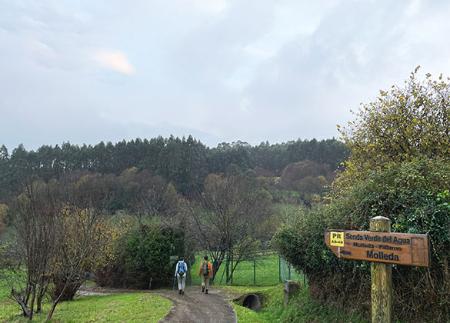
The start is at the eastern end of Arnao beach, in the council of Castrillón. From here, the path crosses the beach in a westerly direction until it reaches the Arnao Mine Museum and the Castillete de la Mina de Arnao, the first vertical coal shaft in Asturias, today converted into an interpretation centre of the area's industrial past. After this first stop, the path begins a gentle ascent towards the Las Arribas viewpoint, offering the first open views of the Cantabrian Sea.
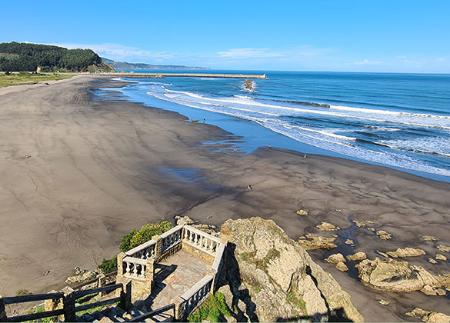
Next, the path reaches the La Ladrona viewpoint, from where you can see the island of the same name and a wide stretch of coastline. From here, the route descends towards the town of Santa María del Mar/El Puertu, where you walk along its beach, one of the most popular in the council, equipped with rest areas and services.
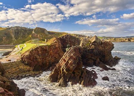
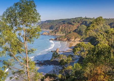
Following the coastline, you reach the Punta El Escayo viewpoint, with views of rock formations shaped by marine erosion. Further on, there is a succession of beaches such as Bahinas, Munielles and El Cordial, until you reach the Deva viewpoint. From this point, the view of the island of La Deva, an area declared a Natural Monument, and the Playón de Bayas, with its protected dune system, reinforce the environmental value of the surroundings.
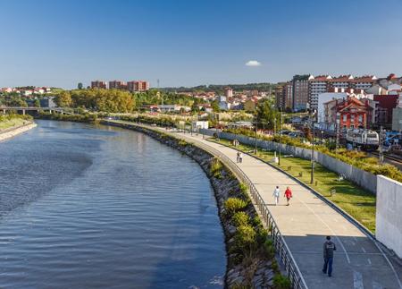
Continuing along the route, the path leads to the Bayas or Racionera viewpoint, which offers another perspective of the Bayas beach and its natural surroundings. From here we continue along the path down to the Bayas beach, along which we move westwards to the Los Quebrantos viewpoint, from where we can see the beach of the same name and the San Esteban estuary. The path continues along the estuary until it reaches the Prau de la Rula park, in L'Arena, where the route ends next to the marina.
This itinerary is ideal for those looking for a complete experience by the sea, combining history, geology, nature and spectacular views in a unique coastal setting.
- It runs partially through the Cabo Busto-Luanco SAC of the Natura 2000 Network.
- The route partially coincides with the GR-204.
Basic tips before going into the mountains
- If you go with a dog, always keep it on a leash.
- Avoid approaching livestock.
- If you find mastiffs protecting livestock, do not approach them, do not pet them and do not feed them. Do not allow them to follow you or stray from their herd. They are working.
- Don't leave a trail. Collect all your waste, including organic waste. Nature is not a dumping ground.
- Act with prudence. Plan your route well, take everything you need and make sure it is adapted to your physical capacity.