El Camín Encantáu
- Dirección Llanes Oriente de Asturias
- Distancia Distancia: 8,6 kms
- Dificultad Dificultad: Baja
- Altitud Altitud: 228 m.
- Desnivel Desnivel: 238 m.
- A pie A pie: 3 h.
- Punto de partida Punto de partida: La Venta los Probes
- Tipo de ruta Tipo de ruta: Senderismo
- Tipo de recorrido Tipo de recorrido: Circular
- Trazado de la ruta Trazado de la ruta: Descargar kml
Información
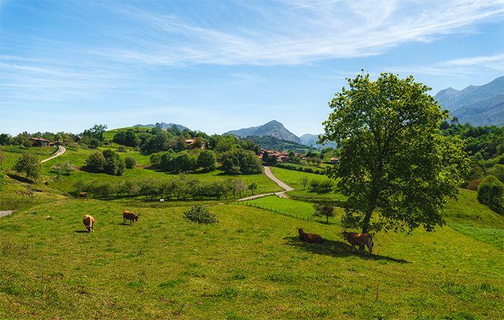
El Camín Encantáu, en el concejo de Llanes, es una ruta diferente. En realidad os resultará un viaje de leyenda por la mitología asturiana, donde abundantes cuentos e historias fantásticas han llegado hasta nuestros días.
Se trata de un paseo a través del tiempo en el que la imaginación y el respeto por el medio ambiente se dan la mano, y donde comprobaréis que los cuélebres, xanas o trasgos de alguna manera existen…
Recorrido
La Venta los Probes - La Venta los Probes 9
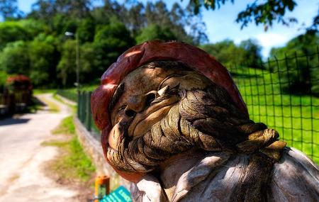
El sendero se inicia en la localidad de la Venta los Probes (Llanes) junto al bar y la bolera donde podemos contemplar las dos primeras de las múltiples tallas de madera que salpican el camino.
Cogemos la carretera a los Callejos y, un poco antes de cruzar el río giramos a la izquierda, caminando junto al río San Miguel. Al llegar a un cruce se gira a la izquierda y tras cruzar la carretera cogemos una pista que sube a Gomezán, donde nos recibe el Sumiciu, el duende asociado a la desaparición de objetos.
Después de pasar el pueblo la pista se convierte en una senda y se introduce en un bello bosque que nos conduce a la localidad de La Malatería donde nos recibe "El hombre del saco", personaje del folclore infantil.
Después de ver la iglesia y el pueblo se llega a la carretera por la que discurrimos hacia la derecha un corto trecho, para coger la segunda pista de la izquierda que se introduce en una zona de pastos, transformándose al poco trecho en sendero, antesala de un bello bosque donde nos recibe el "Pataricu", ser de un solo ojo que vigila a los niños para alimentase de ellos.
Poco después vuelve a ensancharse el camino apareciendo ante nosotros el "Diablo burlón", ser mitológico que se puede transformar en diferentes criaturas como un carnero.
Se continúa por la pista que desciende hacia el pueblo de Villanueva, saliéndonos al paso el "Nuberu", señor de la lluvia y las tormentas, en la antesala del Campu La Prida donde se encuentra la iglesia de Santa Eulalia de Ardisana.
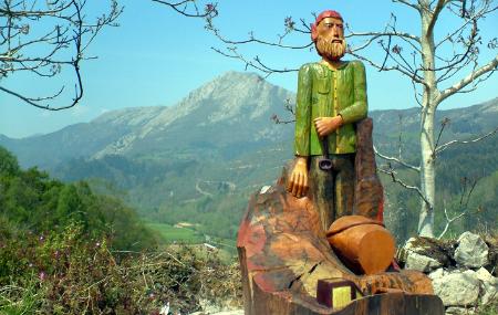
Atravesamos la explanada dejando detrás de nosotros la iglesia para dirigirnos hacia un gran nogal donde sale un camino empedrado que desciende ligeramente, llegando junto a una carretera. Aquí se sigue hacia la izquierda para adentrarnos en el pueblo. Continuamos y a pocos metros torcemos a la derecha y descendiendo por un camino encontramos la Fuente del Cañu y a su vera la figura del "Segador" cabruñando la guadaña.
Nada más pasar sale a la izquierda un camino que nos lleva a Ardisana, donde nos recibe "El Cuélebre", serpiente alada que custodia los tesoros y las princesas, junto a una enorme roca.
Se deja atrás la roca para llegar junto a una carretera donde se continúa hacia la derecha pasando junto a las escuelas. Nada más pasarlas sale a la izquierda un camino empedrado que en descenso se introduce en un bosque. A los pocos metros nos sale un camino a la derecha que continúa el descenso a la vera de un arroyo donde nos sale al paso la talla de la "Lavandera" un personaje bueno y malvado a la vez.
Continuando con el descenso nos encontramos con la Cruz de los Garabiales (año 1.761). Un poco más abajo sale a nuestro paso el "Busgosu", criatura mitad hombre mitad carnero, benefactor y guía a los pastores, ayuda a arreglar las cabañas de las brañas, además de señor de los bosques y protector de flora y fauna que en ellos habita.
Poco después se llega a la carretera a la entrada de Riocaliente donde nos encontramos con la penúltima talla "La Manona o Pesadiellu" mano gigantesca y horrible que perturba todo en una casa. Cruzamos el puente sobre el río San Miguel y nos introducimos en Riocaliente.
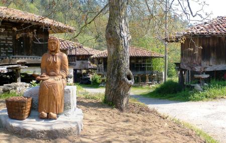
Aquí entre un conjunto de hórreos y a la vera de un enorme castaño nos encontramos con la "Castañera". Volvemos sobre nuestros pasos para regresar a la carretera asfaltada, donde se gira a la izquierda caminando junto al río San Miguel a través de un bello paisaje teniendo al fondo el pico Culobardón de la Sierra de Peña Villa hasta llegar después de 2 km al punto de partida.
Mapa
Itinerario
La Venta los Probes - Gomezán - La Malatería - Villanueva - Palacio - Ardisana - Riocaliente - La Venta los Probes


