Back Ideal routes in Asturias to go with the little ones
The best routes in Asturias to go with the kids
Asturias is a true paradise to enjoy with the family, with many places to choose from where the kids will have a great time.
Asturias is a real paradise to enjoy with the family, and the truth is that the kids have a great time, because there are so many routes, corners and places to enjoy and play, that they can choose, without fear of tiredness or boredom. And among so many options for intelligent and healthy leisure, hiking is one of the most popular. Every day, more and more families are getting into the habit of "getting the bug" of nature and physical exercise into their children, so the sooner they start, the better.
For all these reasons, and because we know that you are often looking for things to do with your children, so that they can be distracted and educated in certain values of sensitivity to the environment, today we would like to suggest some routes that you can take with the children of the house.
From west to east and vice versa, passing through the centre, Asturias offers dozens of trails that will delight the most diverse tastes and circumstances. Let's start our hiking journey!
La Senda de los Molinos de Bimenes, to discover the life of yesteryear.
In the Cider Shire, and more specifically in the heart of the council of Bimenes, you will find the Path of the Mills. In just three kilometres, you will travel to another era, where the subsistence economy marked daily life, and this was closely linked to the richness of the land and the river, with its floods and its fertiliser in the surrounding areas, making corn the basis of the family's diet.
You will be able to see and visit five mills - there is one every half a kilometre or so - and this will show you the importance of this constructive device in the life of yesteryear, which over time has become an element of ethnographic interest. Moreover, the route runs in a pleasant natural environment, in the middle of the forest, next to the river, walking among alders, maples and chestnut trees. If you do the walk calmly and quietly, you might even see some roe deer...

In short, a comfortable route to get in touch with the Asturias of the past, which preserves a natural environment of great purity, in the middle of a valley of lush vegetation, whose panoramic view you can appreciate from the highest part of the route.
The Senda de los Molinos is one of those not-to-be-missed walks in the Cider Shire!
The A Seimeira Route, in Santa Eulalia de Oscos, to enjoy a beautiful waterfall.
The A Semeira route begins in the village of Pumares, right in its recreational area. This village is very characteristic of the area, due to its "ferreira" activity of yesteryear and precisely for this reason you can still contemplate the remains of an old mallet.
From there and following a signposted path, which will leave the river Agüeira on your left, you will begin a slight ascent, to enter a legendary forest populated by riverside species - alders, ashes, willows and hazelnut trees - as well as oaks and chestnut trees.

Most of the path is protected by stone walls covered with moss, and on the ground there is a soft carpet of leaf litter to cushion your steps. When you reach Ancadeira, you will pass by several abandoned buildings that will give you an idea of the importance of this place. The route continues through the magical and solitary "Valle del Desterrado" (Valley of the Banished), which will take you to a crossroads where you will continue straight on until you reach the seimeira (or waterfall in Spanish).
This beautiful waterfall has a drop of approximately 30 metres and is impressive. Nearby, you can also visit the village of Busqueimado, with its chapel dedicated to San Pedro and its two impressive texos (or yew trees in Castilian). And to finish off, after so many surprises
You will start the return journey in the opposite direction!
The Route of the Ferreiros in Taramundi or the approach to an ancestral culture
Taramundi is one of those places that will leave you with unforgettable memories. The proposed hike here is the Ruta de los Ferreiros (Ironmongers' Route). You will leave the village along a well-trodden path towards A Veiga de Llan, where there used to be a mallet and several forges (known as bodegas in this area), and where you can now visit the workshops of two knife-makers. From A Veiga de Llan, and after crossing the river Cabreira, a path through the forest will take you to O Mazonovo, where the Cabreira joins the river Turía. Here you will find the Windmill Museum, whose visit will introduce you to the world of cereal milling and the use of water power to operate the mills and generate electricity.
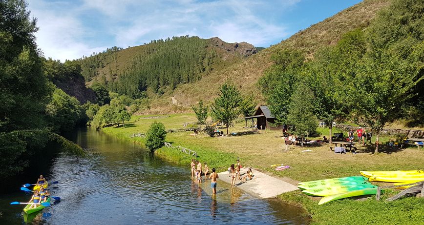
Crossing the Turía, you will leave O Mazonovo along a path that runs through the leafy forest next to the river and will take you to the entrance of A Veiga de Sarza, a village with an interesting history linked to iron working, where there was an old forge, a mallet and numerous iron workers. Nowadays it preserves all the charm of its traditional architecture and has become one of the most beautiful rural tourism centres in the council, which also has a recreational area next to the river, perfect for a well-deserved rest in the middle of the route.

You will continue towards A Garda and Vilanova, and in the latter village you will be able to see two knife craftsmen who keep alive the legacy of their ancestors. Then, through a chestnut forest, you will reach Pardiñas, where the Museum of Cutlery of Taramundi is located, where you can see a live demonstration of how a knife is made, and even learn about the evolution of the work space, from a traditional cellar to a modern workshop.
Leaving Pardiñas, you will face the last stretch of the route, with fantastic views over the valley where the town of Taramundiis located!
El Camín Encantáu in Llanes, to take a bath in mythology
The Camín Encantáu, in the council of Llanes, is a different route. It is a journey through time where imagination and respect for the environment go hand in hand, and where you will see that the cuélebres, xanas and goblins somehow exist...

The route starts in the village of La Venta. From here, following the signposts, you will reach the villages of Comezán, La Maletería, Palaciu, Ardisana and Ricaliente along paths, tracks and, in some sections, local roads. The route begins on the banks of the San Miguel river, which is flat, and then starts to climb the slope up to Comezán, which then becomes smoother in the direction of La Maletería, before moving on to a flat, slightly descending route, which becomes steeper from Ardisana to Ricaliente.
The Pataricu, who keeps watch with just one eye; the Nuberu, king of rain and storms; the Cuélebre, guardian of treasures and princesses; the Busgosu, guardian of the forests and many other beloved characters will help you discover a good part of the nearest and dearest history of the Ardisana valley. The route ends in Ricaliente, among the group of granaries and next to the figure of La Castañera. From here, the easiest way to return to La Venta is along the local LL-14 road, a journey of approximately two kilometres.
You will have taken a refreshing dip in mythology!
Oneta Waterfalls or the charm of unspoilt nature
The Oneta waterfalls are one of those natural monuments that you cannot miss. It is a route where water is the protagonist, as a source of life and beauty, and which attracts the attention due to its surroundings and orography.

The route starts in the village of Oneta, in the council of Villayón. It is a short and quiet walk - approximately 1500 metres long - through beautiful green landscapes. After the first 700 metres, you will come to a fork, where you should take the path on the left. Then, after about 200 metres, you will see a mill, and when you have walked 1200 metres, it will be time to turn off a few more metres to the left, and the first waterfall will appear before your eyes : La Firbia, with a fall of 15 metres, is simply spectacular . Moreover, the continuous landslides over time have adorned it with a peculiar rock cirque, where the water discharges its force.
The second waterfall is La Firbia de Abajo, and is accessed after a steep slope, and the third, called Maseirúa, is the smallest and most inaccessible, as it is in a more abrupt and protected enclave. You will have discovered this impressive set of three permanent waterfalls, located in an incomparable setting, with lush vegetation that will give you the sensation of total immersion in the heart of nature.
Three waterfalls for an unforgettable hiking route!
From Valle de Lago to Lago del Valle, the pure essence of Somiedo
The route starts in the village of Valle de Lago, in the council of Somiedo. You will be in the first Natural Park in Asturias, which is also a Biosphere Reserve. It is a practically straight and ascending path that will take you to Lago del Valle. There are a total of 6 kilometres of ethnography, flora, fauna, geology and landscapes to delight all five senses. Colour, biodiversity and the work of the land and human adaptation to the environment are the predominant features of this route.
About two and a half kilometres from the start of the route, you will come to a fork where you take the path to the right. From here you will begin to see the teitos, which are huts with vegetable roofs typical of this area. They have a rectangular or square floor plan, and the walls are made of masonry, and the roof is usually made of a wooden framework that supports a vegetable roof, generally of broom plant. A little further on you will see another fork, where you take the path to the right, skirting the mountainside. And then - some 500 metres further on - you will be able to enjoy the spectacular panoramic view of the valley from the "braña del Gabitón". Here you can see several more teitos.

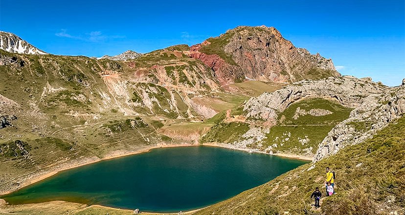
After the first 5 kilometres you will come to another fork, where you will take the path to the left. A few metres further on, after crossing a rocky area with great care, you will enjoy the first view of Lago del Valle, the largest lake in Asturias, whose beauty you can see in the cover photo of this post. After going around it clockwise, you will be at the highest point of the route, and it will be time to continue eastwards, to start the descent to the town of Valle de Lago.
You will have tasted an ethnographic and natural route, in a unique combination!
La Senda del Oso, for a stroll through the Trubia Valleys
The Senda del Oso is one of the most popular greenways in Spain. It is a pedestrian path, of low difficulty and well signposted, which runs along an old mining railway line. It has several rest areas and numerous information panels. For all these reasons it is ideal for walking or cycling, and it is always a great plan to do with the kids.

The Bear Trail crosses four councils: Quirós, Santo Adriano, Proaza and Teverga, which make up a territory known as the Bear Valleys, as it is a refuge for one of the last populations of the Cantabrian brown bear, one of the three species of brown bear in Europe.
One of the main attractions of this route (especially for children) is that it passes right next to the enclosure where the bears Paca and Molina live. The bear enclosure is located in Santo Adriano, very close to the Buyera recreational area, and the best times to see them are when it is cooler, i.e. before midday or after five in the afternoon.
The Senda del Oso has a Y-shaped layout, offering two options for the route: from the Tuñón recreational area, in Santo Adriano, to Cueva Huerta, in Teverga, or from the Tuñón recreational area to Ricao, in Quirós. As the path is almost thirty kilometres long in total, it is advisable to do it in several stages, in order to enjoy it to the full.
This route is well worth a leisurely stroll to enjoy its splendid natural, cultural and sporting surroundings: stretches of holm oak trees, which stand on limestone that is more than three hundred million years old; the Peñas Juntas pass that opens out onto the Teverga Valley; the imposing Peña Sobia; the Teverga climbing school; the tunnels of the old mining railway that will take you to the Valdemurio reservoir and the Quirós climbing school, etc.
In short, you will find rock, bears, vegetation, water and landscapes, as well as the Ethnographic Museum of Quirós, the Bear House and the Prehistoric Park in Teverga.
A whole world of possibilities partially immersed in the Las Ubiñas-La Mesa Nature Reserve!
The Chorrón de Piloña Route, to discover a beautiful waterfall
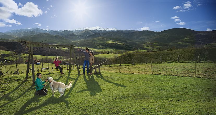
The Chorrón Route, in the municipality of Piloña, is an excellent way to spend the day, exercising in the open air and enjoying nature. It can also be a good option to do with children, as it is a nice short walk, in which you will also find a recreational area with swings, and very close to a beautiful waterfall that you can enjoy both children and adults.
The route starts in the parish of Villamayor, where you can park your car, and next to the church of San Pedro, follow the signs to the recreational area. Cross the Carúa neighbourhood of Villamayor, and after passing a couple of wooden bridges, you will reach the Chorrón recreational area.
The recreational area is in the middle of a forest, next to the river Pequeño or La Cueva. A fairytale place where you will also find a small stone altar with an image of the Virgin of Covadonga. You will also see unique stone constructions called cuerrías or corras, traditionally used to store chestnuts, one of the basic foodstuffs in Asturias before the appearance of potatoes and corn.

The Chorrón or waterfall that gives its name to this route is located barely two hundred metres from the recreational area. It is a waterfall about seven or eight metres high and is actually a small wonder hidden in the heart of the forest. If you feel like it, you can continue the route to the village of La Cueva, and on this ascent you will have marvellous mountain views.
The village of La Cueva is abandoned and has a beautiful cave that gives it its name. If you still want more, continue on to Collada La Doca, reaching Cerro el Tombu, from where you can see the whole valley of Piloña, the Sierra del Sueve and the Picos de Europa. Afterwards, you can retrace your steps or return along the other slope, following the circular route.
Pastures, huts, riverside forests, rivers, waterfalls and beautiful views, all on the same route!
The circular route around the Covadonga Lakes, for an immersion in Picos de Europa
The Covadonga Lakes, in the heart of the Picos de Europa, are one of those places you cannot miss when travelling in Asturias. One of those magical settings, which also offers the possibility of doing a circular route in the surrounding area, which is one of the most popular in the Natural Paradise.
This route is the PR-PNPE-2, according to the official nomenclature of this trail in the Picos de Europa National Park. You will cover a distance of six and a half kilometres in approximately two and a half hours, and the level of difficulty is considered to be low-medium.
As it is a circular route, it can be done clockwise or anti-clockwise. It is most common to start at the Buferrera car park, which is the largest parking area, although you can also start a little higher up, at the Ercina Lake car park.
From the Buferrera car park there are wooden footbridges that lead up to the Pedro Pidal Visitor Centre (if you walk clockwise) or to Lake Enol (in the opposite direction), parallel to the road. If you choose the first option, after the visitor centre, the best thing to do is to go first to the Mirador del Príncipe de Asturias viewpoint, and then go down to the Buferrera Mines, where there is a tunnel (not open to the public) that bears witness to the mining past of this area.

From here you can go to the Entrelagos viewpoint, from where you will have magnificent views of Lake Ercina on one side and Lake Enol on the other. You will head towards the latter, but first you will connect with the Ercina lake, more or less in the middle, to enter the lake known as El Bricial and the Palomberu forest, and then reach the Enol valley, where you will find the Buen Pastor hermitage and the refuge. Once there, you will walk along a pleasant path around the lake, and then straight to the car park.
It will have been a peaceful walk among cows, lakes and forests!
The Cabo Busto Route or the immense attraction of the Asturian coastline
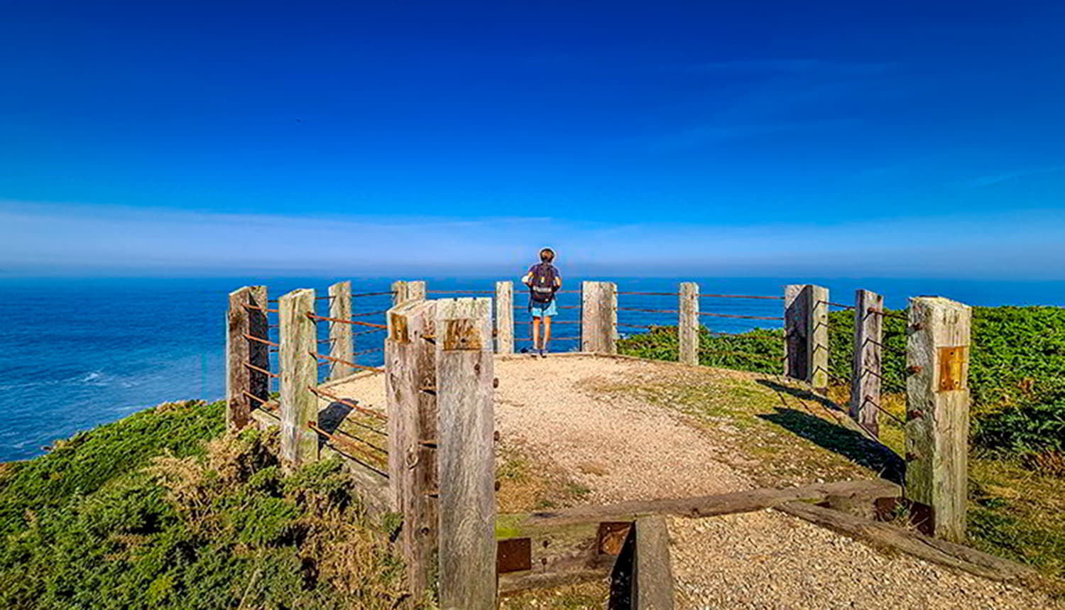
The Cabo Busto Route is one of those hiking experiences you can't miss. It is also one of the best ways to get to know the western part of the Asturian coast. The route starts in the village of Bustu, very close to the cape of the same name, located in the council of Valdés, and where, among many attractions, you will find one of the best cake shops in Spain. It is a circular route, so you will also end up in Bustu.

Here you will find seven viewpoints overlooking the Cantabrian Sea, which are privileged vantage points overlooking the horizon, showing you crystal-clear waters and sea beds of singular beauty, suitable for snorkelling or scuba diving. You will also see imposing cliffs, such as those of Cape Busto, as well as beautiful rocky beaches, both to the east and to the west.
Of course, you will pass through farms, pine forests, oak groves, riverside woods, and when you look out over the coast, in the distance, you can make out Cape Vidio to the east, and the town of Luarca/Ḷḷuarca to the west . The forests are a refuge for jays and sparrowhawks, which you will be able to hear and, if you are lucky, see. Beaches such as Cueva, las Imeas, los Cantones or Bozo will be your companions on your itinerary along the coast, as well as the beaches of Cabo Busto, Serrón or Barchinas. You will also see a small islet called Castiellu el Serrón, and of course the beautiful lighthouse and viewpoint of Cabo Busto.
It's eight kilometres of pleasant route and beautiful natural landscapes!
And to do any route safely do not forget to follow these tips
Subscribe to our newsletter and take advantage of offers, discounts, and news
Subscribe

